


Gjør som tusenvis av andre bokelskere
Abonner på vårt nyhetsbrev og få rabatter og inspirasjon til din neste leseopplevelse.
Ved å abonnere godtar du vår personvernerklæring.Du kan når som helst melde deg av våre nyhetsbrev.
Sei pronto a visitare un luogo che combina sapientemente tradizione e modernità fornendo allo stesso tempo un ricco arazzo di lusso, cultura e storia? Non guardare oltre Doha, la vibrante capitale del Qatar, dove ogni istante offre la possibilità di scoprire qualcosa di nuovo ed emozionante. Immagina di passeggiare lungo la pittoresca Corniche di Doha, con il calmo Golfo Persico da un lato e lo skyline di svettanti edifici dall'altro. Immagina di immergere i tuoi sensi nelle vivaci bancarelle del mercato, nell'intrattenimento tradizionale e nell'autentica cucina del patrimonio di Doha nell'affollato Souq Waqif. Ma questo è solo l'inizio. Doha è una città di contrasti e sorprese dove l'architettura moderna e i servizi di prim'ordine convivono pacificamente con tradizioni secolari. Esplora gli splendidi paesaggi del deserto e delle mangrovie, delizia le tue papille gustative con una varietà di esperienze culinarie e crogiolati nella magnificenza degli hotel a cinque stelle. Le gemme di Doha vanno oltre l'ovvio. Al Museo di Arte Islamica, svela i misteri del passato del Qatar mentre osservi preziosi manufatti e mostre che offrono uno sguardo sul significato storico della regione. Ai musei Msheireb, scopri l'avvincente storia dell'evoluzione del Qatar e lasciati stupire dai magnifici edifici che adornano lo skyline della città . In un safari esilarante, viaggia nel deserto dove le dune di sabbia dorata si estendono a perdita d'occhio e l'orizzonte è dipinto di sfumature arancioni e dorate dal sole al tramonto. Partecipa agli sport acquatici e sulla spiaggia lungo le coste blu o perditi nella pace di parchi e giardini verdeggianti. La vita notturna di Doha si anima quando il sole tramonta. Uno sguardo all'essenza artistica del Qatar può essere visto attraverso spettacoli culturali e produzioni teatrali, mentre vivaci pub, lounge e discoteche offrono intrattenimento senza sosta. Siate certi che mettiamo la vostra salute al primo posto prima di iniziare la vostra esperienza a Doha. Doha ha sviluppato processi approfonditi per garantire una vacanza sicura e piacevole, con particolare attenzione alla salute e alla sicurezza. Allora, siete pronti a scoprire le meraviglie di Doha? Mentre parti per un viaggio che promette di offrirti esperienze oltre i tuoi sogni più sfrenati e ricordi eterni, lascia che il calore, la cultura e la bellezza della città ti abbraccino. Cliccando sul pulsante "ACQUISTA ORA" nella parte superiore della pagina è possibile effettuare subito gli acquisti.
Intraprendi un viaggio attraverso la Corea del Sud come mai prima d'ora con questa guida di viaggio meticolosamente realizzata. Dal ritmo vibrante delle vivaci città alla tranquilla serenità degli antichi templi, immergiti nella bellezza accattivante e nella ricca cultura di questa terra incantevole. Scopri i segreti della cucina sudcoreana con i nostri consigli, assicurandoti di assaporare ogni piatto delizioso che il paese ha da offrire. Che tu sia un viaggiatore esperto o un principiante, la nostra guida è il tuo passaporto per un'avventura indimenticabile.Ma non è tutto: ecco i 5 vantaggi di scegliere la Guida di viaggio 2024 della Corea del Sud: 1. Esplorazione approfondita: addentrati nel cuore della Corea del Sud con una copertura completa sia della vivace vita urbana che dei sereni ritiri dei templi.2. Delizie culinarie: scopri i sapori della Corea del Sud con consigli utili su piatti imperdibili e gemme culinarie nascoste.3. Immersione culturale: immergiti nel ricco arazzo delle tradizioni sudcoreane, acquisendo una comprensione più profonda della sua storia e dei suoi costumi.4. Approfondimenti pratici: esplora il paese come un abitante del posto con suggerimenti e consigli pratici, assicurandoti un'esperienza di viaggio piacevole e senza intoppi.5. Raccomandazioni esclusive: scopri destinazioni fuori dai sentieri battuti ed esperienze uniche che distinguono la nostra guida.Allora cosa stai aspettando? Non limitarti a sognare la Corea del Sud: vivila! Prendi subito la tua copia della Guida di viaggio della Corea del Sud 2024 e apri la porta a un mondo dove città vivaci incontrano templi sereni, dove ogni piatto racconta una storia e dove consigli preziosi aprono la strada a un viaggio indimenticabile
Every country in the world, in one guidebook: Lonely Planet's The World. We've taken the highlights from the world's best guidebooks and put them together into one 900 page whopper to create the ultimate guide to Earth.
Durable and waterproof, with a handy slipcase and an easy-fold format, Lonely Planet's Shanghai City Map is your conveniently sized passport to travelling with ease.
Questa carta topografica presenta un'accurata mappatura dell'isola del Maritaggio, che si trova al largo della costa della Francia. Ã accompagnata da una descrizione della geografia e delle caratteristiche dell'isolaThis work has been selected by scholars as being culturally important, and is part of the knowledge base of civilization as we know it.This work is in the "public domain in the United States of America, and possibly other nations. Within the United States, you may freely copy and distribute this work, as no entity (individual or corporate) has a copyright on the body of the work.Scholars believe, and we concur, that this work is important enough to be preserved, reproduced, and made generally available to the public. We appreciate your support of the preservation process, and thank you for being an important part of keeping this knowledge alive and relevant.
Rand McNally's indexed map of Indiana is a comprehensive and detailed guide to the state's geography and transportation infrastructure. Featuring detailed information on railroads, express companies, post offices, and towns, this map is an essential resource for travelers and businesspeople alike. It also includes detailed geographical features such as islands, lakes, and rivers, making it a valuable tool for anyone interested in the state's natural beauty.This work has been selected by scholars as being culturally important, and is part of the knowledge base of civilization as we know it.This work is in the "public domain in the United States of America, and possibly other nations. Within the United States, you may freely copy and distribute this work, as no entity (individual or corporate) has a copyright on the body of the work.Scholars believe, and we concur, that this work is important enough to be preserved, reproduced, and made generally available to the public. We appreciate your support of the preservation process, and thank you for being an important part of keeping this knowledge alive and relevant.
Dall'iconica Torre Eiffel alle affascinanti strade di Montmartre, Parigi è una città ricca di tesori culturali e artistici. La nostra guida di Parigi è la chiave per scoprire la magia della Città della Luce. Esplorate i luoghi più famosi del mondo, assaporate gli squisiti dolci delle pasticcerie locali e passeggiate lungo la romantica Senna. Ricco di approfondimenti degli esperti, di spunti culturali e di consigli pratici, questo libro è il compagno essenziale per un'indimenticabile avventura parigina.In questa guida troverete: Attrazioni principaliI migliori festivalI migliori museiI migliori parchi nazionaliRequisiti per il visto e il passaportoI migliori cibi tradizionali da provareI migliori hotelOpzioni di trasportoLe migliori attività per famiglie a ParigiE tante altre cose divertenti che non potete permettervi di perderela nostra guida vi aiuterà a sfruttare al meglio il vostro tempo in questa splendida città .
Desde la emblemática Torre Eiffel hasta las encantadoras calles de Montmartre, ParÃs es una ciudad repleta de tesoros culturales y artÃsticos. Nuestra guÃa de viajes de ParÃs es la clave para descubrir la magia de la Ciudad de la Luz. Explore monumentos de fama mundial, saboree exquisitos pasteles en las pastelerÃas locales y pasee por el romántico Sena. Este libro, repleto de opiniones de expertos, aspectos culturales destacados y consejos prácticos, es su compañero esencial para vivir una aventura parisina inolvidable.En esta guÃa encontrará Principales atraccionesLos mejores festivalesLos mejores museosLos mejores parques nacionalesRequisitos de visado y pasaporteLas mejores comidas tradicionalesMejores hotelesOpciones de transporteLas mejores actividades familiares en ParÃsY muchas más diversiones que no puede perdersenuestra guÃa le ayudará a aprovechar al máximo su estancia en esta hermosa ciudad.
Esplora l'affascinante regno della Scozia sotto una luce completamente nuova con questa guida turistica onnicomprensiva e affascinante della Scozia. Immergiti nell'intricato tessuto della storia, nei paesaggi maestosi e nella vibrante cultura che ti invita in questa antica terra di miti e leggende. Scopri i misteri celati all'interno del grande castello di Edimburgo, passeggia attraverso le mistiche Highlands, dove le vette aspre incontrano laghi scintillanti, e arrenditi al fascino di villaggi pittoreschi che ricordano le fiabe. Dall'iconico Loch Nеss alla mozzafiato Isola di Sky, ogni pagina di questa guida ti trasporterà nelle destinazioni più mozzafiato della Scozia.Tuttavia, questa guida supera i semplici elenchi di attrazioni turistiche. Serve come porta personale per incontri indimenticabili. Rivela i tesori nascosti amati dalla gente del posto, assapora i deliziosi piatti tradizionali scozzesi che stuzzicheranno le tue papille gustative e immergiti nel calore e nell'ospitalità della popolazione scozzese.Che tu sia un appassionato di storia, un amante della natura o un avventuriero alla ricerca di sentieri battuti, questa guida turistica della Scozia si rivolge a tutti. Ricco di approfondimenti e informazioni pratiche, è il compagno ideale per pianificare la spedizione scozzese dei tuoi sogni.Non lasciarti scappare l'occasione di intraprendere un'odissea straordinaria attraverso gli accattivanti panorami e le meraviglie senza età della Scozia. Acquista subito la tua copia della guida turistica della Scozia e fai volare la tua voglia di viaggiare!Acquista ora e assisti allo svolgersi dell'incanto della Scozia davanti ai tuoi occhi!
Intraprendi un viaggio straordinario attraverso le strade vivaci e i monumenti iconici di San Francisco. Scopri tesori nascosti, assapora le delizie culinarie e immergiti nell'accattivante storia e cultura di questa straordinaria città . Rivela le storie mai raccontate dietro il Golden Gate Bridge, l'isola di Alcatraz e il Fisherman's Wharf. Ammira la straordinaria architettura vittoriana e i grattacieli contemporanei che definiscono lo skyline della città .Vivi San Francisco in modo autentico esplorando i suoi diversi quartieri, dall'energia dinamica di Chinatown all'essenza bohémien di Haight-Ashbury. Cattura momenti straordinari mostrando paesaggi pittoreschi, monumenti iconici e vivaci scene di strada. La Guida turistica di San Francisco 2024 trascende l'ordinario, offrendo consigli utili e gemme nascoste per rendere il tuo viaggio davvero indimenticabile. Immergiti nella fiorente scena artistica, esplora musei di livello mondiale e osserva le comunità creative della città .Per gli spiriti avventurosi, partecipa ad emozionanti attività all'aria aperta dentro e intorno a San Francisco. Scopri sentieri escursionistici nascosti, rilassati in parchi sereni e crogiolati al sole su splendide spiagge.Cogli l'occasione di incontrare il meglio di San Francisco! Prendi subito la tua copia e lascia che l'incanto della città sulla baia catturi i tuoi sensi. Inizia oggi il tuo viaggio indelebile! Preparati a scoprire San Francisco come mai prima d'ora. Acquista ora e intraprendi un'indimenticabile spedizione attraverso le strade dinamiche della città , i monumenti iconici e i tesori nascosti. Non aspettare: tuffati oggi stesso nell'incanto di San Francisco!
Imbarca in una straordinaria spedizione in Norvegia attraverso le pagine coinvolgenti di "Norway Travel Guide 2024". Questa guida meticolosamente realizzata è il tuo passaporto per scoprire la magia che si trova all'interno dei fiordi, delle città e delle gemme nascoste di questo paese delle meraviglie nordico. Mentre pervedi queste pagine, ti ritrovi trasportato in un regno dove l'antica mitologia e l'innovazione moderna coesistono armoniosamente. Dai paesaggi maestosi dei fiordi ai vivaci paesaggi urbani di Oslo e Bergen, ogni pagina svela un nuovo aspetto dell'accattivante fascino della Norvegia. Tuttavia, questa guida non è solo una mappa: è un portale per sperimentare l'essenza della Norvegia. Tuffati nel ricco arazzo della cultura locale, dalle intricate tradizioni del popolo Sami al brivido di assistere all'affascinante aurora boreale. Concediti i tuoi sensi nei sapori dell'autentica cucina norvegese ed esplora i racconti dietro le reliquie storiche vichinghe e l'architettura medievale. Al di là dei punti di riferimento familiari, "Norway Travel Guide 2024" ti invita a portare alla luce i tesori meno noti che definiscono il fascino del paese. Attraversa i villaggi costieri di Lofoten, intraprendi viaggi panoramici ferroviari attraverso le montagne e assisti allo splendore dei parchi nazionali norvegesi. Ogni raccomandazione all'interno di queste pagine è stata accuratamente selezionata per offrirti un'esperienza autentica e coinvolgente. Che tu sia un avventuriero in cerca di emozioni all'aria aperta, un appassionato di cultura attratto da racconti antichi o un cercatore di tranquillità affascinato dalle viste sui fiordi, questa guida è la tua bussola per un viaggio straordinario. Con informazioni aggiornate, approfondimenti e suggerimenti inestimabili, assicura che la tua esplorazione della Norvegia sia a dir poco notevole. Quindi, armati di curiosità e intraprendi un'odissea di scoperta. Consenti a "Norway Travel Guide 2024" di guidarti attraverso i fiordi, le foreste e i fjells e lascia che serva come chiave per sbloccare la bellezza, la cultura e i ricordi che ti aspettano in questo accattivante regno nordico.
Immergiti nel vibrante polso di Bangkok con la "Bangkok Travel Guide 2024". Questa guida meticolosamente curata è la tua porta d'accesso a un viaggio straordinario attraverso l'accattivante capitale della Thailandia. Mentre navighi in queste pagine, entri in una città dove antichi templi si trovano giustapposti a moderni grattacieli, dove i mercati affollati prosperano accanto a oasi serene. Ogni capitolo svela un nuovo strato del fascino enigmatico di Bangkok, offrendo approfondimenti sulla sua ricca storia, cultura e meraviglie contemporanee. Tuttavia, questa guida è più di una semplice raccolta di raccomandazioni: è un invito a sperimentare l'anima di Bangkok. Approfondisci le intricate complessità della cucina tailandese, assaporando sapori che danzano sul tuo palato. Assisti alla riverenza dei monaci nelle cerimonie tradizionali e perditi nel colorato caos dei mercati locali. Al di là dei punti di riferimento iconici, "Bangkok Travel Guide 2024" ti porta fuori dai sentieri battuti, rivelando gemme nascoste che incapsulano la vera essenza della città . Naviga nei khlong, o canali, di Thonburi, scopri l'arte e la creatività in quartieri eclettici e vivi la tranquillità di antichi templi lontano dalla folla. Che tu sia un esploratore desiderosi di incontri autentici, un appassionato di cultura attratto da tradizioni secolari o un avventuriero culinario in cerca di nuovi gusti, questa guida è il tuo compagno inestimabile. Con informazioni aggiornate, consigli utili e una vasta gamma di raccomandazioni, garantisce che il tuo viaggio attraverso Bangkok sia a dir poco straordinario. Quindi, abbraccia l'incantesimo e immergiti nella vivace vivacità di Bangkok. Lascia che la "Bangkok Travel Guide 2024" sia la tua guida, portandoti nel cuore di questa città accattivante, un luogo dove ogni svolta promette una nuova scoperta, dove storia, cultura e modernità convergono per creare un'avventura indimenticabile.
The top-selling A3 road atlas showcasing Britain's clearest mapping at 3 miles to 1 inch. Featuring large 3 miles to 1 inch scale including Ireland at 16 miles to 1 inch, 68 city, town and port plans, top 300 AA-Inspected caravan and camping sites and over 1,800 golf courses.
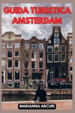
Ti sei mai chiesto cosa rende Amsterdam così affascinante e irresistibile? Se stai pianificando un viaggio nella meravigliosa capitale olandese, allora questa guida è proprio ciò che stai cercando! La "GUIDA TURISTICA AMSTERDAM: La Tua Guida Definitiva alle 10 Attrazioni Principali della Città " è la tua compagna perfetta per scoprire le attrazioni più affascinanti e i segreti meglio custoditi di questa città mozzafiato. Da una cultura ricca di storia a un'atmosfera cosmopolita, Amsterdam ha qualcosa da offrire a ogni viaggiatore curioso. Con questa guida, sarai in grado di pianificare il tuo itinerario perfetto, assicurandoti di non perdere le principali attrazioni come i famosi canali di Amsterdam, i musei di fama mondiale e i quartieri vivaci che ti cattureranno dal primo momento. Ma non è tutto! Oltre alle principali attrazioni, scoprirai anche tesori nascosti, come incantevoli cortili segreti e pittoreschi mercati locali, dove potrai immergerti nella vera essenza di Amsterdam. Questo libro è il risultato di ricerche approfondite e dei migliori consigli da parte di esperti locali, quindi puoi fidarti di ottenere informazioni autentiche e preziose per rendere il tuo viaggio un'esperienza indimenticabile. Non perdere l'opportunità di scoprire Amsterdam con questa guida completa e dettagliata! Acquistala ora e inizia il tuo viaggio nella città dei canali e dei tesori culturali. Vieni a scoprire il fascino senza tempo di Amsterdam - prenota ora la tua avventura nella capitale olandese e preparati a creare ricordi che dureranno per sempre!
ABECEDAIRE de l'eau: histoires diverses sur les bateaux, l'Histoire, des aventures, des lieux du monde qu peuvent inspirer ou faire rêver
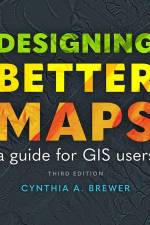
Learn from the best with this popular book on creating successful maps with any GIS or illustration product, written by an expert cartographer.For more than 18 years, Designing Better Maps: A Guide for GIS Users has been essential reading for all mapmakers who use geographic information systems (GIS) across industries and sectors, including government, commercial, creative, or academic. This third edition continues the reliable legacy of this book, distinctive in its clear and efficient emphasis on core cartographic concepts and updated with new and revamped design practices.With more than 400 full-color illustrations, this book applies map design best practices to both reference and statistical mapping, guiding you through the processes of planning maps, using scale and time, understanding and using color, customizing symbols, and more.Whether you face the challenge of making well-designed maps or are already adept at GIS data management and analysis but need better ways to visually communicate spatial information and results, Designing Better Maps teaches how to use GIS tools to design maps in provocative and accessible ways.Award-winning author Cynthia A. Brewer uses her sophisticated mix of experiences--conducting academic research, teaching novice cartographers, mentoring research and mapmaking by advanced students, and collaborating with analysts and mapmakers at various federal agencies--to present this practical information. Brewer is a professor and chair of the Department of Geography at Pennsylvania State University. She teaches introductory cartography and map design courses and advises graduate students working in cartography. She has worked as a map and atlas design consultant for the US Census Bureau, National Cancer Institute, National Center for Health Statistics, and National Park Service.
This A4 format atlas has been revised and updated for 2025 containing up-to-date mapping from the experts at the AA in a giant 2.3 miles to 1 inch scale. Features include a large print place names and index, top 300 AA-Inspected caravan and camping sites and over 240 service areas along with a 6 page clear route planner map.
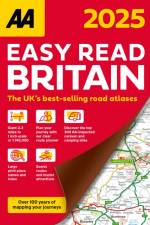
This A3 format atlas has been revised and updated for 2025 containing up-to-date mapping from the experts at the AA in a giant 2.5 miles to 1 inch scale. Features include large print place names and index, 72 city, town and port plans, top 300 AA-Inspected caravan and camping sites, over 1,800 golf courses and a 4 page route planner .
The Brooke's Travel Guide to Argentina is available to assist you whether you want to experience the tango in Buenos Aires, taste wine in Mendoza, or trek through Patagonia's glacial landscape.With the help of Brooke's Argentina Travel Guide, you can streamline the process of planning your trip and make the most of your time. This new edition has undergone a complete redesign with new content, an easy-to-read layout, and gorgeous color photos.In Brooke's travel guide to Argentina, you'll find: An illustrated guide to the best sights and activities is available at ULTIMATE EXPERIENCES.MANY ITINERARIES to efficiently plan your days and make the most of your time.MAP DETAILS to aid in confident navigation.COLOR PHOTOS all through to whet your appetite for travel!AUTHENTIC LOCAL RECOMMENDATIONS on the top attractions, eateries, lodging options, nightlife, activities, side trips, and more."The Best Outdoor Activities in Argentina," Additionally, "What to Eat and Drink in Argentina"TRIP-PLANNING TOOLS AND PRACTICAL TIPS, such as when to go, how to navigate, how to avoid crowds, and how to conserve time and money.A wealth of context on the local people, politics, art, architecture, food, dance, geography, and more is provided by historical and cultural insights.Iguaz Falls-specific features, Spanish language primer with helpful words and key phrasesCurrent coverage includes information on Buenos Aires, Igaz Falls, tango dancing, Patagonia, and more.Enjoy!
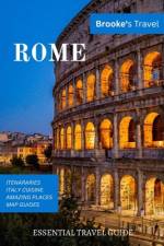
Whether you want to visit the Roman Forum, the Vatican, or the Colosseum, the Brooke's Travel Guide in Rome can help! It's jam-packed with maps, carefully curated recommendations, and everything else you need to streamline your trip planning and maximize your time. This new edition has been completely redesigned, with an easy-to-read layout, updated information, and stunning color photographs.Brooke's Rome travel guide includes the following items: MULTIPLE ITINERARIES TO EFFECTIVELY ORGANIZE YOUR DAYS AND MAXIMIZE YOUR TIME AN ILLUSTRATED ULTIMATE EXPERIENCES GUIDE TO THE TOP THINGS TO SEE AND DODETAILED MAPS to assist you in navigating confidently COLOR PHOTOS throughout to pique your wanderlust!BEST OF FEATURES WITH PHOTOS on Best Museums, Best Ancient Sites, Under the Radar Things to Do in Rome and more.TRIP-PLANNING TOOLS AND PRACTICAL TIPS, such as when to go, how to get around, how to avoid crowds, and how to save time and moneyCOVERAGE INCLUDES: Vatican City, the Roman Forum, the Colosseum, St. Peter's Basilica, the Pantheon, Trastevere, the Trevi Fountain, the Spanish Steps, and much more.
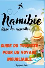
Découvrez l'âme sauvage de l'Afrique avec "Namibie, Terre des Merveilles: Un Guide du touriste pour un voyage inoubliable" !Vous avez toujours rêvé d'explorer des paysages à couper le souffle, de vous plonger dans une culture riche et diversifiée, ou d'observer de près la faune sauvage en toute liberté ? Notre guide est votre billet pour une aventure namibienne inoubliable.Du désert du Namib, le plus ancien du monde, à la Côte des Squelettes, mystérieusement belle, en passant par le Parc National d'Etosha, un véritable éden pour les amoureux de la faune, nous vous emmenons bien au-delà des sentiers battus. Grâce à nos conseils pratiques, nos astuces de voyage et nos ressources supplémentaires, vous serez prêt à vivre le voyage de vos rêves en toute sérénité.Embarquez dans cette aventure captivante, découvrez la Namibie comme vous ne l'avez jamais vue et créez des souvenirs qui resteront gravés à jamais dans votre coeur.N'attendez plus, commandez dès maintenant ce guide et laissez-vous emporter dans l'extraordinaire voyage de votre vie.
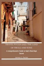
Find the hidden gems of Puglia with TRAVEL PUGLIA comprehensive travel manual! Ideal for first-timers. This manual takes you off the beaten path and shows you the authentic, lesser-known side of this enchanting region. Immerse yourself in the rich history, culture, and cuisine of Puglia, from the enchanting ridge towns to the perfect beaches and everything in between. With insider tips, family travel tips, must-see sights, and dishes, TRAVEL PUGLIA will assist you in planning a definitive Puglia experience and making memories that last forever.Find out in this book vast information on accommodations, transportation, travel requirements, and lots on Puglia travel! "Ready to uncover the magic of Puglia and experience the genuine heart of Italy?Get your copy now and begin planning your unforgettable trip to Puglia!"
Abonner på vårt nyhetsbrev og få rabatter og inspirasjon til din neste leseopplevelse.
Ved å abonnere godtar du vår personvernerklæring.