


Gjør som tusenvis av andre bokelskere
Abonner på vårt nyhetsbrev og få rabatter og inspirasjon til din neste leseopplevelse.
Ved å abonnere godtar du vår personvernerklæring.Du kan når som helst melde deg av våre nyhetsbrev.
Michelin's France paperback A4 atlas offers, in addition of Michelin's clear and accurate mapping, an enhanced view of your journey thanks to its scale 1/200,000. The route planner as well as the time distance charts will help you plan and optimise journey. Michelin's safety alerts warn you about dangerous driving areas and zones subjet to tighter speed checks. Michelin's paperback France atlas also includes information on tourist sights, leisure facilities and scenic routes, as well as service areas to add pleasure and comfort to your journey.Michelin's France paperback tourist and motorist atlas features:- Scale 1/200,000: for an enhanced view of your journey- Key to map pages: to quickly access the region of your interest- A complete town index: To easily indentify to destination of your choice- Distance and time chart: to help you plan your trip- 6 major town plans: Paris, Bordeaux, Lille, Lyon, Marseille & Nantes- Michelin's danger alerts: to help you identify zones at risks for drivers and controlled speed areas- In English language: Keys, indexes and information- The atlas is also cross-referenced with the famous Michelin's Green Guide with tourist sights, scenic routes and leisure facilities.
This atlas is the perfect companion for an enjoyable and safe drive. Convenient and easy to use thanks to its spiral bound cover, this will provide you with precise and reliable information with its mapping scaled 1/150 000 for an enjoyable journey in Northern France, Belgium, Luxembourg and Netherlands. The route planner as well as the time and distance charts will help you plan and optimise your journey, whilst new location maps on top of each page as well as highly pratical street maps will ensure an easy navigation within the atlas. Tourist sights, leisure facilities and scenic routes will add pleasure to your journey.Mileage chart and journey times to help you plan your journey.Key to Map Pages to quickly access your region of interest.67 town plans for easy navigation in urban areas.An extensive place name index to easily identify the destination of your choice.Location maps on top of each pages for an easy navigation within the atlas.
Updated annually, MICHELIN National Map France Route Planning (map 726) will give you an overall picture of your journey thanks to its clear and accurate mapping scale 1/1 000 000. Our map will help you easily plan your safe and enjoyable journey in France thanks to a comprehensive key, a complete name index as well a clever time & distance chart. Michelin's driving information will help you navigate safely in all circumstances. In addition, MICHELIN National Map France Route Planning includes information on service stations and areas so that you can have enjoyable break during your journey! With MICHELIN National Maps, find more than just your way!MICHELIN NATIONAL MAPS feature:- Up-to-date mapping- A scale adapted to the size of the country- A clear and comprehensive key- Distance and time chart- Place name index- Driving and road safety information
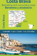
MICHELIN zoom map Zoom Barcelona & Costa Brava is the ideal travel companion to fully explore this tourist destination thanks to its easy-to-use format and its scale of 1/150,000. In addition to Michelin's clear and accurate mapping, MICHELIN Zoom map highlights all the leisure activities available, such as golf clubs and tourist trains. MICHELIN Zoom Maps also include star-rated scenic routes, tourist sights & attractions, as well as camping sites and hotels selected in the famous MICHELIN guides. Make the most of your stay with MICHELIN Zoom Maps!MICHELIN ZOOM MAPS are perfect to discover major tourist areas, with a high level of details in an easy to use format. They nicely complement our Michelin Guides and include: - Various leisure activities, such as water parks, tourist trains, horse racing, etc- Scenic routes and tourist sights crossed referenced with the famous Michelin's Green Guides- Camping sites information from Michelin's Camping Guides- Hotel information from the world famous MICHELIN Guides
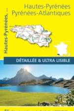
The MICHELIN Hautes Pyrenees, Pyrenees Atlantiques local map, scale 1/150,000 is the ideal companion to fully explore this northern part of France and provides star-rated Michelin tourist itineraries and attractions, as well as impressive 3D relief mapping. MICHELIN local maps are perfect for cyclist and outdoor enthusiasts with over 20 leisure symbols, extensive coverage of cycling paths and nature trails. With MICHELIN local maps, find more than just your way! - Impressive & realistic 3D relief mapping - Michelin selected itineraries and must-sees of the area - A clear and comprehensive key with 20 leisure symbols, as well as cycling paths and nature trails. - Star rated tourist sights and attractions cross referenced with the famous MICHELIN Green Guides. - Main cities plans and a comprehensive place name index
The MICHELIN Bouches du Rhone, Var local map, scale 1/150,000 is the ideal companion to fully explore this northern part of France and provides star-rated Michelin tourist itineraries and attractions, as well as impressive 3D relief mapping. MICHELIN local maps are perfect for cyclist and outdoor enthusiasts with over 20 leisure symbols, extensive coverage of cycling paths and nature trails. With MICHELIN local maps, find more than just your way! - Impressive & realistic 3D relief mapping - Michelin selected itineraries and must-sees of the area - A clear and comprehensive key with 20 leisure symbols, as well as cycling paths and nature trails. - Star rated tourist sights and attractions cross referenced with the famous MICHELIN Green Guides. - Main cities plans and a comprehensive place name index
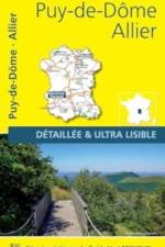
The MICHELIN Allier, Puy de Dome local map, scale 1/150,000 is the ideal companion to fully explore this northern part of France and provides star-rated Michelin tourist itineraries and attractions, as well as impressive 3D relief mapping. MICHELIN local maps are perfect for cyclist and outdoor enthusiasts with over 20 leisure symbols, extensive coverage of cycling paths and nature trails. With MICHELIN local maps, find more than just your way! - Impressive & realistic 3D relief mapping - Michelin selected itineraries and must-sees of the area - A clear and comprehensive key with 20 leisure symbols, as well as cycling paths and nature trails. - Star rated tourist sights and attractions cross referenced with the famous MICHELIN Green Guides. - Main cities plans and a comprehensive place name index
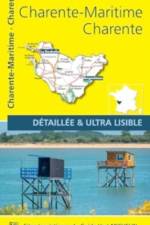
The MICHELIN Charente, Charente Maritime local map, scale 1/150,000 is the ideal companion to fully explore this northern part of France and provides star-rated Michelin tourist itineraries and attractions, as well as impressive 3D relief mapping. MICHELIN local maps are perfect for cyclist and outdoor enthusiasts with over 20 leisure symbols, extensive coverage of cycling paths and nature trails. With MICHELIN local maps, find more than just your way! - Impressive & realistic 3D relief mapping - Michelin selected itineraries and must-sees of the area - A clear and comprehensive key with 20 leisure symbols, as well as cycling paths and nature trails. - Star rated tourist sights and attractions cross referenced with the famous MICHELIN Green Guides. - Main cities plans and a comprehensive place name index
The MICHELIN Bas Rhin, Haut Rhin, Territoire de Belfort local map, scale 1/150,000 is the ideal companion to fully explore this northern part of France and provides star-rated Michelin tourist itineraries and attractions, as well as impressive 3D relief mapping. MICHELIN local maps are perfect for cyclist and outdoor enthusiasts with over 20 leisure symbols, extensive coverage of cycling paths and nature trails. With MICHELIN local maps, find more than just your way! - Impressive & realistic 3D relief mapping - Michelin selected itineraries and must-sees of the area - A clear and comprehensive key with 20 leisure symbols, as well as cycling paths and nature trails. - Star rated tourist sights and attractions cross referenced with the famous MICHELIN Green Guides. - Main cities plans and a comprehensive place name index
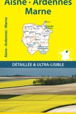
The MICHELIN Aisne, Ardennes, Marne local map, scale 1/150,000 is the ideal companion to fully explore this northern part of France and provides star-rated Michelin tourist itineraries and attractions, as well as impressive 3D relief mapping. MICHELIN local maps are perfect for cyclist and outdoor enthusiasts with over 20 leisure symbols, extensive coverage of cycling paths and nature trails. With MICHELIN local maps, find more than just your way! - Impressive & realistic 3D relief mapping - Michelin selected itineraries and must-sees of the area - A clear and comprehensive key with 20 leisure symbols, as well as cycling paths and nature trails. - Star rated tourist sights and attractions cross referenced with the famous MICHELIN Green Guides. - Main cities plans and a comprehensive place name index
Ride where the adventure never ends!Adventure is calling as a new snowmobile season arrives in snow country! The Maine 2023-2024 Snowmobile Trail Atlas includes over 14,000 miles of groomed and backcountry snowmobile trails created from over 100 individual maps to show the most up-to-date and accurate trails possible! Discover new routes, plan scenic day rides, and epic multi-day adventures with the 2023-2024 Maine Snowmobile Trail Atlas. Now, you can plan the adventure of a lifetime for you and your crew!Unforgettable Rides and ExperiencesThe map shows ITS trails, snowmobile club trails, and ungroomed trails where you can lay first tracks after a fresh snowfall! Also included on the map are scenic and awesome hot spots and side trips like the Abandoned Locomotives, B-52 Crash Site, and Coburn Mountain Summit (the highest elevation you can reach by snowmobile in Maine). Now, you can plan ahead to see scenic views and unique landmarks instead of discovering them out on the trail when you're out of time! Maine's three legendary loop trails, the Moose Loop, Katahdin Loop, and Black Fly Loop, are clearly marked on the map for those who enjoy touring scenic and dynamic terrain. The Winter 2023-2024 edition includes marked trailer parking locations and fuel stops!2023-2024 Maine Snowmobile Trail Atlas Includes: ITS Primary Corridor TrailsITS Secondary Connector TrailsSnowmobile Club TrailsUngroomed TrailsLake Crossing TrailsTrail Route Numbers and NamesMore Detailed MapsGas StationsParking LocationsParts and Repair LocationsSnowmobile Club InformationMaine's Legendary Loop Trails: Moose LoopKatahdin Loop TrailBlack Fly LoopHot Spots and Side Trips: Grand FallsAbandoned LocomotivesCoburn Mountain (the highest elevation you can reach by snowmobile in Maine)Moxie FallsB-52 Crash SiteLow's Covered BridgeScenic OverlooksMany more remote historic sites and natural landmarks!Terrain Features & Elevations***PLEASE NOTE***These maps are intended for trip planning purposes only and are not for navigation. Maine's snowmobile trail routes can change daily due to weather conditions, logging operations, landowner requests, etc.Contact local snowmobile clubs for the most updated information on trail routes and closures.
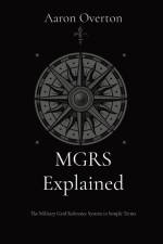
The Military Grid Reference System (MGRS) is the standard use by all NATO military forces to locate any point on Earth down to one meter locations. This is called a "geocode" - a unique identifier for any location or object that is short and can be fairly easily read by humans.The MGRS coordinate system is a vital part of land navigation and location coordination during operations. However, information online about the system is not particularly easy to understand. This book is intended to provide both a broad explanation of MGRS, but also deeper detail on elements of MGRS that are not immediately obvious. It also explains some practical uses to assist with land navigation, like calculating distances and azimuths.
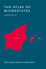
An ideal gift for anyone with an intrigue for geographical curiosities.Defined as sovereign states with a very small population, land area, or both, microstates serve as fascinating case studies of geopolitical significance. This atlas explores the unique history, politics, and self-determination of the world's smallest states.
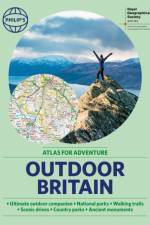
Ever wanted to explore Britain's finest National Parks, go surfing on the best beaches or follow the Pilgrims' Trail? Philip's RGS Outdoor Britain maps it all, from the majestic heights of the Scottish Highlands to the lush valleys of Wales and all the heritage and activities in between.
Whether you've always dreamed of skirting the US on a motorcycle, are looking to go coast-to-coast in an RV or simply want to roll down your car windows and plug into a classic playlist, Road Trips in the USA will give you all the inspiration you need for a road trip to remember.
A comprehensive alphabetically arranged list of Welsh place-names with their English meanings. New edition. First published in 1983; ISBN 9780000676504.
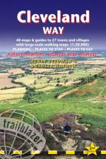
All-in-one hiking route guide, maps and accommodations for the 109-mile Cleveland Way, set in the North York Moors National Park. Includes 48 large-scale walking maps (3 1/8 inches to 1 mile); 8 town maps and 12 overview maps. Full details of all accommodations and campsites, restaurants and pubs; plus full public transport information. Includes day-walks.
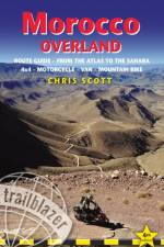
For the independently-mobile traveller the mountains and deserts of southern Morocco are a year-round destination offering a thrilling variety of experiences. Covering over 10000km from the High Atlas to the Mauritanian border, Morocco Overland features detailed GPS off-road routes for 4WDs, motorcycles and mountain bikes as well as scenic byways suitable for any vehicle.
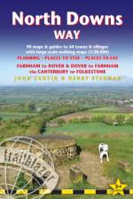
All-in-one hiking route guide, maps and accommodations for the 131mile North Downs Way, from Farnham to Dover via Canterbury. Includes 90 large-scale walking maps (3 1/8 inches to 1 mile); 15 town maps and 14 overview maps. Full details of all accommodations and campsites, restaurants and pubs; plus full public transport information. Includes day-walks.
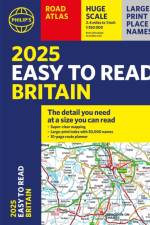
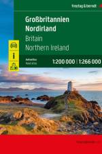
Der Autoatlas Großbritannien - Nordirland 1:200.000 - 1:266.000 ist der ideale Begleiter für alle, die mit dem Auto unterwegs sind und dabei nicht nur die Hauptstraßen und Autobahnen nutzen möchten. Er ist ideal für die Planung und erweist sich auch während der Reise als unverzichtbare Orientierungshilfe. Mit dem detaillierten Kartenbild und dem genauen Maßstab lassen sich auch weniger befahrene Nebenstraßen entdecken, die in Übersichtskarten meist gar nicht eingezeichnet sind. Informationen zum Straßenatlas Großbritannien - Nordirland Großbritannien - Nordirland 1:200.000 - 1:266.000 Spiralbindung Camping- und Stellplätze Touristische Informationen Ortsregister 64 Innenstadtpläne 328 Seiten, Format 22,5 x 30 cm Der ideale Autoatlas für Großbritannien und Nordirland Das dichte Straßennetz ist exakt abgebildet und viele Ausflugsziele sind in der Karte eingezeichnet. Auto- und Motorradfahrer schätzen die exakte Kartographie besonders für die Planung und Orientierung vor Ort. Damit die Reise auch mit Wohnmobil, Wohnwagen oder Camper gut planbar ist, sind alle Camping- und Stellplätze im Atlas eingezeichnet. Spiralbindung Der Autoatlas Großbritannien und Nordirland ist besonders komfortabel in der Handhabung da er sich durch die Spiralbindung bequem aufklappen lässt. So bleibt die gewünschte Seite auch während der Fahrt immer geöffnet. Innenstadtpläne Mit den 64 enthaltenen Cityplänen kann man sich in den Städten gut orientieren, darunter etwa Liverpool, London, Manchester, Bristol und Edinburgh.
Abonner på vårt nyhetsbrev og få rabatter og inspirasjon til din neste leseopplevelse.
Ved å abonnere godtar du vår personvernerklæring.