


![A New and Elegant General Atlas [cartographic Material]: Comprising All the New Discoveries, to the Present Time; Containing Sixty-three Maps af Aaron Arrowsmith](https://cdnbackdoor.tales.as/thumbnail/150x225/products/00232/27064/a-new-and-elegant-general-atlas-cartographic-material-comprising-all-the-new-discoveries-to-the-present-time-containing-sixty-three-maps.jpg)
Gjør som tusenvis av andre bokelskere
Abonner på vårt nyhetsbrev og få rabatter og inspirasjon til din neste leseopplevelse.
Ved å abonnere godtar du vår personvernerklæring.Du kan når som helst melde deg av våre nyhetsbrev.
Discover 66 great bushwalking tracks across New South Wales state in Australia, in this handy guide.
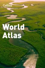
Eighth edition of this popular atlas from the prestigious and authoritative Times Atlas range. Latest satellite images and fascinating historical maps. This world atlas contains the breadth, scale and detail to make it an ideal reference resource for school, home and business.
Catering for the 'new' wave of tourists - New Zealanders actually holidaying in New Zealand! Wild coasts, jaw-dropping cliffs and caves, tranquil bays, thermal hotspots, towering alps, primeval forests, lakes and braided rivers, offshore islands...New Zealand's wonders are top of anyone's must-see list. This magnificent touring guide dedicated to natural attractions is structured geographically around itineraries - 22 in the North Island and 25 in the South - each of which takes in several sites within one area, describing their natural beauty and listing a few good short walks or detours that show off the scenery at its best. The itineraries are flexible, allowing the reader to simply follow the book or use it as back-up for more personalised touring plans. The text is supported by route instructions, detailed maps, illustrated panels on notable plants and animals, and stunning images from Andrew Fear.
The Ninth Edition of the Oxford & Grand Union Canal Companion has been extended to an unprecedented 176 pages.
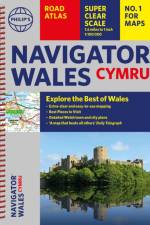
Explore the many attractions of Wales with this easy-to-use road atlas showing all the top spots. Easy-to-read mapping, superb extra detail, and a great lie-flat format make this the ultimate Welsh road trip companion.
A beautiful gift for the adventurers in your family.A new, fully updated edition of this bestselling atlas of the world. Great value and contains all the world maps you need in a budget atlas, for family, study and business use.
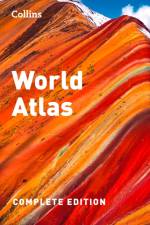
A beautiful gift for the adventurers in your family.This atlas presents a complete view of the world, bringing it to life through innovative maps, stunning images and detailed content.
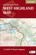
This compact booklet of maps shows the full route of the 95 mile West Highland Way Scottish Long Distance Route, via Loch Lomond and Rannoch Moor. This booklet is included with the Cicerone guidebook to the trail, and shows the full route on Ordnance Survey 1:25,000 maps.
A compact map of Tasmania for touring throughout the state with a distance grid and index for planning and reference. Marked on the mapping are highways, major and minor roads, camping and rest areas, 24-hour fuel, information centres, picnic areas, caravan parks, and lookouts.
The book presents the results of a doctoral thesis conducted under the supervision of two international governmental universities in Egypt and the USA. This book is very important for specialists in the field of Physical Geography with concentration of Geographic Information Science and Remote Sensing techniques for Coastal Hazard Assessment. It deals with coastal hazards and disasters using unique techniques and methods, such as Coastline Change Detection, Sea-Level Rise Modeling and Future Predication, Coastal Erosion Hazard Mapping, and Coastal Vulnerability Index. The integration of geospatial technologies that applied accurately in this book especially for the coastal hazard mitigation and protection devise evaluation makes it very helpful for researchers and academics, as well as for coastal and civil engineers.
Volltreffer !!! Hiermit hältst Du DIE Praxisanleitung zu Deinem GPSMAP 67 in den Händen - Für Wanderer, Alpinisten & MTBiker.Diese zu Papier gebrachte GPS-Schulung ist speziell auf GPS-Neulinge zugeschnitten, die somit nicht nur den Umgang mit diesem Geräte-Modell, sondern auch allgemeines Grundwissen zur GPS-Technik, Navigation und den Einstieg in die Tourenplanung vermittelt bekommen.- Mit Schritt für Schritt-Anleitungen zum Mitmachen- Anhand der gezeigten Beispielsituationen schnell in die Praxis finden- GPS-Begriffe wie Tracks, Routen, Wegpunkte, Zwischenziele, POI¿s, Koordinaten etc. verstehen und verwenden,- Kurz ins Geocaching schnuppern,- Praktisches & sinnvolles Zubehör entdecken,- Den Umgang mit elektronischem Kartenmaterial kennenlernen,- Tourenplanung und -auswertung unterwegs am Handy/Tablet PC sowie am Desktop PC anwenden (für Windows-Nutzer bestens geeignet, Mac mit Abweichungen),- Ein dauerhaft wertvolles Nachschlagewerk mit einem klar strukturierten Inhaltsverzeichnis und umfangreichen IndexInzwischen oft kopiert und doch nie erreicht sind die "GPS Praxisbücher" von Red Bike die Originale und wirklichen Helfer im Bereich GPS-Navigation mit Garmin-Geräten. Speziell für jeden Gerätetyp werden aus der Sicht des Anwenders die Möglichkeiten und Vorgehensweisen sowie Tipps und Tricks für jedermann leicht und verständlich erklärt.
A beautifully crafted atlas that provides extensive and accurate geographic information, including detailed maps that reflect the latest discoveries and exploration during the time of its publication.This work has been selected by scholars as being culturally important, and is part of the knowledge base of civilization as we know it.This work is in the "public domain in the United States of America, and possibly other nations. Within the United States, you may freely copy and distribute this work, as no entity (individual or corporate) has a copyright on the body of the work.Scholars believe, and we concur, that this work is important enough to be preserved, reproduced, and made generally available to the public. We appreciate your support of the preservation process, and thank you for being an important part of keeping this knowledge alive and relevant.
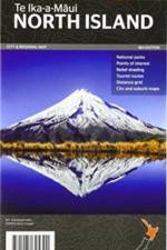
Falset kort i målestokken 1:1 mio. med register og afstandsstabeller. På bagsiden af kortet er et oversigtskort over nationalparkerne og bykort over Auckland, Wellington, Whangarei, Napier, Gisborne, Taupo, New Plymouth, Kerikeri, Hamilton, Urewera National Park, Rotorua, Palmerston North og Tauranga.
From cave paintings to Google, a thought-provoking investigation of how maps do not just reflect the world around us, but shape the way we live. Maps go far beyond just showing us where things are located. All Mapped Out is an exploration of how maps impact our lives on social and cultural levels. This book offers a journey through the fascinating history of maps, from ancient cave paintings and stone carvings to the digital interfaces we rely on today. But it's not just about the maps themselves; it's about the people behind them. All Mapped Out reveals how maps have affected societies, influenced politics and economies, impacted the environment, and even shaped our sense of personal identity. Mike Duggan uncovers the incredible power of maps to shape the world and the knowledge we consume, offering a unique and eye-opening perspective on the significance of maps in our daily lives.
Abonner på vårt nyhetsbrev og få rabatter og inspirasjon til din neste leseopplevelse.
Ved å abonnere godtar du vår personvernerklæring.