


Gjør som tusenvis av andre bokelskere
Abonner på vårt nyhetsbrev og få rabatter og inspirasjon til din neste leseopplevelse.
Ved å abonnere godtar du vår personvernerklæring.Du kan når som helst melde deg av våre nyhetsbrev.
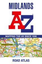
A full-colour, regional road atlas of the Midlands from A-Z Maps, featuring 46 pages of continuous road mapping.
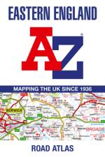
A full-colour, regional road atlas from A-Z Maps. Featuring more than 50 pages of continuous mapping of regions in the east of England.
Die neue Endlich-Reihe nimmt dich mit zu den schönsten Sonnenuntergängen, den erfrischensten Bergseen, den höchsten Gipfeln und den schönsten Winterwegen. Für Jede und Jeden haben wir das passende Buch, um endlich etwas Neues auszuprobieren. Damit auch nichts schief gehen kann, haben wir dir eine Packliste, Grundwissen und einen Verhaltenskodex sowie viele weitere Informationen vor und nach dem Tourenteil zusammengestellt. Und das Wichtigste: Mit den KOMPASS-Karten im Buch behältst du immer den Überblick und siehst trotzdem alle wichtigen Details. Jetzt heißt es nur noch: Endlich kann es losgehen!
Driven by the increasingly expanding needs of infrastructure construction, operation and maintenance, as well as the rapid developments of intelligent sensing and information technology, precise engineering surveying has been transformed from static, discrete, and manual into dynamic, continuous, and intelligent ways. This transformation leads to an advanced multidisciplinary field, dynamic and precise engineering surveying, on which the author has worked for over two decades. This book systematically summarizes the fundamentals, methods, and applications in dynamic and precise engineering surveying. The contents mainly include two parts: the first part introduces principles and methods of dynamic and precise engineering surveying; the second part presents representative applications in which innovative methods and advanced equipment are applied in the construction, operation and maintenance of mega and complex infrastructures.Readers engaged in surveying and mapping, civil engineering, water conservancy engineering, railway engineering, electronic information, and computer science, including undergraduates, graduates, researchers and engineers, will find it an informative reference.
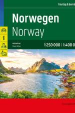
Der Straßenatlas Norwegen 1:250.000 - 1:400.000 ist der ideale Begleiter für alle, die in Norwegen mit dem Auto unterwegs sind und dabei nicht nur die Hauptstraßen nutzen möchten. Er ist ideal für die Planung und erweist sich auch während der Reise als unverzichtbare Orientierungshilfe. Mit dem detailreichen Kartenbild und dem genauen Maßstab lassen sich auch weniger befahrene Nebenstraßen entdecken, die in Übersichtskarten meist gar nicht eingezeichnet sind. Landschaftlich schöne Strecken sind farblich hervorgehoben. Informationen zum Straßenatlas Norwegen Norwegen 1:250.000 - 1:400.000 Spiralbindung verdeckt Camping- und Stellplätze Touristische Informationen Ortsregister mit Postleitzahlen Format 23 x 29,7 cm Der beste Autoatlas für Norwegen Das dichte Straßennetz Norwegens ist exakt abgebildet, landschaftlich schöne Abschnitte und Touristenstraßen sind farblich hervorgehoben und viele Ausflugsziele sind in der Karte eingezeichnet. Auto- und Motorradfahrer schätzen die exakte Kartographie von freytag & berndt besonders für die Planung und Orientierung vor Ort. Damit die Reise auch mit Wohnmobil, Wohnwagen oder Camper gut planbar ist, sind alle Camping- und Stellplätze im Atlas eingezeichnet. Verdeckte Spiralbindung Der Autoatlas Norwegen ist besonders komfortabel in der Handhabung da er sich durch die Spiralbindung bequem aufklappen lässt. Auch während der Fahrt bleibt die gewünschte Seite so geöffnet. Innenstadtpläne Mit den enthaltenen Cityplänen kann man sich in diesen Städten gut orientieren: Bodø, Bergen, Hammerfest, Kristiansand, Narvik, Stavanger, Oslo, Trondheim. Gedruckt in Österreich
Ready to turn your travel dreams into reality? Whether you're a first-time traveler or looking to enhance your globetrotting experiences, the #1 bestselling book by travel author Nikki Page, Let's Travel the World, is your ultimate guide to embarking on unforgettable adventures across the glo
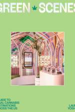
The first ever guide to ethically-operated legal cannabis destinations across the US.
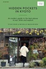
Hidden Pockets in Kyotois your guide to losing yourself in this Japanese city that seamlessly intertwines modern and traditional influences. Whether you’re satisfying your tastebuds in contemporary cafes, wandering among the untarnished architecture of Gion or heading back in time while visiting ancient temples and shrines, Kyoto is a captivating city to explore. Curated by authors Steve Wide and Michelle Mackintosh, who consider Japan their ‘home away from home’, this travel guide navigates the country’s cultural capital like a local, with chapters for kissatens (coffee shops), gardens, temples, omiyage (local products), mindful experiences and places to enjoy delectable sweets. Build your day with a variety of half-day and full-day itineraries and bask in Kyoto’s seasonal beauty as you explore lantern-lit alleys that reveal the city’s unique precincts, and uncover hidden artisanal treasures and flavors that will challenge and delight your senses. Venture beyond the metropolis to unearth the heart of the city with this Curious Travel Guide.
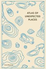
In 45 unique maps and with evocative photography, Atlas of Unexpected Places is a journey to far-off lands, obscure discoveries and unimaginable locations.
Since the last decades of the twentieth century, the circumstances surrounding map use and map making have drastically changed owing to advances in information and communication technologies (ICTs). In particular, the spread of web maps and mobile devices have altered the way people interact with maps. This book features the latest works on theoretical and practical issues of these changes by terming them "e;ubiquitous mapping"e;. In particular, the book pays attention to not only the technological basis but also multidisciplinary human-social aspects. The book covers the topics of the evaluation of ICT-based technologies for context-aware mapping, the theory and application of crowd-sourced geospatial information and collaborative mapping, and both the positive and negative effects of ubiquitous mapping on human society.
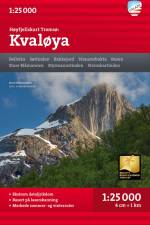
Dette er ett av to unike kart med en detaljrikdom som aldri tidligere er vist over .området rundt Tromsø. Terrenginformasjonen i kartet er basert på laserskanning. fra fly. Fjellskrenter, vassdrag, breer og andre naturelementer vises mye mer detaljert med denne teknologien.Et kart i målestokk 1:25.000 er nyttig for deg som planlegger en topptur til Skittentinden (1042 moh), Store Blåmannen (1044 moh) eller Hollenderen (1016 moh).Kartet vil også kunne brukes av de som ønsker å forlate merkede stier for å utforske egne ruter i høyfjellet.
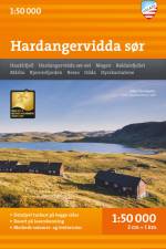
Med kartvisninger på både for- og baksiden dekker dette kartet området kring Hardangervidda sør.Kartet er en del av den moderne kartserien fra Calazo, med unik terrenginformasjon basert på laserskanning fra fly og bedre nøyaktighet i detaljene. Vi har blant annet brukt detaljerte flyfoto til å korrigere stier i området. Vi har også identifisert og lagt til flere nye stier som manglet i de offisielle databasene. Kartet dekker alle de mest populære fjellområdene, hytter som drives både av DNT og av andre aktører, markerte turruter og fungerer like godt om vinteren med merkede vinterruter og preparerte skiløyper.
HettaPallas -reitille! Suosituin vaellusreittimme kulkee vanhimmassa kansallispuistossamme ja jatkuu Ylläkselle ja Aakenukselle asti. Seudulla riittää retkeiltävää tunturireittien lisäksi myös Jerisjärvellä ja Ounasjoella. Karttamme painetaan mainiolle Tyvek-materiaalille, joka on vedenkestävää ja repeämätöntä. Niinpä sinun ei tarvitse suojata karttaasi sateelta eikä karttasi repeydy käytössä. Valmistaja takaa materiaalin kestävän 20 000 taittokertaa. Nerokkaan lehtijaon ansiosta kaikki alueen tärkeimmät retkikohteet mahtuvat yhdelle kartalle.
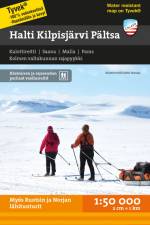
Kolmen valtakunnan huiput Upeat suurtunturimme sijaitsevat Käsivarren erämaa-alueella. Kalottireitti vie Kilpisjärveltä länteen Pältsalle ja Parakselle sekä koilliseen Haltille, jonne pääsee lyhyempää reittiä pohjoisesta käsin. Karttamme painetaan mainiolle Tyvek-materiaalille, joka on vedenkestävää ja repeämätöntä. Niinpä sinun ei tarvitse suojata karttaasi sateelta eikä karttasi repeydy käytössä. Valmistaja takaa materiaalin kestävän 20 000 taittokertaa. Nerokkaan lehtijaon ansiosta kaikki alueen tärkeimmät retkikohteet mahtuvat yhdelle kartalle.
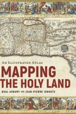
A stunning journey through the Holy Land, as told by the rare maps and prints that have long inspired Jewish, Christian, and Muslim pilgrimages. From the earliest days of the Roman Empire to the current war between Israel and Hamas, mapping the Holy Land has been a never-ending source of high aspirations and bitter conflict. Sacred to Jews, Christians, and Muslims, the Holy Land has always inspired Christians to walk in the footsteps of the Bible, to imagine the route of the Exodus, or discover the places of Jesus' ministry. Muslims, too, longed to see the geographical contours of the ummah, the greater Muslim community, while Jews remembered the days when Jerusalem was the destination for three holy festivals. In response, cartographers from Late Antiquity to the Modern Age drew their inspiration from Jewish, Christian, and Muslim pilgrimages to depict, with growing confidence, the exotic locations of the Holy Land. Mapping the Holy Land is the first book to tell the thrilling story of these travels and the incredible prints and maps they spawned, up to the wars of the twentieth and twenty-first centuries. Illustrated with rare, hand-colored maps and engravings throughout and riveting scene-setting history, this remarkable volume from rare maps collector Neal Asbury, CEO of The Legacy Companies and host of Neal Asbury's Made in America, and National Geographic best-selling author Jean-Pierre Isbouts, coauthors of Mapping America, shows how the faithful overcame impossible odds to reach the Holy Land, and dives deep into the historical understanding of these elusive lands from Roman times up to the modern Israeli-Arab conflict.
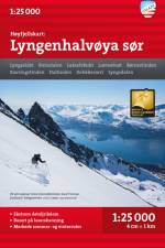
Et kart i målestokk 1:25 000 gir god støtte til deg som går på topptur, driver med brevandring eller på andre måter forlater de merkede stiene i dalbunnen og finner egne ruter oppe i høyfjellet. Det er laget i materialet Tyvek, som tåler vann, er beskyttet mot rifter og har lav vekt.]]>
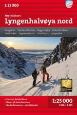
Dette er en del av den moderne kartserien fra Calazo med en detaljrikdom som aldri tidligere er vist over Lyngen. Terrenginformasjonen i kartet er basert på nye data innhentet fra laserskanning fra fly. Fjellskrenter, vassdrag og breer og andre naturelementer vises mye mer detaljert med denne teknologien. Kartet inneholder også flere stier enn noe kart tidligere over samme område.Et kart i målestokk 1:25 000 gir god støtte til deg som går på topptur, driver med brevandring eller på andre måter forlater de merkede stiene i dalbunnen og finner egne ruter oppe i høyfjellet. Det er laget i materialet Tyvek, som tåler vann, er beskyttet mot rifter og har lav vekt.
An excellent world atlas for everyday use at home or work, representing broad coverage at a great price. Clear, authoritative Times atlas mapping fully updated.
Abonner på vårt nyhetsbrev og få rabatter og inspirasjon til din neste leseopplevelse.
Ved å abonnere godtar du vår personvernerklæring.