

![Progress Report of the Hydrometric Survey of Manitoba for the Climatic Years 1918-19 [microform] af Charles H. Attwood](https://cdnbackdoor.tales.as/thumbnail/150x225/products/00161/69103/progress-report-of-the-hydrometric-survey-of-manitoba-for-the-climatic-years-1918-19-microform.jpg)

![The Kohl Collection of Maps Relating to America [microform] af Winsor](https://cdnbackdoor.tales.as/thumbnail/150x225/products/00294/22896/the-kohl-collection-of-maps-relating-to-america-microform.jpg)
![Coast and Harbour Surveys in Hudson Bay and Strait [microform] af J. W. (James Williams) Tyrrell](https://cdnbackdoor.tales.as/thumbnail/150x225/products/00294/20351/coast-and-harbour-surveys-in-hudson-bay-and-strait-microform.jpg)

![Descriptions of Land [microform]: a Text-book for Survey Students af R. W. (Richard William) Cautley](https://cdnbackdoor.tales.as/thumbnail/150x225/products/00161/72261/descriptions-of-land-microform-a-text-book-for-survey-students.jpg)
Gjør som tusenvis av andre bokelskere
Abonner på vårt nyhetsbrev og få rabatter og inspirasjon til din neste leseopplevelse.
Ved å abonnere godtar du vår personvernerklæring.Du kan når som helst melde deg av våre nyhetsbrev.
Dieses Lehr- und Übungsbuch richtet sich an Sie als Studierende und praktisch tätige Fachleute der Geodäsie, der Geomatik, der Vermessung, der Ingenieurmathematik und verwandter Fachrichtungen. Sie erhalten ein theoretisches Grundgerüst, um geodätische und statistische Berechnungen selbst ausführen und fachspezifische Softwareprodukte sachkundig und professionell benutzen zu können.Das Buch enthält 92 teils ganzseitige, farbige Abbildungen und 160 praktische Zahlenbeispiele. Mit deren Hilfe können Sie die vorgestellten Berechnungsverfahren nicht nur theoretisch nachvollziehen, sondern lernen auch deren praktische Anwendung kennen. Weiterhin finden Sie 111 Aufgaben, die Sie selbst lösen und mit den angegebenen Ergebnissen vergleichen können. Die meisten Berechnungen lassen sich auch mit einer kostenlosen Online-Software nachvollziehen, auf die unter den Beispielen und Aufgaben verlinkt wird. Bei der Lektüre kommen Sie ohne besondere mathematische und geodätische Spezialkenntnisse aus. Die praktischen Beispiele und Aufgaben sind sämtlich aus den Bereichen Tachymetrie, Nivellement und den Grundlagen der Satellitennavigation gewählt.
Hinter jeder Kurve ein neues Abenteuer: Auf Patagonien-Tour vor traumhafter BergkulisseBereit für eine Reise ans "Ende der Welt"? Patagonien, das steht für unendliche Weiten und erhabene Landschaften, leuchtende Gletscher und majestätische Gipfel. Exklusiv für das CURVES-Magazin hat Fotograf Stephan Bogner die schönsten Panoramastraßen dieses einmaligen Landstrichs erkundet.Die gewohnt phänomenalen Luftbildaufnahmen zeigen aufregende Routen mitten ins Nirgendwo. Ob Sie gemütlich im Caravan durch die wilde Steppe gondeln oder den Nervenkitzel der Serpentinen mit atemberaubenden Ausblicken vorziehen: Das einzigartige Naturerlebnis macht Ihren Trip garantiert zur unvergesslichen Reise.- Patagonien: Bilder einer überwältigenden Landschaft, die man so noch nicht gesehen hat- Die reizvollsten Routen und einsamsten Bergstraßen: inklusive Karte zur Streckenplanung- Einzigartiges Fahrerlebnis auf endlosen Straßen: für Autotouren, Motorrad- und Campingreisen- Mit ausgesuchten Empfehlungen: die besten Hotels und Sehenswürdigkeiten Patagoniens - CURVES - Die Leidenschaft für schöne Kurven: ein einmaliger Mix aus Reisebericht und BildbandAuto fahren mit Genuss auf den schönsten Straßen der Welt: Patagonien für IndividualistenPassstraßen mit Ausblick, ein unschlagbares Bergpanorama und weite, unberührte Hochebenen: Die charakteristische Landschaft am südlichen Zipfel von Chile und Argentinien bietet ständig neue Highlights. "Soulful Driving" lautet Stephan Bogners Rezept für entspannte Roadtrips, bei denen Sie das Tempo selbst bestimmen. Passend dazu empfiehlt er komfortable Übernachtungsmöglichkeiten, gute Lokale und lohnende Ziele.Genießen Sie den Fahrtwind und finden Sie heraus, wo sich Gürteltier und Guanako Gute Nacht sagen: Mit CURVES-Patagonien entdecken Sie Panoramastraßen zum Verlieben und die besten Reisetipps für Touren auf zwei oder vier Rädern. Zweisprachig: Deutsch / EnglischCurve after curve a new adventure: Touring Patagonia with its fantastic mountain rangesReady for a trip to the "end of the world"? Patagonia stands for infinite and awe-inspiring landscapes, glistening glaciers and majestic peaks. Exclusively for the CURVES magazine, photographer Stephan Bogner explored the most beautiful scenic roads of this unique area.Marvellous aerial views show exciting routes right in the middle of nowhere. No matter whether you're driving casually through the wild steppe in your caravan or prefer the thrills of winding roads with breathtaking views: The extraordinary nature experience makes your trip most certainly an unforgettable journey.- Patagonia: Pictures of an overwhelming landscape you have never seen like this before- The loveliest routes and loneliest mountain roads: with maps for route planning- Unique driving experience on endless roads: for tours by car, motorbike, and caravaning- Exquisite recommendations: Patagonia's best hotels and sights- CURVES - the passion for lovely curves: an exceptional mix of travelogue and illustrated bookDelightful driving on the world's most beautiful roads: Patagonia for individualistsMountain passes with a view, matchless mountain panoramas and vast untouched plateaus: the characteristic landscape at the south end of Chile and Argentina is full of highlights. "Soulful Driving" is Stephan Bogners' motto for leisurely road trips, where you set the pace. To top this off, he recommends comfortable accommodation, fine restaurants and sights worth seeing.Enjoy the airflow and find out where armadillos and guanacos bid good night: With CURVES Patagonia you will explore and fall in love with scenic roads and find the best tips for tours on two or four wheels.
Introducing 'Philip's Navigator Trucker's Britain: Spiral', a masterful creation by Philip's Maps. This book, published in 2023, is a unique addition to the genre of map and travel guides. The Octopus Publishing Group, a renowned name in the publishing world, is proud to present this comprehensive guide to the roads of Britain. The book is designed specifically for truckers, providing detailed road maps and all the information a long-haul driver might need on their journey. The spiral binding allows for easy use on the go. Don't miss out on this essential companion for every trucker navigating Britain's highways and byways.
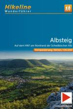
Er ist einer der ältesten Weitwanderwege im Lande - der Albsteig, welcher über weite Strecken der steil abfallenden Albtraufkante folgt und damit regelmäßige Aussichten der Sonderklasse garantiert - sein Spitzname "Traumbalkon im Süden" kommt nicht von ungefähr. Die Natur spielt ganz klar die Hauptrolle auf diesem Weg von einer Donaustadt zur anderen, doch zwischendurch gibt es immer wieder imposant gelegene Burgen, kühle Höhlen oder bizarre Felsformationen, natürlich auch hübsche Dörfer und einladende Fachwerk-Städtchen zu beschauen. Der Albsteig führt oft auf der Höhe entlang und bietet teilweise Ausblicke bis hin zu den Alpen. Neben ausgedehnten Wäldern nimmt er ebenso Moore, Wiesen und Steppenheiden, Bachtäler, Wasserfälle und manche Quelle mit. Eine schöne Ergänzung der Vielzahl an Eindrücken sind die gemütlichen Gasthäuser, in denen man sich wohlverdient den Freuden der Schwäbischen Küche hingeben kann.
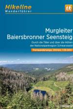
Die Murgleiter führt 110km lang durch das Murgtal.Der Weg im nördlichen Schwarzwald startet in Gaggenau und endet in Schliffkopf.Der Baiersbronner Seensteig ist eine 91km lange Rundtour rund um Baiersbronn und führt durch eine besonders sehenswerte wie seensreiche Landschaft.
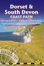
All-in-one hiking route guide, maps and accommodations for the 217-mile footpath that runs around the entire coastline of South Devon and Dorset: from Plymouth to Poole Harbour. Part 3 of the South West Coast Path, a 630-mile national trail from Minehead to Poole. Includes 97 large-scale maps (3 1/8 inches to 1 mile); 29 town plans and 13 overview maps. Full details of all accommodations and campsites, restaurants and pubs; plus full public transport information. Includes day-walks.
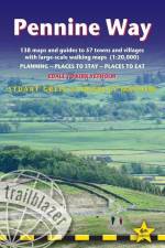
All-in-one hiking route guide, maps and accommodations for the 253-mile Pennine Way, from England into Scotland. Includes 138 large-scale walking maps (1:20,000 or 3 1/8 inches to 1 mile); 10 town maps and 15 overview maps. Full details of all accommodations and campsites, restaurants and pubs; plus full public transport information. Includes day-walks.
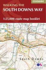
Map of the 100 mile (160km) South Downs Way National Trail, between Eastbourne and Winchester. This booklet is included with the Cicerone guidebook to the trail and shows the full route on OS 1:25,000 maps. The trail typically takes a week to walk and is suitable for most levels of ability.
Abonner på vårt nyhetsbrev og få rabatter og inspirasjon til din neste leseopplevelse.
Ved å abonnere godtar du vår personvernerklæring.