


Gjør som tusenvis av andre bokelskere
Abonner på vårt nyhetsbrev og få rabatter og inspirasjon til din neste leseopplevelse.
Ved å abonnere godtar du vår personvernerklæring.Du kan når som helst melde deg av våre nyhetsbrev.
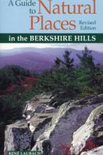
The book describes facilities, geological & physical highlights, plant communities, and animals, including mammals, birds, reptiles, amphibians, and fish for 33 sites in a clear, simple, easy to use format. This guide also covers wildlife observation tips, seasonal highlights, and Berkshire natural history, and includes detailed maps, illustrations and directions.
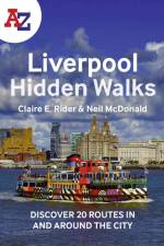
Discover hidden gems around Liverpool with 20 walking routes. Featuring 20 walks in and around the city, including lesser-known circuits and details on popular walks. Accompanied by guided walking instructions and written by a local expert, A-Z Liverpool Hidden Walks is the perfect way to explore the city in a new light.
Discover hidden gems around Brighton with 20 walking routes. Featuring 20 walks in and around the city, including lesser-known circuits and details on popular walks. Accompanied by guided walking instructions and written by a local expert, A-Z Brighton Hidden Walks is the perfect way to explore the city in a new light.
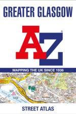
Navigate your way around Glasgow with this detailed and easy-to-use A-Z Street Atlas. Printed in full-colour, paperback format, this atlas contains 168 pages of continuous street mapping.
Falset landkort over Mallorca i målestokken 1:50.000. Lille indsat hæfte på 70 sider med indeks og tilhørende GPS koordinater. Hæftet indeholder også en lille guide til de mest kendte destinationer på øen.
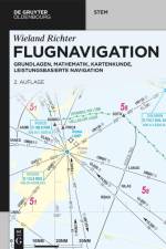
Dieses Buch behandelt die begrifflichen und sachlichen Grundlagen der Flugnavigation sowie die mathematisch-geometrischen Zusammenhänge mit zahlreichen Berechnungsbeispielen. Wegen des engen Bezugs zur Kartographie, welche die benötigten raum- und sachbezogenen Informationen für die thematischen Karten und Navigationsdatenbanken bereitstellt, sind die theoretischen Aspekte sowie der praktische Gebrauch und die Interpretation moderner Navigationskarten inhaltlicher Schwerpunkt. Weiterer Schwerpunkt ist die leistungsbasierte Navigation, wie diese in der heutigen Luftfahrtpraxis mithilfe integrierter bordseitiger Navigationssysteme in Verbindung mit den Ab- und Anflugverfahren realisiert wird. Hierbei werden Funk-, Trägheits- und Satellitennavigation kombiniert. Mithin widmet sich dieses Buch den Letzteren in einer angemessenen Detailtiefe sowie der Architektur der Bordsysteme am Beispiel der weltweit verbreiteten Airbus A320-Flugzeugfamilie. Des Weiteren werden relevante Aspekte der Flugsicherung einbezogen. Zielgruppe sind alljene, die ihre Ausbildung zum Piloten oder Fluglotsen mit einem Studium im Bereich der Luftfahrt kombinieren, Verfahrensplanende bei der Flugsicherung, Studierende des Verkehrsingenieurwesens oder der Geowissenschaften und alle, die sich für Navigationskarten und -systeme sowie die damit verbundenen aktuellen Technologien begeistern. Die vorliegende zweite Auflage ist gleichermaßen geeignet für Neueinsteiger und Fortgeschrittene, die Praxisbeispiele verhelfen zum "Ankommen". Zahlreiche hochwertige Abbildungen fördern die Anschaulichkeit, großer Wert wird auf Allgemeinverständlichkeit gelegt bei dennoch mathematischer Fundierung. Das Buchkonzept mit dem Schwerpunkt auf aktueller Thematik bindet die traditionellen Navigationssysteme jedoch soweit ein, dass die Leserinnen und Leser Kenntnisse erwerben, welche ihnen dazu verhelfen, oben genannte Systeme als alleinige Navigationsmittel anwenden zu können. Auch werden die vom Luftfahrtbundesamt für die Ausbildung zum Verkehrsflugzeugführer im Fach Navigation geforderten Inhalte im Wesentlichen abgedeckt.
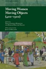
The present collection forges new ground in the discussion of aristocratic and royal women, their relationships with their objects, and how they, through this material record, navigated the often-disparate spaces of Byzantium, Eastern, and Western Europe from 400 to 1500.
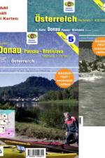
Zwei Karten, gefalzt auf DIN A5 in PE-Hülle, serienmäßig auf wasserfester Folie ("Yupo"®)!erste Karte: Planungs-und Wildwasserübersicht im Maßstab 1: 450 000, 71x63cm, für Kanuten und Ruderer einschließlich Hinweisen zu Wasserständen, Wehranlagen / Schleusen, Campingplätzen, Kanu- u. Rudervereinen, Gewässersperrungen, Fluss-Kilometer, vor allem auch Wildwasser-Schwierigkeitsstufen aller Gewässer zweite Karte: Donaukarte im Maßstab 1: 75.000 DIN A1, Passau bis Bratislavafür Kanuten, Ruderer, Radwanderer und Yachtsportler: genaue Gewässerdarstellung mit Strömungsgeschwindigkeiten, Rast- und Biwakplätzen, auch Donau-Altarme+ Nebengewässer enthalten, Camping +Vereine +Häfen mit Anschriften-Ausstattungsliste, einschl. Donau-Radwanderweg mit Fahrradfreundlichen Quartieren
Part of the bestselling Ultimate series, this is the definitive guide to cycling in Australia.
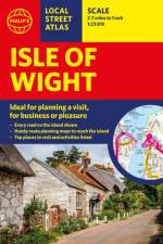
This pocket-sized street atlas of the Isle of Wight gives detailed coverage of the whole of the island and mainland towns nearby.
"Many people who have fulfilled the 'power dream' found it empty and have given it up; the American Dream has become a dead-end street."-Dr. Claude Mr. Steiner, 1981
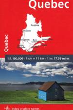
MICHELIN National Map QUEBEC will give you an overall picture of your journey thanks to its clear and accurate mapping scale 1/1,100,000. Our National Map Series will help you easily plan your safe and enjoyable journey thanks to a comprehensive key, a complete name index as well a clever time & distance chart. Michelin's driving information will help you navigate safely in all circumstances. In addition, some MICHELIN National Maps are cross-referenced with the MICHELIN Green Guide highlighting destinations worth stopping for! With MICHELIN National Maps, find more than just your way! MICHELIN NATIONAL MAPS feature: - Up-to-date mapping - A scale adapted to the size of the country - A clear and comprehensive key - Distance and time chart - Place name index - Driving and road safety information - Tourist sights information
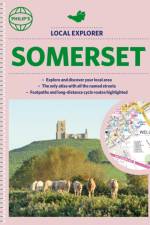
Philip's created this new series for walkers, cyclists and local explorers at a scale that provides greener options to uncover all the nature and hidden gems in your local area. From Bath to Yatton, we cover all of Somerset in glorious detail.
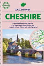
Philip's created this new series for walkers, cyclists and local explorers at a scale that provides greener options to uncover all the nature and hidden gems in your local area. From Chester to Winsford, we cover all of Cheshire in intriguing detail.
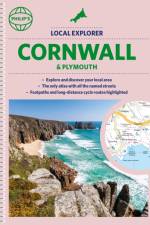
Who hasn't explored and enjoyed their surrounding area recently and come to appreciate what is on our respective doorsteps? Philip's have created this new series for walkers, cyclists and local explorers at a scale that provides greener options to uncover all the nature and hidden gems in the local area. The detailed scale allows explorers, walkers and cyclists to avoid main roads and select pathways, bridleways and lanes for optimum enjoyment. Whether it's meandering through the local parks or historic houses, exploring neighbourhood nature spots or the local town, we have the clear mapping and information you need. If you do have to travel to reach areas you'd like to explore, all A and B roads are clearly shown on our Route Planner and we include all the large-scale town and city plans. Exceptional detail allows the user to pinpoint exactly where they need to go and the best route to follow. * The only atlas with every road, street and lane in the area named, along with the best pedestrian routes, long-distance cycle routes. * Highlighting lanes, alleyways, footpaths and bridleways, camping and caravan sites, golf courses, parks, gardens and many, many other places of interest * Contains all the usual one-way streets, barriers, car parks, railway and bus stations, hospitals, colleges and schools, police and fire stations, places of worship, post offices, shopping and leisure centres
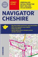
The only detailed colour atlas that gives comprehensive coverage of the entire region - no other atlas names every street in Cheshire. The perfect back-up for emergency services, delivery drivers and locals.
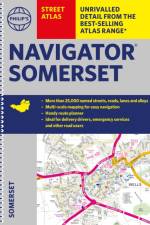
The only detailed colour atlas that gives comprehensive coverage of the entire region - no other atlas names every street in Somerset. The perfect back-up for emergency services, delivery drivers and locals.
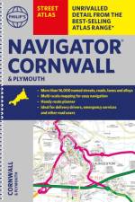
The only detailed colour atlas that gives comprehensive coverage of the entire region - no other atlas names every street in Cornwall and Plymouth. The perfect back-up for emergency services, delivery drivers and locals.
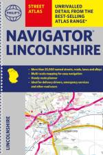
The only detailed colour atlas that gives comprehensive coverage of the entire region - no other atlas names every street in Lincolnshire. The perfect back-up for emergency services, delivery drivers and locals.
Abonner på vårt nyhetsbrev og få rabatter og inspirasjon til din neste leseopplevelse.
Ved å abonnere godtar du vår personvernerklæring.