


Gjør som tusenvis av andre bokelskere
Abonner på vårt nyhetsbrev og få rabatter og inspirasjon til din neste leseopplevelse.
Ved å abonnere godtar du vår personvernerklæring.Du kan når som helst melde deg av våre nyhetsbrev.
Michelin's France Road Atlas A4 is the perfect companion for safe and enjoyable drive in France. Convenient and easy to use thanks to the spiral bound cover, Michelin France Atlas will provide you with precise and reliable information with its updated mapping scaled 1/200 000 (1 cm = 2 km). Smart and practical, this atlas includes tourist sights, leisure facilities and scenic routes recommended in the famous Michelin Green Guide as well 40 embedded city plans plus 16 with QR codes for easy access to your smartphone for online mapping and tourist information! Michelin's checklist will help you prepare your journey before your leave and Michelin's safety alerts will warn you about dangerous driving areas, such as steep hills and level crossing. Michelin's route planner as well as the time and distance charts will help you plan and optimise your journey. Michelin's France road atlas will make sure that you make the most of your journey in France! Michelin's France tourist and motorist atlas (A4 spiral) features:- Scale 1/200 000- Spiral bound for lay-flat convenience- Time & distance charts- Route planner with major itineraries- Tourist sights and scenic drives pulled directly from Michelin's famous Green Guide travel series using the embedded QR codes.- Extensive place name index for rapid look-up- Location map on top of each page for an easier navigation within the atlas- 40 City maps embedded in the map of their surrounding areas with QR code to guide you through the last few miles of your journey with your smartphone plus 16 QR codes for city plans on your phone
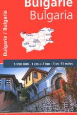
Falset kort i målestokken 1:700.000 med register. På kortet er markeret seværdigheder, som er omtalt i Michelin Green Guide Romania. Indsatte bykort over Sofia, Plovdiv samt Varna.
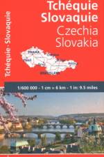
Falset kort i den præcise målestok 1:600.000 med register. Indsatte bykort over Prag og Bratislava. Forventede køretider samt afstandsangivelser.- Praktisk information om sikkerhed- Opdateret kartografi
Much has changed in this region since the first edition of this Atlas was published in 2016, notably the confirmation of the route of HS2 and extensions to the West Midlands Metro. As a consequence, a completely revised edition of this masterly cartographic portrayal of the railways and tramways of the West Midlands by leading railway cartographer, Joe Brown, is particularly timely.The Atlas covers the entire West Midlands continuous urban area of Birmingham, Walsall, Wolverhampton, West Bromwich, Stourbridge and Dudley. It also features the towns and cities surrounding this core area. This includes Stafford, Lichfield, Tamworth, Nuneaton, Coventry, Rugby, Leamington Spa, Stratford-upon-Avon, Bromsgrove and Kidderminster. As well as dealing with the complex railway system that served the area, the entire historic passenger tramway network of the region is mapped with opening and closing details provided in an Appendix. This is brought up to date with the current West Midlands Metro system and future extensions to it which have been announced as well as the planned Coventry ''Very Light Rail'' system.Intricate and finely drawn mapping shows individual track and platforms for all lines whether open and closed, as well as stations, changes of station name and opening and closing dates, and much, much more. Many of those both interested in both transport and local history will already be aware of the superb quality of Joe Brown''s cartography and will wish to add this new and much enhanced edition of the Birmingham and West Midlands Railway Atlas to their libraries.
This is the essential companion to the fascinating world of Scottish placenames. It features more than 8,000 placenames, from districts, towns and villages to rivers, lochs and mountains, and also includes a comprehensive introduction and maps.
Falset kort over Rusland indtil lige vest for Uralbjergene samt området ved Baikalsøen i målestokken 1:2 mill. - øvrige Rusland i målestokken 1:10 mill. Indsat hæfte med register samt 4 bykort. Afstandstabel samt 7 selvklæbende markeringspile for at bevare overblikket.
An essential aide-memoire for those with an interest in all aspects of whisky. It is an invaluable guide for anyone wondering about the place-name on the label of a bottle of Scotch. It provides information on the meaning of the name, the language it is from, or if it is even real.
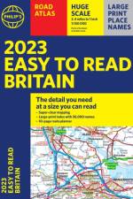
The detail you need - at a size you can read. Our newest bestselling 2023 Easy to Read Britain Road Atlas from Philip's has super-clear, large-scale, large-print maps that everyone can read easily. Practical and chunky A4-sized paperback.
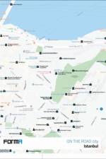
This well-researched guide to contemporary building design in Istanbul explores new architectural directions and urban development in Turkey's largest and most visited city.
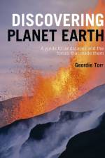
An illustrated guide to the wonders of planet Earth.
Walking guide to the Pembrokeshire Coast National Park, with 20 best routes chosen by the park rangers. Each walk varies in length from 2 to 10 km and can be completed in less than 4 hours.
Walking guide to the Broads National Park, with 20 best routes chosen by the park rangers. Each walk varies in length from 2 to 10 km and can be completed in less than 4 hours.
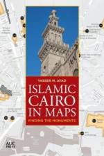
A portable, easy-to-use map guide that locates over 700 hundred Islamic-era monuments in historic Cairo using the most sophisticated Geographic Information Systems (GIS) technology This portable, easy-to-use map guide helps you locate over seven hundred Islamic-era monuments in Cairo's historic core, stretching from the city's northern walls all the way southward to the Mosque of Ibn Tulun and the Citadel, and beyond to Coptic Cairo, which includes monuments that pre-date Islamic rule. Clearly divided into six digestible main sections, the first five contain clusters of monuments, while the sixth covers structures scattered all around the old Cairene urban fabric. The clear, uncluttered cartographic style makes finding where you want to go a pleasure, and the maps are accompanied by a comprehensive index of monuments that gives their dates where known, their location referenced to their corresponding map pages, and a timeline of key periods and dynasties. Attractively designed in full color and including over twenty photographs of key monuments, this guide is conveniently packed into a slim 104 pages--handy enough to take anywhere and great for planning and remembering excursions. It is not only an ideal companion for the city's visitors and residents but an invaluable resource for historians, writers, and students.
Abonner på vårt nyhetsbrev og få rabatter og inspirasjon til din neste leseopplevelse.
Ved å abonnere godtar du vår personvernerklæring.