


Gjør som tusenvis av andre bokelskere
Abonner på vårt nyhetsbrev og få rabatter og inspirasjon til din neste leseopplevelse.
Ved å abonnere godtar du vår personvernerklæring.Du kan når som helst melde deg av våre nyhetsbrev.
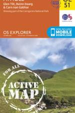
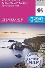
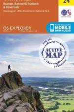
OS Explorer is the Ordnance Survey's most detailed map and is recommended for anyone enjoying outdoor activities like walking, horse riding and off-road cycling. Providing complete GB coverage the series details essential information such as youth hostels, pubs and visitor information as well as rights of way, permissive paths and bridleways.
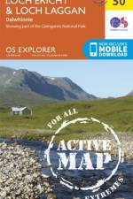
OS Explorer is the Ordnance Survey's most detailed map and is recommended for anyone enjoying outdoor activities like walking, horse riding and off-road cycling. Providing complete GB coverage the series details essential information such as youth hostels, pubs and visitor information as well as rights of way, permissive paths and bridleways.
This revised and expanded second edition continues to address the fundamental principles of visual perception and map symbolism, and critically examines the assumptions which lay behind the theories of psychophysical testing and cartographic communication.
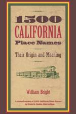
This is the new "e;pocket"e; version of the classic California Place Names, first published by California in 1949. Erwin G. Gudde's monumental work, which went through several editions during its author's lifetime, has now been released in an expanded and updated edition by William Bright. The abridged version, originally called 1000 California Place Names, has grown to a dynamic 1500 California Place Names in Bright's hands. Those who have used and enjoyed 1000 California Place Names through the decades will be glad to know that 1500 California Place Names is not only bigger but better. This handbook focuses on two sorts of names: those that are well-known as destinations or geographical features of the state, such as La Jolla, Tahoe, and Alcatraz, and those that demand attention because of their problematic origins, whether Spanish like Bodega and Chamisal or Native American like Aguanga and Siskiyou.Names of the major Indian tribes of California are included, since some of them have been directly adapted as place names and others have been the source of a variety of names. Bright incorporates his own recent research and that of other linguists and local historians, giving us a much deeper appreciation of the tangled ancestry many California names embody. Featuring phonetic pronunciations for all the Golden State's tongue-twisting names, this is in effect a brand new book, indispensable to California residents and visitors alike.
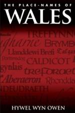
The Place-Names of Wales was originally published in 1998 and reissued in 2005 in the Pocket Guide series. This current updated publication adds some thirty entries, which importantly take into consideration more recent research. The entry for each place-name provides details of historical forms and dates; analyses each name into its component linguistic elements; tracks the later linguistic development of the name and the influences upon it particularly within a bilingual society; compares the name with similar names elsewhere, and interprets that meaning within the history of Wales and in the local context having regard for the landscape and changing land-use. In addition to explaining the link between place-names and language, history and landscape, the introduction includes a section on the significance of place-name study, and a short section to allow non-Welsh speakers to understand some relevant sound-changes.
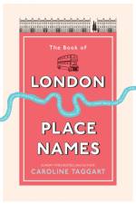
Ever wondered if Cheapside really is cheap, what you do in Threadneedle Street, or who the knights of Knightsbridge were?Did you know that Piccadilly is actually an insult? And that Euston Road was built because there were too many cows on Oxford Street? Or that the River Fleet was covered over partly because of a drunken butcher? Take a trip down narrow lanes, through cobbled streets and crowded markets to discover the meanings behind the city s place names. Meet forgotten residents whose names survive in the places where they lived, such as Sir George Downing of Downing Street, and uncover tales from London s murky past that have shaped the modern city.From famous landmarks to forgotten rivers, grand thoroughfares to lost palaces, and ancient villages swallowed up as the city grew, Caroline Taggart explains the hidden meanings behind familiar places. If you have ever wanted to learn more about the history of London and discover the people, events and stories that shaped our capital city, then come on a journey that will show you London in a new light...
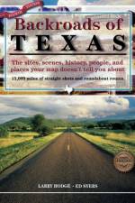
This new edition takes you off the major highways to discover the sights, scenes, history, and places that make the Lone Star State unique.
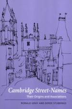
This book, first published in 2000, draws on the great wealth of associations of street-names in Cambridge. It is not a dictionary, but it provides a series of entries on such topics as the Reformation, George IV and his wife, twentieth-century British scientists, businessmen, Elizabethan times, medieval Cambridge, mayors, millers, and builders. It includes hermits and coal merchants, field marshals and laundresses, martyrs and bombers, unscrupulous politicians and the founder of a Christian community, Cromwell and Newton, an Anglo-Saxon queen and the discoverer of Uranus - all people who lived in or often visited Cambridge. The ancient Stourbridge fair is included, along with castles and boat-races, sewage pumps and the original Hobson of 'Hobson's Choice'. Who was St Tibb? Where did Dick Turpin hide? Where was the medieval takeaway? Unlike earlier works, this is a history of everybody for everybody.
Fully revised and updated for an 8th edition, the Student World Atlas brings the Earth's geography to life with state-of-the-art mapping from up-to-date satellite and cartographic sources.Detailed maps reveal the Earth's physical structure, oceans, climate, population and economy. Borders and boundaries of the world's countries have been fully updated and are clearly explained, while a world fact-file and gazetteer highlight key statistical data for each country, allowing direct comparisons between nations. A section devoted to learning map skills develops your understanding and practical use of maps.Student World Atlas is the perfect geography resource and an essential reference for students of all ages.
How many people have looked at a map of the Highlands and been intrigued and yet, at the same time, felt excluded by the wealth and strangeness of the place names recorded? Reading the Gaelic Landscape is a must for anyone who is interested in the Scottish Highlands and its ancient tongue. It will encourage people to read and understand the seemingly obscure Gaelic words, and also provides an insight into landscape history. The text will enrich the experience of walkers, climbers, sailors, bird watchers and fishers by sketching the Gaelic context where they enjoy and pursue their interests. Outdoor enthusiasts will no longer struggle with unfamiliar spellings and words as they will acquire a new dimension of place through an understanding of place names in the Highlands. Enough knowledge about pronunciation and Gaelic grammar is provided for readers to enable them to pronounce names, so that a native speaker can understand them. Sufficient grammar is given to help the reader see the different forms of words, which occur in various combinations in place names. The vast linguistic resource of place names written in an endangered language would also be opened up to learners and schoolchildren in Gaelic medium education who would be able to broaden their vocabulary beyond what is normally taught, and reacquaint themselves with their rural heritage. The book takes a unique and comprehensive approach, as it expands and categorises current place name vocabulary and provides commentaries on Gaelic ecology, culture and landscape between each section. There is also a comprehensive index, which directs readers to examples of different name types which are grouped according to whether they describe plants, animals, physical or man-made features. Specific themes explored include how Gaelic poets like Sorley MacLean and Duncan Bn MacIntyre used Highland landscape symbolically in their work. The lyrical tradition of the shieling and Fingalian legend is connected in this way as well. Place names are also used to speculate about species extinctions and the history of the mythical Caledonian Forest. Readers will learn about diverse aspects of place and how these have been recorded, through a deeper understanding of a language, specific to the landscape of the Scottish Highlands and unique in its perception of that landscape.
Mappe med to kortblade, som dækker hele Åland og en stor del af skærgården vest for Åbo. Kortene er udviklet til dig, som på forskellig vis vil nyde friluftslivet. De viser markerede cykel- og vandringsruter, grillpladser, overnatningsmuligheder, seværdigheder og skærgårdsbutikker. Vi har også medtaget de vigtigste sømærker for at forenkle navigationen for dem, som ror eller løber på skøjter.Kortene er trykt på Tyvek, et ekstremt slidstærkt og helt vandfast materiale.
A procession through Hong Kong's outposts of good food, design, retail, and more, this definitive travel guide will make you feel like a local no matter where you are from.Vertigo-inducing skyscrapers that cling to mountainous slopes and busy fishing villages that proudly hold on to their cultural heritage: Hong Kong is more diverse than you'd imagine. Navigate the futuristic covered skyways connecting office towers and you'll pass over temples from which incense smoke trails towards the heavens. This city can appear to be an impenetrable collection of concrete high-rises, but you are rarely further than a short taxi ride from verdant hikes. The mix of high and low will charm the most hardened urban travellers. Monocle's Hong Kong takes you on a fresh journey from the best dining spots to side-street food stalls. The Monocle team will also show you where to head for rich retail experiences and handmade shoes and shirts. Then there are walks to take you away from the hustle and bustle of Central into plant-filled streets where the din of the city disappears. Hong Kong may have been built on trade and commerce but it's now also a place where contemporary art thrives. It's a global hub that welcomes visitors. You should be next.
The Peak District, a captivating book authored by the talented writer, was published by Ordnance Survey in the year 2020. This book belongs to the genre of travel and exploration, enticing readers with its detailed portrayal of the Peak District. The author's vivid description of the landscapes, the rich history and the cultural diversity of the Peak District makes it an engrossing read. This book is more than just a travel guide, it provides an immersive experience making readers feel like they are exploring the Peak District themselves. Published by Ordnance Survey, known for their meticulous details and accuracy, this book is a must-have for every travel enthusiast. Dive into the enchanting world of The Peak District and embark on an unforgettable journey.
Falset landkort trykt på vejrbestandigt plastpapir (PolyArt - miljøvenligt) med papomslag. Brugervenligt og fuldt opdateret kort, ideelt for planlægning og rejsebrug. - GPS-egnet - Udførligt register - Højdekurver med angivelse i meter - Seværdigheder - Afstande i km - Campingpladser - 80 gram - Dobbeltsidet - 70x100 cm
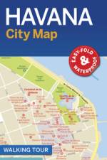
- Easy to use fold-out map- Durable, full colour & waterproof- Extensive street & site index- Handy slip case- Walking tours
5. udgave 2018. Travel reference map in the scale 1:1,4 mill. with detailed insert maps of Bogota, Medellin and Cartagena. Printed on plastic paper.
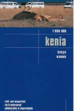
Falset landkort trykt på vejrbestandigt plastpapir (PolyArt - miljøvenligt) med papomslag. Brugervenligt og fuldt opdateret kort, ideelt for planlægning og rejsebrug. Kortet indeholder en del af det nordlige Tanzania med Kilimanjaro, Arusha og Moshi.- GPS-egnet - Udførligt register- Højdekurver med angivelse i meter- Seværdigheder- Afstande i km- Campingpladser- 80 gram- DobbeltsidetMålestok 1:950.000.
9. udgave 2018. Falset kort med register i målestokken 1:1,1 mill. trykt på plastpapir. Indsatte bykort over Central Tokyo, , Nara, Osaka, Sapporo og Kyoto. Trykt på begge sider af papiret og indeholder også et register.
Ahkkastugorna - Gissurisstugorna - Suorvadammen - Alkavare kapell - Rinim - Pårek - Aktse
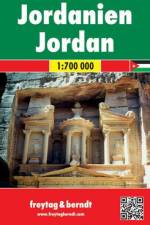
Falset kort i målestokken 1:700.000. Turistkort med mange praktiske informationer. Seværdigheder, campingpladser, vejbeskaffenhed, bykort og omfangsrigt stednavneregister.
THE COMPREHENSIVE, RELIABLE, INDISPENSABLE GLOBAL REFERENCE WORK - FULLY UPDATED FOR 2020VOLUME 3 OF 3 - CONTAINS: Countries: Portugal to Zimbabwe. Appendices: Abbreviations, International Organizations and Groups, Environmental Agreements, Country and Hydrographic Codes, Geographic Names, Weights & Measures, Strategic Materials.For Volume 1, search for "1949117138".For Volume 2, search for "1949117146". Unique three-volume, large-format edition. Giant 8"x10" size - easy to read and navigate. New for 2020: Strategic Materials appendix. Complete & unabridged - 1,800+ pages total, 600+ pages per volume. "Batteries last hours, books last decades. Get the print edition!" Looks AMAZING on any professional or home bookshelf!The World Factbook provides up-to-date information on the history, people, government, economy, geography, communications, transportation, military, and transnational issues for 267 world entities. This almanac-style reference work is created with input and data from numerous government departments, and is the single most accurate source of intelligence on the nations and peoples of our world.CREATED BY THE CIA, TRUSTED BY INTELLIGENCE OFFICERS, DIPLOMATS, ACADEMICS, JOURNALISTS AND OTHER PROFESSIONALS AROUND THE GLOBE.Sources include: Antarctic Information Program (National Science Foundation) - Armed Forces Medical Intelligence Center (Department of Defense) - Bureau of the Census (Department of Commerce) - Bureau of Labor Statistics (Department of Labor) - Council of Managers of National Antarctic Programs - Defense Intelligence Agency (Department of Defense) - Department of Energy - Department of State - Fish and Wildlife Service (Department of the Interior) - Maritime Administration (Department of Transportation) - National Geospatial-Intelligence Agency (Department of Defense) - Naval Facilities Engineering Command (Department of Defense) - Office of Insular Affairs (Department of the Interior) - Office of Naval Intelligence (Department of Defense) - Oil & Gas Journal - United States Board on Geographic Names (Department of the Interior) - United States Transportation Command (Department of Defense) - and more...Proudly Published in the U.S.A. by CARLILE MEDIA.
THE COMPREHENSIVE, RELIABLE, INDISPENSABLE GLOBAL REFERENCE WORK - FULLY UPDATED FOR 2020VOLUME 2 OF 3 - CONTAINS: Countries: The Gambia to Poland.For Volume 1, search for "1949117138".For Volume 3, search for "1949117154". Unique three-volume, large-format edition. Giant 8"x10" size - easy to read and navigate. Complete & unabridged - 1,800+ pages total, 600+ pages per volume. "Batteries last hours, books last decades. Get the print edition!" Looks AMAZING on any professional or home bookshelf!The World Factbook provides up-to-date information on the history, people, government, economy, geography, communications, transportation, military, and transnational issues for 267 world entities. This almanac-style reference work is created with input and data from numerous government departments, and is the single most accurate source of intelligence on the nations and peoples of our world.CREATED BY THE CIA, TRUSTED BY INTELLIGENCE OFFICERS, DIPLOMATS, ACADEMICS, JOURNALISTS AND OTHER PROFESSIONALS AROUND THE GLOBE.Sources include: Antarctic Information Program (National Science Foundation) - Armed Forces Medical Intelligence Center (Department of Defense) - Bureau of the Census (Department of Commerce) - Bureau of Labor Statistics (Department of Labor) - Council of Managers of National Antarctic Programs - Defense Intelligence Agency (Department of Defense) - Department of Energy - Department of State - Fish and Wildlife Service (Department of the Interior) - Maritime Administration (Department of Transportation) - National Geospatial-Intelligence Agency (Department of Defense) - Naval Facilities Engineering Command (Department of Defense) - Office of Insular Affairs (Department of the Interior) - Office of Naval Intelligence (Department of Defense) - Oil & Gas Journal - United States Board on Geographic Names (Department of the Interior) - United States Transportation Command (Department of Defense) - and more...Proudly Published in the U.S.A. by CARLILE MEDIA.
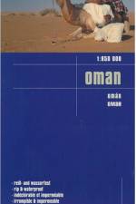
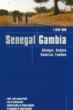
Falset landkort trykt på vejrbestandigt plastpapir (PolyArt - miljøvenligt) med papomslag. Brugervenligt og fuldt opdateret kort, ideelt for planlægning og rejsebrug.- GPS-egnet - Udførligt register- Højdekurver med angivelse i meter- Seværdigheder- Afstande i km- Campingpladser- 80 gram- Dobbeltsidet- 1:550.000
Abonner på vårt nyhetsbrev og få rabatter og inspirasjon til din neste leseopplevelse.
Ved å abonnere godtar du vår personvernerklæring.