


Gjør som tusenvis av andre bokelskere
Abonner på vårt nyhetsbrev og få rabatter og inspirasjon til din neste leseopplevelse.
Ved å abonnere godtar du vår personvernerklæring.Du kan når som helst melde deg av våre nyhetsbrev.
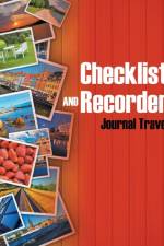
Yes, you travel; but wouldn''t it be great to still be productive while you''re on the road? Write your thoughts, your observation and your adventures when pictures are no longer enough to contain your emotions. This journal is complete with spaces for itineraries, written documentations, contact sheets and even your mileage history! Go ahead and grab a copy today!
Who is an American girl? This coloring book will teach your child that there is no basic definition of an American girl to conform to. All that matters is that your child remains herself and can stand on her own beliefs. This coloring book is an effective reminder that being unique is one''s own signature. Coloring is a highly encouraged activity that will lead to self-confidence over time.
There''s plenty of space to write and paste pictures of your dream destinations. Keeping a visual of where you want to go helps you become more determined to work and complete your travel fund. Treat this travel journal as your bucket list and tick one off whenever you reach a destination. By the way, don''t forget to write memories here too!
Namenwelten ist eine breit angelegte Dokumentation zu Namen und Namenforschung im deutsch-skandinavischen Raum. Einen Schwerpunkt bilden Beiträge, die Fragen nach Herkunft, Entstehung und Bildungsweise von Ortsnamen nachgehen und dabei umfangreiches neues onymisches Material vorstellen. Die Erforschung der Personennamen umfasst auch theoretisch-methodische Aspekte, allgemeine Prinzipien sowie Kontinuität und Tradition der Namengebung. Eine Reihe runologisch orientierter Artikel widmet sich den in Runeninschriften überlieferten Namen und verknüpft sie mit sprach(geschicht)lichen Problemen; dabei werden in Einzelfragen auch benachbarte Forschungsgebiete gestreift. Der Index erschließt annähernd 5000 Orts- und Personennamen.
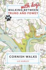
A dog walking book for dog lovers in Cornwall
Fußball gilt schon seit langem als die wichtigste Nebensache der Welt. Kein Wunder also, dass Sportgroßveranstaltungen wie die UEFA Europameisterschaft zu gewaltigen Mega-Events geworden sind, die weltweit ein Millionenpublikum unterhalten.Bei Turnieren wie diesen geht es aber längst nicht mehr nur um Sport und Unterhaltung. Sportgroßveranstaltungen werden mittlerweile oft als Investitionen in ganze Regionen angesehen. Lisa Smekal untersucht in ihrer Publikation anhand der UEFA EURO 2008 die ökonomischen, ökologischen sowie sozialen Auswirkungen von Sportgroßveranstaltungen.In der Hoffnung auf positive wirtschaftliche und gesellschaftliche Effekte, wetteifern Städte und Nationen bereits seit langem um die Ehre, große Sport-Events austragen zu dürfen. Smekal analysiert nun die Nachhaltigkeit solcher Mega-Events.Aus dem Inhalt: - Fußball;- Sportgroßveranstaltung;- UEFA EURO 2008;- Europameisterschaft;- Eventmanagement;- Nachhaltigkeit
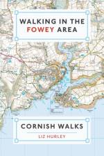
Eleven walks ranging from 3 to 11 miles. Each walk comprises of essential information including a map, an elevation and photos. It then goes on to gives clear detailed instructions accompanied by tales of local history and knowledge. An invaluable guidebook.
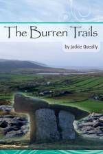
This full colour guide to the Burren presents a series of itineraries for cyclists or car users to explore the hidden as well as the better known sites in the International Geopark and surrounds of this stunning limestone region in Counties Clare and Galway, Ireland. Includes good directions, maps, GPS, mileage, photos and informative text. Written by local prolific author and guide Jackie Queally, who also is a biofield tuner (sound healing). Quirky and fun to read, it will whet your appetite to explore this beautiiful nature-laden area at your leisure.
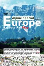
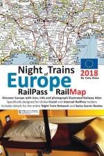
Night Trains of Europe 2018 Edition is substantially updated and revised with details of over 160 night trains which regularly traverse the continent.Explore the whole European railway network with the 74 page paperback version of illustrated RailPass RailMap Europe Designed specifically for Interrail or Eurail global railpass holders. Easy to navigate full colour print version covers 31 European countries in addition to Turkey and North AfricaPurchase includes complementary PDFs via website link. Updated 2018 edition includes detailed RailMaps of the most spectacular Alpine routes including French Alpine routes, northern Italy and western Austria. Brand new for 2018 are icons indicating UNESCO listed sites, significant religious buildings, castles and attractive Medieval towns.Buyer Beware! Please note that RailPass RailMap 2018 has been specifically designed with the Global RailPass holder (interrailer) in mind. THIS IS NOT A COMPLETELY DEFINITIVE RAILWAY MAP. Instead RailPass RailMap is all about enabling easy and quick reference navigation around the entire European railway network in an easy to locate (i.e. top tourist destinations), easy to understand (easy to identify train types), easy to pack away format (i.e. can be folded in half) and full colour durable quality paper plus long lasting laminated gloss cover (i.e. large printed folding maps quickly suffer from tearing). The large square paperback format enables large spreads which have the look and feel of a folded map with many duplications so you can easily follow the network across the spreads.All the most popular tourist destination, cities and major towns on the network are highlights in large bold print. All the major network connections, scenic routes, intersections and junctions are easy to follow to enable you to quickly get to your chosen destinations.New for 2018 is major ferry crossings sailing info and railpass discounts for UK, Ireland, Sweden, Denmark, Finland, Spain, Italy and Greece.Included: Detailed explanation of night train network with simplified infographic displaying relevant connections and major stops for each country with departing Night Train services including timetable info, schedule notescurrency and www.links to check departure times Index with Country flag and RailMap pages Detailed explanation of RailMap legend and what to look out for on RailMap Easily identified High speed routes where compulsory reservations and supplments are required (bright orange lines) and where no additional cost is requred (purple lines) Main railway lines (seat reservation usually required in Eastern Europe) Majority of local lines (in most cases no additional seat reservation requirement) Green highlighted and easy to identify scenic routes so you can plan the most interesting and awesome routes Swiss scenic routes are clearly identified with special highlights and legend so you know exactly how to make the very best of your time in this wonderful scenic rich country Bus routes (pink lines) where the train network is in repair or is seasonal etc. Ski resorts and popular summer hiking destinations Ports and popular ferry routes including discounts that railpass attracts and sailing info etc Train stations with shower facilities National parks and areas of outstanding beauty Cities and towns with nearby airports (with highlighted airport codes) Sandy beaches and stunning coastlines Mountain ranges and major inland lakes This is an indispensable railway travel guide designed by an experienced Interrailer with a passion for creating informative railway maps. RailPass RailMap is continually updated. To learn more please visit RailMapEurope
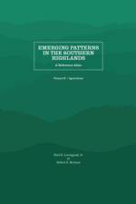
The second volume of Emerging Patterns in the Southern Highlands: A Reference Atlas focuses on agriculture in the 156 counties in the Southern Appalachian region. In addition to the maps and data, six essays by scholars of the region are included to support and enrich the volume.
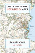
An informative walking guide for the Mevagissey area. Relying on OS maps and local knowledge, this is the perfect guidebook for anyone that wants to explore and discover new corners and unknown facts. Contains nine walks, ranging from four to eight miles and from easy to strenuous. Many are suitable for dogs but full details accompany each walk.
The OS Landranger Map series covers Great Britain with 204 detailed maps, perfect for day trips and short breaks. Each map provides all the information you need to get to know your local area and includes places of interest, tourist information, picnic areas and camp sites, plus Rights of Way information for England and Wales.
A handy pocket-sized guide to the best food, drink and sights to see in Havana
The Ordnance Survey Puzzle Book was the biggest-selling puzzle book of 2018. And now it is back, and bigger and better than before!
The Dales Way is a 79 mile (127km) long distance trail in the north of England, running between Ilkley, in North Yorkshire and Bowness-on-Windermere, in Cumbria.
The OS Landranger Active Map series covers Great Britain with 204 detailed maps, perfect for day trips and short breaks. Tough, durable and weatherproof, covered in a lightweight protective plastic coating that can be written on, so that your favourite routes can be easily highlighted.
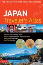
Finding your way around the various regions of Japan is a breeze with this handy Tuttle Japan Traveler's Atlas. Designed for the adventurous traveler and containing all the maps you'll need on your explorations, this atlas includes many views that are not available anywhere else.The atlas is conveniently divided into the major regions of Japan:TokyoMt. Fuji & Around TokyoCentral HonshuKyotoKansaiHiroshima & Western HonshuNorthern HonshuHokkaidoShikokuKyushuOkinawa & the Southwest Islands Each of the 148 maps in this atlas is presented in a logical, easy-to-follow manner, with emphasis on the most frequently-visited areas. All cities, towns, villages, places of interest including nature reserves are indexed for quick reference.Comprehensive: detailed insets are given for all the major cities, travel destinations and business hubs in Japan.Informative: Precise locations are indicated for all popular sights, hotels, restaurants, temples, shopping malls and other essential locations.Practical: The handy size, well-designed key maps and comprehensive index help you find any place you are looking for quickly.Reliable: No need to worry about cell service or battery—the maps in this atlas are thoroughly researched and regularly updated by the leading publisher of Asia Pacific maps.
"Between 1650 and 1800, the social and intellectual changes that were sweeping Europe also transformed its mapmaking practices. Throughout the nations on the continent as well as their overseas territories, a new emphasis on geometrical principles gave rise to improved tools for measurement and mapping of the world, even as the rising power of the state enabled large-scale mapping and surveying projects. As illustrated in this comprehensive history, however, cartography encompasses a wide variety of processes for making, circulating, and using maps of different types, and the developments of the Enlightenment era affected these processes in different ways, depending on the type of map and the context of its production. The volume's 489 encyclopedia-style articles, contributed by an international cast of 207 scholars and experts, range from short biographical sketches of key individuals to multipart entries on such broad topics as "Geodetic Surveying," "Thematic Mapping," and "Map Collecting." Each entry includes bibliographical references, and the volume is illustrated with 954 images, all printed in full color"--
Enhanced, large scale (1: 25,000) Ordnance Survey mapping in a handy atlas format with all the mapping you need to walk the Llyn Peninsula section of the Wales Coast Path.
Sunnyside discusses changes to British house names from medieval naming practices to the present-day. The demise of pub names and shop names such as la Worm on the Hope and the Golden Tea Kettle & Speaking Trumpet are detailed alongside the rise of heraldic names such as the Red Lion.
Insight Guides Travel Map USA & South Canada Travel made easy. Ask local experts. This detailed travel map is all you need to plan your route and navigate your way around USA & South Canada; also includes a comprehensive index and a fabulous free app. Features of this travel map to USA & South Canada:- Drawn to a scale of 1:4 million, showing the entire area, complete with a comprehensive index- Ideal for route planning before and during your trip- Places of interest highlighted using pictorial symbols- Handy distance indicators give distances to the nearest town and other major locations- Intermediate driving distances marked on main roads- City plans of Chicago, Los Angeles, Miami, New York, San Francisco & Washington D.C. - Extensive legend shown in 4 languages- Innovative and unique extras: a free app with top travel tips, must-see places, restaurants and hotelsYou may also be interested in: Insight Guides USA on the Road, Insight Guides CanadaAbout Insight Guides: Insight Guides is a pioneer of full-colour guidebooks, with almost 50 years' experience of publishing high-quality, visual travel guides with user-friendly, modern design. We produce around 400 full-colour print guide books and maps, as well as phrase books, picture-packed eBooks and apps to meet different travellers' needs. Insight Guides' unique combination of beautiful travel photography and focus on history and culture create a unique visual reference and planning tool to inspire your next adventure.
Abonner på vårt nyhetsbrev og få rabatter og inspirasjon til din neste leseopplevelse.
Ved å abonnere godtar du vår personvernerklæring.