

Gjør som tusenvis av andre bokelskere
Abonner på vårt nyhetsbrev og få rabatter og inspirasjon til din neste leseopplevelse.
Ved å abonnere godtar du vår personvernerklæring.Du kan når som helst melde deg av våre nyhetsbrev.
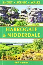
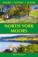
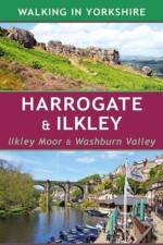
This new title is one of the first two in an updated series of Paul Hannon's `Short Scenic Walks' guidebooks. The principle feature is that all walks are less than five miles in length, offering a perfect half day's stroll for families, casual walkers and all who want to enjoy a leisurely exploration of Britain's outstanding country landscapes
This new title is one of the first two in an updated series of Paul Hannon's `Short Scenic Walks' guidebooks. The principle feature is that all walks are less than five miles in length, offering a perfect half day's stroll for families, casual walkers and all who want to enjoy a leisurely exploration of Britain's outstanding country landscapes.
This book provides 25 enjoyable outings amid a rich variety of scenery. A collection of 40 colour photographs depict features and landscapes along the routes, while the concise route descriptions are complemented by a wealth of background information.
This book provides 25 enjoyable outings amid a rich variety of scenery. A collection of 40 colour photographs depict features and landscapes along the routes, while the concise route descriptions are complemented by a wealth of background information.
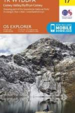
OS Explorer is the Ordnance Survey's most detailed map and is recommended for anyone enjoying outdoor activities like walking, horse riding and off-road cycling. The OS Explorer range of OL maps now includes a digital version of the paper map, accessed through the OS smartphone app, OS Maps.
A handy pocket-sized guide to the best food, drink and sights to see in San Francisco, plus day trips further afield
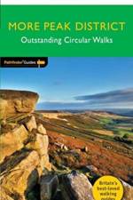
A new Pathfinder (R) walking guide to the Peak District, featuring 28 circular rambles clearly arranged by length and grade, visiting both the White Peak countryside of the south and the more rugged Dark Peak of the north, with all walks accompanied by GPS waypoints, Ordnance Survey maps and colour photography.
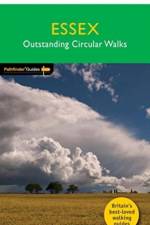
28 fabulous coastal and country walks offering an exploration of the lonely marshes, rolling farmlands, ancient woodlands and attractive villages of Essex. Graded by length and ranging from 3 to 9 miles all routes come with a clear, large-scale OS map, GPS waypoints and highlight where to park, good pubs and places of interest en route.
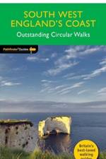
New Pathfinder (R) walking guide to South West England featuring 30 circular walks ranging in length from 2 to 13 miles. Exploring the UK's most popular National Trail, the South West Coast Path, all walks are accompanied by GPS waypoints, Ordnance Survey maps and colour photography
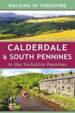
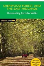
28 circular, graded walks all tried and tested by seasoned walkers. The routes range from extended strolls to exhilarating hikes, so there is something for everyone.
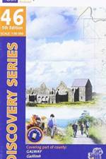
The Discovery Series are designed for tourist and leisure activities. Each one covers an area of 40km x 30km at the scale of 1:50,000. There are 93 sheets in the series. 75 are produced by Ordnance Survey Ireland and 18 by Ordnance Survey Northern Ireland. The maps produced by Ordnance Survey Northern Ireland are called the Discoverer Series.
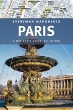
Explore Paris with 10 large-scale, fold-out maps for each of the cityâEUR(TM)s neighbourhoodsDetails of more than 300 places to visit âEUR" museums, parks, galleries, historical sites, restaurants, music venues and shopsAll the practical advice you need âEUR" including getting around and where to stay âEUR" plus a transport mapPLUS BRAND NEW PAGES... Ten must-see sightsThemed walks: Le Marais; The Banks of the Seine; The Canals of East ParisParis in 3 days; plus day trips close to the cityParis on a budget
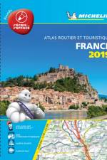
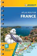
Michelin Tourist and Motoring Atlases are the perferct travel companions for holiday planning and everyday journeys. In addition to clear and accurate mapping, the Michelin motoring altas series will help you optimise and add comfort to your journey. In scales from 1:150,000 to 1:8,500,000
Michelin Tourist and Motoring Atlases are the perferct travel companions for holiday planning and everyday journeys. In addition to clear and accurate mapping, the Michelin motoring altas series will help you optimise and add comfort to your journey. In scales from 1:150,000 to 1:8,500,000
'Imagine a grown-up version of Horrible Histories.' Sunday Times
The OS Landranger Active Map series covers Great Britain with 204 detailed maps, perfect for day trips and short breaks. Tough, durable and weatherproof, covered in a lightweight protective plastic coating that can be written on, so that your favourite routes can be easily highlighted.
The OS Landranger Map series covers Great Britain with 204 detailed maps, perfect for day trips and short breaks. Each map provides all the information you need to get to know your local area and includes places of interest, tourist information, picnic areas and camp sites, plus Rights of Way information for England and Wales.
The OS Landranger Active Map series covers Great Britain with 204 detailed maps, perfect for day trips and short breaks. Tough, durable and weatherproof, covered in a lightweight protective plastic coating that can be written on, so that your favourite routes can be easily highlighted.
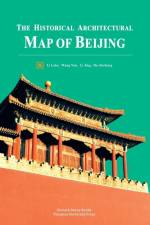
Beijing has been the capital of China for over 800 years. There are many architectural buildings left from the old days, which have witnessed numerous historical events, and are treasures of traditional culture, representative of genuine Chinese style. They are valuable not only because of their independent function as buildings, but also because of their unrivaled diversity and integrity, which constitute the most unique, most valuable and best preserved artistic masterpieces, both traditional and dynamic. It will be a great pleasure for people who come to Beijing for a visit traveling around the city with a map in search of the imperial flavors, folk customs and architectural charm. For people working in the fields of architecture, planning, history and art, or students in these fields, this is part of their essential tasks. The Historical Architectural Map of Beijing offers an extensive knowledge of the city to those who are interested in traditional Chinese architecture and culture, and those who travel in Beijing, exploring the history of the city.Li Luke is a post-doctorate and assistant research fellow in the School of Architecture at Tsinghua University, majoring in architectural history and theory. Wang Nan is a post-doctorate and assistant research fellow of urban planning at Tsinghua University. Li Jing is pursuing her doctoral degree at Tsinghua University, majoring in architectural history and theory. Hu Jiezhong is pursuing her doctoral degree at Tsinghua University, majoring in architectural history and theory.
Die vorliegende Arbeit beschäftigt sich mit den aktuellen Entwicklungen im Weltraumtourismus und setzt dabei einen Fokus auf dessen Angebote und den weltweiten Anbietermarkt. Im Rahmen einer konstitutiven Betrachtung wird der Weltraumtourismus zudem hinsichtlich seiner touristischen Kernelemente untersucht. Einen weiteren Schwerpunkt bildet die Nachfrage nach Weltraumtourismus.Es wird der Frage nachgegangen, wie sich der Markt für Weltraumtourismus gebildet hat, wie dieser aktuell aussieht und sich in Zukunft entwickeln wird und welche Nachfragegruppe sich für diesen Markt erkennen lässt. Ziel ist es zu klären, inwiefern der Weltraumtourismus ein bereits heute existierender Markt ist, ob dieser zukunftsfähig ist und welche Nachfragegruppe sich für Weltraumangebote interessiert.Neben literarischen und elektronischen Nachweisen stellt ein Experteninterview mit dem europäischen Spezialreiseveranstalter ¿European Space Tourist¿ eine ergänzende Informationsquelle dar.Im Ergebnis wird deutlich, dass sich der Markt für Weltraumtourismus noch am Anfang seiner Entwicklung befindet. Viele Angebote werden bereits seit Jahren beworben, sind aber bis heute noch nicht verwirklicht worden. Aufgrund der noch fehlenden Angebote, kann man aktuell nur von einem terrestrischen und weltraumnahen Weltraumtourismus sprechen. Zukünftige Pläne und Projekte sowie ein großes Interesse der Bevölkerung an einem Weltraumflug lassen auf positive Entwicklungen in der Zukunft schließen. Während sich in der Theorie der sogenannte ¿extreme¿ Erlebnistourist klassifizieren lässt, zeigt die Praxis eine eher durchmischte Nachfragegruppe.
WORK IS IN FRENCH This book is a reproduction of a work published before 1920 and is part of a collection of books reprinted and edited by Hachette Livre, in the framework of a partnership with the National Library of France, providing the opportunity to access old and often rare books from the BnF's heritage funds.
Abonner på vårt nyhetsbrev og få rabatter og inspirasjon til din neste leseopplevelse.
Ved å abonnere godtar du vår personvernerklæring.