Gjør som tusenvis av andre bokelskere
Abonner på vårt nyhetsbrev og få rabatter og inspirasjon til din neste leseopplevelse.
Ved å abonnere godtar du vår personvernerklæring.Du kan når som helst melde deg av våre nyhetsbrev.
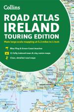
The 1:400,000 scale road and leisure map of Iceland provides a wealth of useful information for travelers wishing to experience the breathtaking beauty of Iceland. With the road map from freytag & berndt , drivers and motorcyclists can explore Iceland safely and efficiently, regardless of whether they stay on the main roads or choose adventurous routes on secondary roads. The entire road network of the island is shown exactly on the map, and many excursion destinations and sights, such as geysers and opportunities for whale watching, are also marked on the map. Caravan drivers and campers will of course find all campsites and pitches on the map. Iceland road map information Scale 1:400,000 Cityplan Reykjavik 1:20.000 Whale watching, lookouts Campsites and pitches Register of places with postcodes double sided Format: 70 x 90 cm Waterproof and tear resistant Located in Southwest Iceland, the Golden Circle offers some of Iceland's tourist highlights. These include the Thingvellir National Park (THingvellir), the Geysir geothermal area and the spectacular Gullfoss waterfall , which impresses with its mighty cascades.
Den 34. udgave af Sveriges bedste vejatlas viser forskellige vejtyper, frakørselsnumre, vejafstande, rastepladser, vandrerhjem, camping, stellpladser/autocamperparkering og bykort. Den indeholder desuden information om seværdigheder, golfbaner, STF-vandrerhjem samt oversigtskort med ladestandere, afstande og færgeforbindelser. Temakort viser museer, dyreparker, forlystelsesparker og verdensarv. Atlasset afsluttes med en fortegnelse over almindeligt forekommende færdselsskilte, køretøjsmarkering for farligt gods og et udførligt stednavneregister. Alt, hvad man forventer sig af et godt atlas og lidt til!
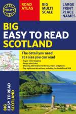
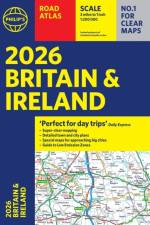
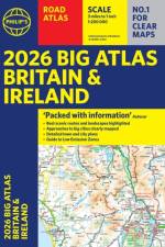
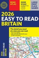
With the detail you need at a size you can read, the latest edition of 2026 Philip's Big Easy to Read Road Atlas of Britain is super-clear, super-sized and bang up-to-date in a large paperback format. Over 100,000 copies sold of thePhilip's Easy Read Road Atlases of Britain.
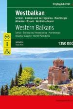
Road atlas of Serbia - Bosnia and Herzegovina - Montenegro - Albania - Kosovo - North Macedonia 1:150,000.Planning map Balkan 1:1,000,000 and Europe 1:3,500,000.Spiral binding concealed.Camping and pitches, tourist information.Eight city maps, including Sarajevo, Tirana and Belgradeplace register with postal codes.320 pages, format 23 x 29.7 cm
The new AA Touring Atlas Scotland is the go-to travel companion for discovering the very best of Scotland. Designed with travellers in mind, this easy-to-read, user-friendly atlas combines premium quality with unbeatable value, ensuring you get the most out of your journey. Includes the popular North Coast 500 route.
Michelin's France luxurious tourist and motoring atlas is super resistant and easy to use thanks to its fold-out multiflex binding. In addition of Michelin's clear and accurate mapping, this atlas will give you an enhanced view of your journey thanks to its scale 1/200,000. The route planner as well as the time distance charts will help you plan and optimise journey. Michelin's new safety alerts warn you about dangerous driving areas and zones subjet to tighter speed checks. This atlas also includes 40 cities plans with QR codes linking to your smartphone for an easy navigation in urban areas. Information on tourist sights, leisure facilities, scenic routes, as well as service areas will add pleasure and comfort to your journey Michelin's France multiflex tourist and motoring atlas features:- Scale: 1/200,000: for an enhanced view of your journey- Fold flat making it easier to read your journey as you go along- Key to map pages: to quickly access the region of your interest- A complete town index: To easily indentify to destination of your choice- Distance and time chart: to help you plan your trip- 40 city plans with QR Code to guide you through the last few miles of your journey with your smartphone- Michelin's danger alerts: to help you identify zones at risks for drivers and controlled speed areas- Main Road Map for an overview of France's primary road network- 18 pages of European mapping scale 1/3,500,000- 20 pages dedicated to motorway service areas - with facilities available on-site.- In English language: Keys, indexes and information. The atlas is also cross-referenced with the famous Michelin's Green Guide with tourist sights, scenic routes and leisure facilities.
MICHELIN National Map Southeastern France will give you an overall picture of your journey thanks to its clear and accurate mapping scale 1:500.000. Our map will help you easily plan your safe and enjoyable journey in Southeastern France thanks to a comprehensive key, a complete name index as well a clever time & distance chart. Michelin's driving information will help you navigate safely in all circumstances. In addition, MICHELIN National Map Southeastern France is cross-referenced with the famous MICHELIN Green Guide highlighting destinations worth stopping for! With MICHELIN National Maps, find more than just your way!- Up-to-date mapping- A scale adapted to the size of the country- A clear and comprehensive key- Distance and time chart- Place name index- Driving and road safety information- Tourist sights information
MICHELIN National Map Southwestern France will give you an overall picture of your journey thanks to its clear and accurate mapping scale 1:500.000. Our map will help you easily plan your safe and enjoyable journey in Southeastern France thanks to a comprehensive key, a complete name index as well a clever time & distance chart. Michelin's driving information will help you navigate safely in all circumstances. In addition, MICHELIN National Map Southeastern France is cross-referenced with the famous MICHELIN Green Guide highlighting destinations worth stopping for! With MICHELIN National Maps, find more than just your way!- Up-to-date mapping- A scale adapted to the size of the country- A clear and comprehensive key- Distance and time chart- Place name index- Driving and road safety information- Tourist sights information
MICHELIN National Map northeastern France will give you an overall picture of your journey thanks to its clear and accurate mapping scale 1:500.000. Our map will help you easily plan your safe and enjoyable journey in northeastern France thanks to a comprehensive key, a complete name index as well a clever time & distance chart. Michelin's driving information will help you navigate safely in all circumstances. In addition, MICHELIN National Map northeastern France is cross-referenced with the famous MICHELIN Green Guide highlighting destinations worth stopping for! With MICHELIN National Maps, find more than just your way!- A scale adapted to the size of the country- A clear and comprehensive key Distance and time chart- Place name index- Driving and road safety information- Tourist sights information
Updated annually, MICHELIN National Map Northwestern France 706 will give you an detailed picture of your journey from Amiens to Brest and La Rochelle to Clermont-Ferrand thanks to its clear and accurate mapping scale 1/500,000. Our map will help you easily plan your safe and enjoyable journey in the southwestern parts of France thanks to a comprehensive key, a complete name index as well a clever time & distance chart. Michelin's driving information will help you navigate safely in all circumstances. Furthermore this map features zoom on major cities and towns as well as QR codes to the complete your journey with ViaMichelin. This map includes tourist sights, scenic route and is cross-referenced with the famous MICHELIN Green Guide highlighting destinations worth stopping for! With MICHELIN National Maps, find more than just your way! MICHELIN NATIONAL MAPS feature:- Up-to-date mapping- A scale adapted to the size of the country- A clear and comprehensive key- Distance and time chart- Place name index at the reverse side of the map- Driving and road safety information- Tourist sights information
Updated annually, the best selling MICHELIN National Map France (map 721) will give you an overall picture of your journey in France thanks to its clear and accurate mapping scale 1/1,000,000. Our map will help you easily plan your safe and enjoyable journey in France thanks to a comprehensive key, a complete name index as well a clever time & distance chart. Michelin's driving information will help you navigate safely in all circumstances. In addition, MICHELIN National Map France is cross-referenced with the famous MICHELIN Green Guide highlighting destinations worth stopping for! With MICHELIN National Maps, find more than just your way!MICHELIN NATIONAL MAPS feature:- Up-to-date mapping- A scale adapted to the size of the country- A clear and comprehensive key- Distance and time chart- Place name index- Driving and road safety information
Abonner på vårt nyhetsbrev og få rabatter og inspirasjon til din neste leseopplevelse.
Ved å abonnere godtar du vår personvernerklæring.