


Gjør som tusenvis av andre bokelskere
Abonner på vårt nyhetsbrev og få rabatter og inspirasjon til din neste leseopplevelse.
Ved å abonnere godtar du vår personvernerklæring.Du kan når som helst melde deg av våre nyhetsbrev.
*Funta place-names, epitomize the complex network of linguistic and historical intersections in post-Roman Britain. It was a Latin term originally, but adopted and adapted by non-Romans, and used to describe liminal spaces where British and Germanic peoples met. Despite their relevance to a number of key questions about interactions between these cultures, they have never been systematically catalogued and studied before. This research, combining linguistic and archaeological analysis, remedies this. The book provides a detailed gazetteer of sites, extensive analysis and interpretation and, finally, an explanation of language usage and development in the fifth century. It precisely defines the *funta element in place names for the first time. It also discusses the development of British to Old English culture, and provides an insight into peaceful interactions between the different cultures that made up early Anglo-Saxon England, to temper the more traditional characterization of this period as a Dark Age.
Crucial Maps was the last series of articles by the author, the results of his systematic investigations into New Brunswick's physiography, aborigines, early explorations, wars and settlements.
The National Park of the Brecon Beacons is an area of natural beauty and historical interest where people live and visit to enjoy its amenities. It lives and breathes the history of this wonderful and sometimes wild part of Wales.
Street atlas covering the towns and villages throughout the Kingdom of Fife
The Ordnance Survey Puzzle Book is a captivating piece penned by the Ordnance Survey. Published by Orion Publishing Co in 2018, this book provides an intriguing journey that keeps readers engaged from start to finish. Delving into the genre of puzzle books, this title stands out as a unique blend of entertainment and challenge. The Ordnance Survey, known for their detailed maps, brings their expertise into the realm of puzzles, creating a book that is as informative as it is enjoyable. Whether you're a puzzle enthusiast or a geography buff, this book is a must-have addition to your collection. Published by the renowned Orion Publishing Co, this book guarantees quality content that will keep you entertained for hours on end.
The definitive guide to all sub-Saharan African countries, providing economic and directory data, articles written by experts on topics of regional interest and thoroughly updated country chapters.
Europa's comprehensive survey of the countries and territories of the region, providing expert analysis and commentary and containing up-to-date economic, socio-political and directory material.
Scrupulously revised and updated, bringing you impartial and comprehensive coverage of this vast area, this is an unrivalled survey on the countries and territories of this immense region.
A vast library of information on the countries and territories of this region. Combining analysis with facts and figures, it provides up-to-date coverage of key socio-political and economic topics.
Henry Eliot and Matt Lloyd-Rose are old friends and Curiocity is their first book. Henry has led cheese walks in London, written a book about mazes called Follow This Thread, and he is the creative editor of Penguin Classics. Matt Lloyd-Rose has been a primary teacher, police officer and social researcher in London. He wrote this book while living in Buenos Aires.
Street mapping in atlas form covering towns & villages throughout Ayrshire
Brand new Street Atlas of the towns and villages throughout Moray & Speyside. Includes Aviemore, Elgin, Forres, Grantown on Spey & Nairn. Clear street mapping with an index to the streets
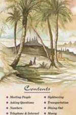
Written to provide the most widely understood pronunciation of the Arabic words and phrases.Easy-to-use from the moment you pick it up. Even a novice with the language can use ARABIC a language map right away.Use ARABIC a language map when checking in to your hotel, dining at the local restaurants, meeting new people, dealing with emergencies and many other situations which one typically encounters while traveling.Increasing awareness of the Muslim world has led to an increase in interest in studying the regions and cultures of the Middle East. Even if actual travel is curtailed for the moment, study of the language and culture is increasing domestically.
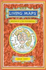
Discover the human side of the city in this fascinating and richly illustrated collection of personified maps.
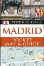
This handy pocket-sized guide is packed with ideas for things to do in Madrid, and includes a sturdy pull-out map to help you navigate with ease: everything you need for a perfect day out.From people-watching on Plaza Mayor to exploring world-class art in the magnificent Museo del Prado - discover the essential sights of Madrid with this great-value, concise travel guide and map.Inside Madrid Pocket Map and Guide:- Compact format - about the size of a mobile phone - means you can slip it in your pocket on a day trip or short stay- Easy-to-use pull-out map shows Madrid in detail, and includes a Metro map- Colour-coded area guide makes it easy to find information quickly and plan your day- Illustrations show the inside of Toledo Cathedral, El Escorial and Palacio Real- Colour photographs of Madrid's museums, architecture, shops, cathedrals and more- Covers Old Madrid, Bourbon Madrid, Around La Castellana and moreOn a longer break? Try our DK Eyewitness Top 10 Madrid for a more in-depth guide to the city. About DK Eyewitness Travel: DK's highly visual Eyewitness guides show you what others only tell you, with easy-to-read maps, tips and tours to inform and enrich your holiday. DK is the world's leading illustrated reference publisher, producing beautifully designed books for adults and children in over 120 countries.
And he saith unto them, "Follow me, and I will make you fishers of men."-Matthew 4:19
Inhaltsangabe:Problemstellung: Die Provinz Western Cape in Südafrika hat sich im Laufe der letzten Jahre zu einer beliebten Urlaubsdestination für Besucher aus Übersee entwickelt. In der vorliegenden Arbeit möchte ich untersuchen, warum das Western Cape gerade für Touristen aus Übersee so attraktiv ist. Die Abhängigkeit der Tourismusbranche von den Übersee-Incoming-Touristen zieht sich dabei in vielerlei Hinsicht wie ein roter Faden durch meine gesamte Arbeit. In einem ersten Schritt gehe ich auf die Entwicklung des Tourismus im südlichen Afrika im Allgemeinen ein. Die Zunahme des Tourismus innerhalb Südafrikas steht im folgenden Kapitel im Vordergrund, bevor ich auf die verschiedenen Tourismusregionen des Landes eingehe. Im Anschluss führe ich in Anlehnung an eine SWOT-Analyse das Potenzial des Western Cape hinsichtlich des Übersee-Incoming-Tourismus auf. SWOT ist die englische Abkürzung für Stärken (Strengths), Schwächen (Weaknesses), Chancen (Opportunities) und Risiken (Threats). Der Tourismus im Western Cape zeichnet sich unter anderem durch eine große Anzahl verschiedener Tourismusarten aus, die ich im weiteren Verlauf meiner Ausarbeitung vorstelle. Hierbei liegt der Schwerpunkt auf dem für diese Provinz sehr bedeutenden Städtetourismus. Innerhalb dieser Tourismusart habe ich eine Auswahl zentraler Sehenswürdigkeiten und Unterkünfte hinsichtlich des Einflusses von Übersee-Incoming-Touristen untersucht. Neben dem Weintourismus stehen des Weiteren die für Besucher aus Übersee relevanten neueren Arten des Tourismus im Western Cape wie etwa der Golf- oder Township-Tourismus im Mittelpunkt. In einem weiteren Kapitel widme ich mich den Perspektiven dieser Provinz hinsichtlich des Tourismus aus Übersee. Insgesamt hängt die Zukunft des Tourismus von einer Vielzahl von Faktoren ab, die die Entwicklung sowohl positiv als auch negativ beeinflussen können. Dies verdeutlichen verschiedene Krisen- und Entwicklungsszenarien, die unterschiedliche Möglichkeiten hinsichtlich der Entwicklung von Besucherzahlen aus Übersee aufzeigen. Ein Fazit mit einer abschließenden Bewertung bildet den Schlusspunkt dieser Examensarbeit, in der ich die verschiedenen Angebote für den Übersee-Incoming-Tourismus am Beispiel des Western Cape aufzeige. Inhaltsverzeichnis: Textprobe:Textprobe: Kapitel 3.2., Entwicklung nach 1994: Nach vier Jahrzehnten wurde 1994 mit dem Ende der ethnischen Segregation der demokratische Wandel in Südafrika eingeläutet. Dieser [¿]
Inhaltsangabe:Einleitung: Eine der häufigsten Forderungen an das Destinationsmanagement und die Tourismusbetriebe ist die Sicherung der Dienstleistungsqualität. Der weltweite Wettbewerb touristischer Zielgebiete, das veränderte Nachfrageverhalten der Gäste und die Forderung nach abwechslungsreichen Produkten und Angeboten sind Gründe für die Notwendigkeit der kontinuierlichen und ganzheitlichen Produktion von Dienstleistungsqualität in Tourismusbetrieben und Destinationen. Für das Erreichen und Sichern von Wettbewerbsvorteilen in touristischen Destinationen ist ein professionelles Qualitätsmanagement unter besonderer Berücksichtigung der Kundenzufriedenheit von enormer Wichtigkeit. Die vorliegende Arbeit ist in fünf Kapitel unterteilt. Kapitel 2 beschäftigt sich mit der Definition der wichtigsten Begriffe, der Erläuterung und Darstellung von Dienstleistungsqualität, Total Quality Management und Kundenzufriedenheit im Tourismus. Kapitel 3 widmet sich der Darstellung der Destination Herzogtum Lauenburg unter Berücksichtigung geografischer und tourismuswirtschaftlicher Aspekte. Den Kern dieser Arbeit stellt die in Kapitel 4 präsentierte Analyse der Gästezufriedenheit dar. Die durchgeführte Gästebefragung soll sowohl negative als auch positive Serviceaspekte, wie sie während eines Aufenthaltes im ?Herzogtum Lauenburg? empfunden wurden, herausfiltern. Die anschließende Analyse der Ergebnisse soll zu einem Gesamtbild führen, welches das aktuelle Niveau der touristischen Servicequalität im Herzogtum Lauenburg widerspiegelt. Basierend auf den Analyseergebnissen sollen zum Teil in Kapitel 4, aber überwiegend in Kapitel 5, Handlungsempfehlungen für ein weiteres Vorgehen in Bezug auf das Qualitätsmanagement innerhalb der Destination erarbeitet werden, die im besten Fall Anwendung finden und zu einer kontinuierlichen Verbesserung und/oder Standardisierung der Servicequalität führen. Inhaltsverzeichnis:Inhaltsverzeichnis: Abbildungs- und TabellenverzeichnisIV AbkürzungsverzeichnisV 1.Einleitung1 2.Qualitätsmanagement im Tourismus2 2.1Begriffliche Grundlagen2 2.2Dienstleistungsqualität5 2.2.1Die Dimensionen der Dienstleistungsqualität6 2.2.2Der SERVQUAL-Ansatz9 2.2.3Das GAP-Modell11 2.3Total Quality Management im Tourismus15 2.3.1Das Qualitätsmodell der ISO 9000:2000 Richtlinien16 2.3.2Das Qualitätsmodell der EFQM18 2.4Die Kundenzufriedenheit21 2.4.1Die Entstehung der Kundenzufriedenheit21 2.4.1.1Das C/D Paradigma als Basismodell der [¿]
Inhaltsangabe:Einleitung: Event-Management ist ein Begriff, der mit Event-Marketing gleichgesetzt wird. Als Laie versteht man unter Event-Management in der Regel nur die Konzeption, Planung und Durchführung eines Events. Der Begriff Event-Marketing hingegen verrät, wo der Event-Bereich eigentlich einzuordnen ist: im Marketing. Hier geht es nicht nur um die allgemeine Organisation eines Events von Anfang bis Ende, sondern auch darum zum Beispiel ein Produkt zu vermarkten. Das heißt, dass das Produkt durch das Marketing-Event Produktpräsentation mit bestimmten, inszenierten Stimmungen, Highlights und anderen emotionalen Maßnahmen hervorgehoben und somit eine erlebte Werbebotschaft vermittelt werden soll. Events werden als kommerzielle Ereignisse, als Mittel zur Unternehmenskommunikation und zur Aktivierung von Zielgruppen immer wichtiger. Event-Marketing und -Management sind somit identisch und bilden ein interessantes, aufregendes und vielseitiges Themengebiet. Dieses Instrument wird im Marketing seit ca. Mitte der 90er Jahre verwendet. Der Grund für die Erschaffung eines neuen Marketinginstruments ist simpel: Aufgrund wachsender Dienstleistungsmärkte, fortschreitender Konsumgüterproduktion, die eine regelrechte Produktüberflutung auf den internationalen Märkten zur Folge hat, gut informierter und kritischer Kunden sowie stark verkürzter Produktlebenszyklen konnte die Zielgruppe durch klassisches Marketing (Werbung in Print, Rundfunk, TV, auf Plakaten, durch PR, etc.) nicht mehr erreicht werden. Eine neue Form des Marketings musste also gefunden werden, die die Zielgruppe direkt anspricht und lange in Erinnerung bleibt. Diese Vorstellung wurde durch das Event-Marketing realisiert: Wie bereits erwähnt, kreiert Event-Marketing durch Veranstaltungen bestimmte Stimmungen und Gefühle, die die anwesende Zielgruppe aufgrund ihrer Einzigartigkeit lange in Erinnerung behalten und mit dem auf dem Event präsentierten Produkt in Verbindung gebracht werden sollen. Im Event-Management haben wir es also ?viel mehr mit individuellen Entscheidungen, subjektiven Wahrnehmungen und psychologischen Effekten zu tun als in der Betriebswirtschaft oder Technik?. Die im Jahr 2004 durchgeführte EU-Osterweiterung öffnet die europäischen Grenzen und bietet somit auch allen deutschen Branchen eine Vielzahl von Möglichkeiten. In diesem Sinne gilt es für mich zu überprüfen, was Osteuropa der deutschen Event-Branche bieten kann. Dieses Gebiet ist bislang noch nicht erforscht, [¿]
Inhaltsangabe:Abstract: The intensity of competition in the tourism business, especially in the hotel industry has continuously grown during the last years. This development leads to the situation that capital investments in the hospitality industry are connected with ever increasing risks. In order to minimize these risk potentials, a detailed evaluation of the competitiveness and market compatibility of a planned project is an essential part of any project development process. Those analyses are covered in the course of a feasibility study which encloses all aspects that influence the success of a hotel project. In this context, a feasibility study serves as an information tool for project developers, investors, tenants, hotel operators and financiers in order to make decisions with regard to a specific hotel project. The preparation of a feasibility study requires the combination of a multitude of aspects, hence input from all participants in the project development process. Getting hold of information and the appropriate usage of this information is crucial in order to ensure the success of a study. The main objective of this diploma thesis is to identify the most important and current issues in feasibility evaluation of hotel projects. In practice, many studies are prepared following a fixed model, which has not been changed for years. However, the hospitality industry is highly competitive and dynamic, new additions to the existing supply therefore need to be analyzed very carefully. The focus of this diploma thesis is specifically put on the hospitality industry. This means that feasibility evaluation for other types of project development in the tourist industry is not subject to this study. The aim of the thesis is on the one hand to point out aspects that have to be taken into consideration in any study, and to give suggestions for improvements on the other hand. The author has laid down the following four hypotheses that serve as the main source for the research questions. - Hypothesis 1: The sensitivity analysis is the most important component of a feasibility study. - Hypothesis 2: A feasibility study is the most important decision making factor for the investor in a hotel project. - Hypothesis 3: If the results of a feasibility study seem to turn out negative, then the operative concept of the project is changed. - Hypothesis 4: The level of the construction cost is the factor that is most difficult to estimate and is therefore [¿]
Inhaltsangabe:Einleitung: Jedes Jahr das gleiche Spiel. Kaum sind die Schulzeugnisse verteilt, beginnen die Sommerferien und Unmassen an Menschen packen die Koffer, laden ihre Autos voll bis unters Dach, manche schnallen auch noch das Surfbrett oder Fahrrad oben drauf und stürzen sich auf die Autobahnen in Richtung Ferienziel. An den Schaltern der Flughäfen sieht es ähnlich aus und auch die Bahnhöfe bieten kein anderes Bild. Überall tummeln sich schwer bepackte Menschen, einige fröhlich, andere gestresst, manche verzweifelt und hektisch auf der Suche nach ihren Reisedokumenten, wiederum andere stolpern über Koffer, Golfschlägersets und Kinderwagen. Der Familienhund springt aufgeregt kläffend um das Chaos herum. Mittendrin liest jemand in einem Reiseführer und ist in Gedanken schon am Urlaubsziel angelangt. Alle warten sie darauf, dem Alltag zu entkommen und in den wohlverdienten Urlaub zu starten. Urlaub und Reisen gehört für die meisten Deutschen zusammen. Und auch wenn die Urlaubsreise mittlerweile für viele eine Selbstverständlichkeit geworden ist, so soll sie doch jedes Mal wieder etwas Besonderes sein. Doch ?das Besondere? ist für jeden etwas anders. Viele lassen sich den Urlaub gänzlich organisieren, manche verlassen sich auf die Veranstaltungsangebote vor Ort, aber einige greifen auch zum Reiseführer, um sich von ihm informieren und durch die Fremde leiten zu lassen ? um das Reiseziel selbst zu entdecken. Dabei ist es egal, ob sich die Ferienregion im In- oder Ausland befindet. Auf Menschen mit Reiseführern trifft man überall. Gang der Untersuchung: Den Ausgangspunkt dieser Arbeit bildete der Auftrag, unter Beachtung bestimmter Vorgaben einen Reiseführer für die Stadt Norden in Ostfriesland zu erstellen. Daraus ergab sich eine Fülle von Fragen. Wie schreibt man einen Reiseführer? An wen soll er sich richten? Was macht einen guten Reiseführer aus, wie lässt er sich begrifflich definieren? Diese Fragen zogen weitere nach sich: Gibt es allgemein akzeptierte Qualitätsstandards für Reiseführer? Wie kann man gute von schlechten unterscheiden? Was erwarten die Käufer von ihnen, was versprechen ihre Hersteller? Wodurch werden Inhalte und Gestaltung beeinflusst? Und schließlich ? welche Konsequenzen ergeben sich aus den Antworten für jemanden, der vom Reiseführernutzer zum Autor werden will? Die vielen sich aufdrängenden Fragen ließen es als geboten erscheinen, sie zu systematisieren, unter eine Leitfrage zu stellen und mit ihrer Hilfe [¿]
Inhaltsangabe:Einleitung: Die Tourismusbranche konnte in den vergangenen Jahrzehnten weltweit enorme Wachstumsraten verzeichnen und hat auch in Deutschland den ökonomischen Stellenwert klassischer Wirtschaftsbereiche, wie z.B. des Maschinenbaus, erreicht. In den letzten Jahren jedoch stagnierte das Wachstum auf dem deutschen Reisemarkt. Gründe hierfür werden vor allem in der stagnierenden wirtschaflichen Situation hierzulande gesehen. Die negative Einschätzung vieler Bundesbürger zur eigenen finanziellen Situation, bedingt durch Arbeitslosigkeit und Sozialabbau, lässt viele Menschen heutzutage auf ihren Urlaub verzichten oder veranlasst sie dazu, ihre Reiseabsichten einzuschränken. Das Marktsegment der Senioren gewinnt in vielen Wirtschaftsbereichen zunehmend an Bedeutung. Der Anteil der Personen ab 60 Jahren wird von heute 25 Prozent auf 37 Prozent im Jahre 2050 in Deutschland ansteigen. Aufgrund dieser demographischen Entwicklung bietet sich für den Tourismussektor die Möglichkeit, neue Märkte zu erschließen. Diese Möglichkeit bietet sich insbesondere dann, wenn es gelingt, die immer wichtiger werdende Zielgruppe der Senioren über speziell für sie angepasste touristische Produkte und Dienstleistungen zu erreichen. Die Zielgruppe der multimorbiden Senioren stellt in diesem Zusammenhang eine besondere Herausforderung an die Logistik und Infrastruktur der touristischen Anbieter und Zieldestinationen dar. Es müssen vielfältige Besonderheiten in Hinblick auf die verschiedensten Formen von Erkrankungen und den daraus resultierenden Behinderungen berücksichtigt werden. Doch gerade diese, in der Vergangenheit oftmals vernachlässigte Zielgruppe, stellt ein enormes Marktpotential für die Tourismusbranche dar. Das Ziel dieser Arbeit besteht darin herauszufinden, ob Reiseangebote für die Zielgruppe der multimorbiden Senioren überhaupt von den Reiseveranstaltern in deren Produktpalette berücksichtigt werden und wie diese Angebote gestaltet sind. Dabei stehen folgende Aspekte im Vordergrund: Welche Merkmale kennzeichnen Reisende mit Mobilitäts- und Aktivitätseinschränkungen? Welche speziellen Vorkehrungen müssen für diese Zielgruppe in Hinblick auf touristische Servicedienstleistungen, Beförderung und Unterkunft getroffen werden? Gang der Untersuchung: Die vorliegende Arbeit umfasst acht Kapitel. Nach der Einleitung werden in Kapitel zwei zunächst die Grundlagen der Marktsegmentierung vorgestellt, um anschließend eine Abgrenzung der Senioren von den [¿]
Inhaltsangabe:Einleitung: In den letzten Jahrzehnten wurde der europäische Luftverkehrsmarkt erheblichen Veränderungen unterzogen, die im Wesentlichen auf die Liberalisierung des Luftverkehrs zurückzuführen sind. Mit der dadurch geschaffenen Möglichkeit zur freien Preisbildung, freien Bestimmung der Kapazitäten und Frequenzen, dem Wegfall der Markteintrittsbarrieren sowie der nun existierenden Kabotagefreiheit wurde ein weitgehend freier Markt geschaffen. Dies führte zu einer Nachfragesteigerung nach Flugreisen, wie es sie in dieser Form bisher noch nicht gegeben hat. Längst ist das Fliegen kein Luxusgut mehr und wird von breiten Schichten der Bevölkerung genutzt, so dass der Luftverkehr zu einem unverzichtbaren Teil des Gesamtsystems Verkehr geworden ist. Die Nachfragesteigerung wurde vor allem durch den verstärkten Markteintritt neuer Fluggesellschaften hervorgerufen, die mit innovativen und revolutionären Konzepten sowie niedrigen Preisen um Kunden werben. Diesen neuen kostenbewussten Wettbewerbern, den so genannten Low Cost Airlines, wurden anfangs nur geringe Überlebenschancen am Markt eingeräumt. Mittlerweile setzen sich die Low Cost Airlines jedoch zunehmend auch auf dem europäischen Markt durch, indem sie den etablierten Fluggesellschaften preissensible Urlaubsreisende sowie preissensible Geschäftsreisende abwerben, vorwiegend neue Nachfrage generieren und dadurch gegen den allgemeinen Trend Umsätze und Gewinne steigern. Trotz einer Reihe von Marktaustritten bzw. Übernahmen in der Vergangenheit und Gegenwart und einer sich abzeichnenden Konsolidierung des Marktes werden die Low Cost Airlines auch weiterhin kontinuierlich Marktanteile gewinnen und mit ihrem komplexitätsreduzierten Preis- und Geschäftsmodell mittel- und langfristig eine feste Rolle im europäischen Luftverkehrsmarkt einnehmen. Diese Entwicklung verdeutlicht den zunehmenden Konkurrenzkampf im Luftverkehrsmarkt in Zeiten eines immer geringeren wirtschaftlichen Wachstums und eines zunehmenden Kostendrucks auf die Unternehmen. Die etablierten Fluggesellschaften stehen nunmehr auf Grund der zunehmenden Angleichung der Geschäftsmodelle und dem Eintritt neuer Mitbewerber sowohl untereinander im Wettbewerb, als auch mit den Low Cost Airlines. Vor diesem Hintergrund stellt sich nun die Frage, inwieweit die etablierten Fluggesellschaften und insbesondere die Ferienfluggesellschaften mit den neuen Anbietern konkurrieren und welche möglichen Einflüsse und Herausforderungen sich daraus [¿]
Abonner på vårt nyhetsbrev og få rabatter og inspirasjon til din neste leseopplevelse.
Ved å abonnere godtar du vår personvernerklæring.