


Gjør som tusenvis av andre bokelskere
Abonner på vårt nyhetsbrev og få rabatter og inspirasjon til din neste leseopplevelse.
Ved å abonnere godtar du vår personvernerklæring.Du kan når som helst melde deg av våre nyhetsbrev.
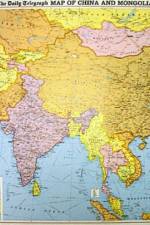
Provides an in-depth library of information on the countries and territories of South Asia. This title includes a vast range of economic, political and statistical data. Combining impartial analysis with facts and figures, it provides an overall perspective on this increasingly important region.
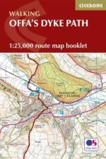
Map of the 177 mile (283km) Offa's Dyke Path National Trail, between Sedbury (near Chepstow) and Prestatyn. The trail takes 2 weeks to walk, and is suitable for walkers at all levels of experience. This compact booklet of OS 1:25,000 maps shows the full route, providing all of the mapping you need, and is included with the guidebook.
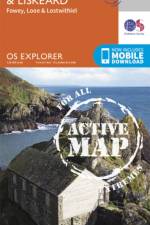
OS Explorer is the Ordnance Survey's most detailed map and is recommended for anyone enjoying outdoor activities such as walking, horse riding and off-road cycling. The series provides complete GB coverage and can now be used in all weathers thanks to OS Explorer - Active, a tough, versatile version of OS Explorer. The OS Explorer Active range now includes a digital version of the paper map, accessed through the OS smartphone app, OS Maps.
This book explores international trends in naming and contributes to the growing field of critical onomastic enquiry. The contributors to this publication examine why names are not only symbols of a person or place, but also manifestations of cultural, linguistic and social heritage in their own right.
This book explores international trends in naming and contributes to the growing field of critical onomastic enquiry. The contributors to this publication examine why names are not only symbols of a person or place, but also manifestations of cultural, linguistic and social heritage in their own right.
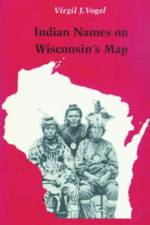
Place names tell us as much about how people lived as do relics dug from the ground. They are historical records of the location and migration of people, plants, and animals. Virgil Vogel's research into Native American influence on place names has resulted in an account that illuminates the history and culture of Wisconsin Indians.
Using colourful graphics, this book traces the history of urban transport systems, including rare and historic maps, diagrams, and photographs.
How many place names are there in the Hawaiian Islands? Even a rough estimate is impossible. Hawaiians named taro patches, rocks, trees, canoe landings, resting places in the forests, and the tiniest spots where miraculous events are believed to have taken place. And place names are far from static--names are constantly being given to new houses and buildings, streets and towns, and old names are replaced by new ones. It is essential, then, to record the names and the lore associated with them now, while Hawaiians are here to lend us their knowledge. And, whatever the fate of the Hawaiian language, the place names will endure. The first edition of Place Names of Hawaii contained only 1,125 entries. The coverage is expanded in the present edition to include about 4,000 entries, including names in English. Also, approximately 800 more names are included in this volume than appear in the second edition of the Atlas of Hawaii.
Originally published in 1929, this book was based on a course of three lectures delivered by Mawer at King's College, Cambridge . The text provides a study of the problems and possibilities associated with the study of place names. A detailed index is also provided.
''The Atlas of Climate Change Impact on European Cultural Heritage'' aims to reveal the links between climate science and the potential damage to our material heritage. While the vulnerability atlas shows overall patterns of threat, greater detail about the scientific basis of the project can be found in the appendices, which give some background to the underlying science.
This work gives the origins and meanings of geographical and political features of the former Soviet Union. All 15 countries that were once part of the U.S.S.R. are included. Each of the more than 2,000 entries provides, first, the name of the feature along with its Cyrillic counterpart, followed by the country, and the geographical location within the country; an account of the name's origin and meaning then follows, with appropriate historical, topographical and biographical references. Cross references provide former names and alternate spellings or forms of current names.
In 1832 John Thomson published the first large-scale atlas of Scotland organised by county. Not only did this provide an invaluable and accurate picture of Scotland prior to the Clearances but it also marked out this Atlas as a highly significant milestone in the history of mapping.
Text, maps, and illustrations present the history of the world from 4,000,000 BC to 1997.
"The Cotswold Town and Village Guide": The latest fully updated edition of the "Definitive Guide to Places of Interest in the Cotswolds" as the author says this is the result of my continuing love affair with the Cotswolds, an area that he has known for most of his life.
William A Read (1869-1962) was a renowned linguist whose career included 38 years as a professor of English at Louisiana State University. This volume includes his three Louisiana articles combined: ""Louisiana Place-Names of Indian Origin"" (1927), ""More Indian Place-Names in Louisiana"" (1928), and ""Indian Words"" (1931).
A companion ? Indian Place Names in Alabama?, this long out-of-print guide offers a new introduction from Patricia Wickman in which she provides current understandings of Seminole language and derivations and a brief analysis of Read's contribution to the preservation of the Native linguistic record.
Abonner på vårt nyhetsbrev og få rabatter og inspirasjon til din neste leseopplevelse.
Ved å abonnere godtar du vår personvernerklæring.