


Gjør som tusenvis av andre bokelskere
Abonner på vårt nyhetsbrev og få rabatter og inspirasjon til din neste leseopplevelse.
Ved å abonnere godtar du vår personvernerklæring.Du kan når som helst melde deg av våre nyhetsbrev.
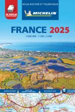
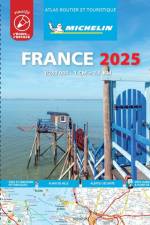
Michelin's France luxurious tourist and motoring atlas is super resistant and easy to use thanks to its fold-out multiflex binding. In addition of Michelin's clear and accurate mapping, this atlas will give you an enhanced view of your journey thanks to its scale 1/200,000. The route planner as well as the time distance charts will help you plan and optimise journey. Michelin's new safety alerts warn you about dangerous driving areas and zones subjet to tighter speed checks. This atlas also includes 40 cities plans with QR codes linking to your smartphone for an easy navigation in urban areas. Information on tourist sights, leisure facilities, scenic routes, as well as service areas will add pleasure and comfort to your journey Michelin's France multiflex tourist and motoring atlas features:- Scale: 1/200,000: for an enhanced view of your journey- Fold flat making it easier to read your journey as you go along- Key to map pages: to quickly access the region of your interest- A complete town index: To easily indentify to destination of your choice- Distance and time chart: to help you plan your trip- 40 city plans with QR Code to guide you through the last few miles of your journey with your smartphone- Michelin's danger alerts: to help you identify zones at risks for drivers and controlled speed areas- Main Road Map for an overview of France's primary road network- 18 pages of European mapping scale 1/3,500,000- 20 pages dedicated to motorway service areas - with facilities available on-site.- In English language: Keys, indexes and information. The atlas is also cross-referenced with the famous Michelin's Green Guide with tourist sights, scenic routes and leisure facilities.
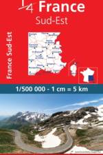
MICHELIN National Map Southeastern France will give you an overall picture of your journey thanks to its clear and accurate mapping scale 1:500.000. Our map will help you easily plan your safe and enjoyable journey in Southeastern France thanks to a comprehensive key, a complete name index as well a clever time & distance chart. Michelin's driving information will help you navigate safely in all circumstances. In addition, MICHELIN National Map Southeastern France is cross-referenced with the famous MICHELIN Green Guide highlighting destinations worth stopping for! With MICHELIN National Maps, find more than just your way!- Up-to-date mapping- A scale adapted to the size of the country- A clear and comprehensive key- Distance and time chart- Place name index- Driving and road safety information- Tourist sights information
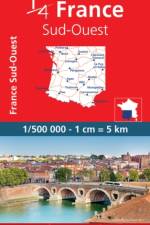
MICHELIN National Map Southwestern France will give you an overall picture of your journey thanks to its clear and accurate mapping scale 1:500.000. Our map will help you easily plan your safe and enjoyable journey in Southeastern France thanks to a comprehensive key, a complete name index as well a clever time & distance chart. Michelin's driving information will help you navigate safely in all circumstances. In addition, MICHELIN National Map Southeastern France is cross-referenced with the famous MICHELIN Green Guide highlighting destinations worth stopping for! With MICHELIN National Maps, find more than just your way!- Up-to-date mapping- A scale adapted to the size of the country- A clear and comprehensive key- Distance and time chart- Place name index- Driving and road safety information- Tourist sights information
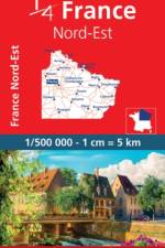
MICHELIN National Map northeastern France will give you an overall picture of your journey thanks to its clear and accurate mapping scale 1:500.000. Our map will help you easily plan your safe and enjoyable journey in northeastern France thanks to a comprehensive key, a complete name index as well a clever time & distance chart. Michelin's driving information will help you navigate safely in all circumstances. In addition, MICHELIN National Map northeastern France is cross-referenced with the famous MICHELIN Green Guide highlighting destinations worth stopping for! With MICHELIN National Maps, find more than just your way!- A scale adapted to the size of the country- A clear and comprehensive key Distance and time chart- Place name index- Driving and road safety information- Tourist sights information
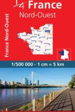
Updated annually, MICHELIN National Map Northwestern France 706 will give you an detailed picture of your journey from Amiens to Brest and La Rochelle to Clermont-Ferrand thanks to its clear and accurate mapping scale 1/500,000. Our map will help you easily plan your safe and enjoyable journey in the southwestern parts of France thanks to a comprehensive key, a complete name index as well a clever time & distance chart. Michelin's driving information will help you navigate safely in all circumstances. Furthermore this map features zoom on major cities and towns as well as QR codes to the complete your journey with ViaMichelin. This map includes tourist sights, scenic route and is cross-referenced with the famous MICHELIN Green Guide highlighting destinations worth stopping for! With MICHELIN National Maps, find more than just your way! MICHELIN NATIONAL MAPS feature:- Up-to-date mapping- A scale adapted to the size of the country- A clear and comprehensive key- Distance and time chart- Place name index at the reverse side of the map- Driving and road safety information- Tourist sights information
Updated annually, the best selling MICHELIN National Map France (map 721) will give you an overall picture of your journey in France thanks to its clear and accurate mapping scale 1/1,000,000. Our map will help you easily plan your safe and enjoyable journey in France thanks to a comprehensive key, a complete name index as well a clever time & distance chart. Michelin's driving information will help you navigate safely in all circumstances. In addition, MICHELIN National Map France is cross-referenced with the famous MICHELIN Green Guide highlighting destinations worth stopping for! With MICHELIN National Maps, find more than just your way!MICHELIN NATIONAL MAPS feature:- Up-to-date mapping- A scale adapted to the size of the country- A clear and comprehensive key- Distance and time chart- Place name index- Driving and road safety information
The maps produced by Ordnance Survey Ireland are called the Discovery Series. Discoverer Sheet No. 15 covers Belfast.
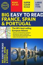
The Philip's Big Easy to Read France, Spain and Portugal Road Atlas, in a large spiral A3 format, is the must-have large type, travelling atlas for anyone who needs the big picture for moving around these countries.
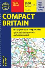
In a handy flexibound format, this fully revised edition of Philip's Compact Britain Road Atlas features updated cartography from the Philip's digital database, which has been voted Britain's clearest and most detailed mapping in an independent consumer survey.
Falset kort i målestokken 1:100.000 med indsat bykort over Thorshavn, stednavneregister og turistinformationer. Smukt suppleret med farvefotos fra øerne. Tegnforklaring på dansk.- Campingpladser- Vandreruter med højdeangivelser- Fuglerugepladser- Færger- Bykort over Thorshavn- Byregister- Vandafvisende og rivefastFormat: 84 x 121 cm i udfoldet tilstandKortet er trykt på stenpapir(Stenpapir er et alternativ til almindeligt papir. I stedet for at lave papir af træ, laves stenpapir af 80% kalk og 20% HDPE. Da kalk er naturligt hvidt, og HDPE er gennemsigtig, anvendes der ikke blegemidler i produktionen, hvilket man anvender til almindelig papirproduktion. Modsat almindeligt papir, bruges der heller ikke vand eller kemikalier til produktionen af stenpapir.Ved produktionen af stenpapir, undgår man fældning af træer, brug af kemikalier, blegemidler, vand og forurening af spildevand.
Michelin's France 100% laminated A4 atlas offers, in addition of Michelin's clear and accurate mapping, an enhanced view of your journey thanks to its scale 1/250,000.Convenient and easy to use thanks to its spiral bound cover, this atlas comes with extra-resistant laminated pages on which you can trace and erase your journey. The route planner as well as the time distance charts will help you plan and optimise journey. Michelin's new safety alerts warn you about dangerous driving areas and zones subjet to tighter speed checks. Michelin's laminated France atlas also includes information on tourist sights, leisure facilities and scenic routes, as well as service areas to add pleasure and comfort to your journey. Michelin's France laminated tourist and motorist atlas features:- Scale 1/250,000: for an enhanced view of your journey- Extra resistant pages: to draw/erase your journey as you go along- Key to map pages: to quickly access the region of your interest- A complete town index: To easily indentify to destination of your choice- Distance and time chart: to help you plan your trip- 6 major town plans: Paris, Bordeaux, Lille, Lyon, Marseille & Nantes- Michelin's danger alers: to help you identify zones at risks for drivers and controlled speed areas- In English language: Keys, indexes and information
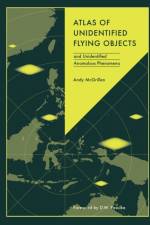
Whether you're a believer or a skeptic, this book is an essential read for anyone looking to understand the full scope of UFO and UAP sightings worldwide.
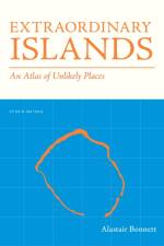
Discover the world's most remote and mysterious islands in this beautifully designed book. Spanning continents and cultures, it explores exotic, hard-to-reach locations with an international appeal. Divided into four sections—Strange, Scary, Remote, and Naturally Odd—it unveils the haunting beauty and enigmatic allure of these isolated and extraordinary places.
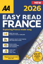
The AA Easy Read France is a brand new large-format atlas covering France at a large, easy-to-read scale of 4 miles to 1 inch. Featuring super scale, detailed city plans with mapping produced by leading European cartographers MairDumont and a £10 off AA European Breakdown cover promotion
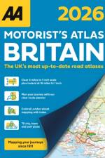
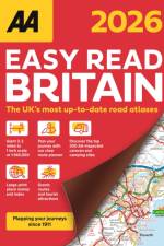
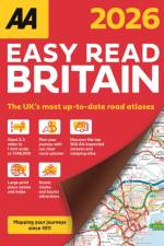
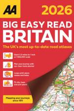
Up-to-date mapping from the experts at the AA. Easy Read Britain Atlas 2026 features include a giant 2.3 miles to 1 inch scale, A4 format revised and updated for 2026, 6 page clear route planner map, top 300 AA-Inspected caravan and camping sites and over 240 service areas.
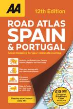
Road atlas covering Spain and Portugal with clear detailed road mapping, including 50 city street plans and 10 large scale approach maps. Features include distance chart and travel information, map legends and page title in 12 European languages and £10 off AA European Breakdown cover offer.
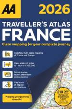
Fully updated for 2026, this A4 format road atlas of France provides clear mapping at 4.7 miles to 1 inch. Featuring detailed city maps of Paris, Lille and Lyon,16 pages of overview mapping of Europe, France and scenic routes, campsites and tourist attractions and £10 off AA European Breakdown Cover promotion.
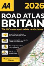
The AA Road Atlas Britain, fully updated for 2026 includes a large 3.2 miles to 1 inch scale in A4 format and a 6 page clear route planner map. This top-selling road atlas showcases Britain's clearest mapping from the experts at the AA. Each page has been titled with its geographical location so you can turn to the page you need more easily.
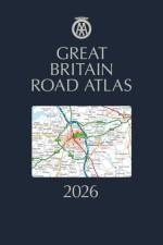
The AA Great Britain Road Atlas is a premium hardback A4 road atlas showcasing Britain's clearest mapping at 3.2 miles to 1 inch. With up-to-date mapping from the experts at the AA in a large 3.2 miles to 1 inch scale.
Up-to-date mapping from the experts at the AA. Easy Read Britain Atlas 2026 features include a giant 2.3 miles to 1 inch scale, A4 format revised and updated for 2026, 6 page clear route planner map, top 300 AA-Inspected caravan and camping sites and over 240 service areas.
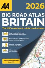
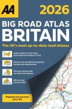
The AA Big Road Atlas Britain is an A3 road atlas showcasing Britain's clearest mapping at 3 miles to 1 inch. Fully updated, features include large 3 miles to 1 inch scale including Ireland at 16 miles to 1 inch, 68 city, town and port plans, top 300 AA-Inspected caravan and camping sites and over 1,800 golf courses.
The AA Big Road Atlas Britain is an A3 road atlas showcasing Britain's clearest mapping at 3 miles to 1 inch. Fully updated, features include large 3 miles to 1 inch scale including Ireland at 16 miles to 1 inch, 68 city, town and port plans, top 300 AA-Inspected caravan and camping sites and over 1,800 golf courses.
Updated A3 format atlas providing giant scale mapping at 2.5 miles to 1 inch. Features include 72 city, town and port plans, top 300 AA-Inspected caravan and camping sites, over 1,800 golf courses and 4 page route planner.
Updated A3 format atlas providing giant scale mapping at 2.5 miles to 1 inch. Features include 72 city, town and port plans, top 300 AA-Inspected caravan and camping sites, over 1,800 golf courses and 4 page route planner.
Abonner på vårt nyhetsbrev og få rabatter og inspirasjon til din neste leseopplevelse.
Ved å abonnere godtar du vår personvernerklæring.