


Gjør som tusenvis av andre bokelskere
Abonner på vårt nyhetsbrev og få rabatter og inspirasjon til din neste leseopplevelse.
Ved å abonnere godtar du vår personvernerklæring.Du kan når som helst melde deg av våre nyhetsbrev.
This atlas of Brighton, Worthing, Hove, Newhaven and Shoreham-by-Sea includes separate coverage of Lewes and Seaford. The 41 pages of coloured street mapping features coverage of:
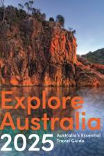
The latest revised and updated edition of Australia's favourite travel guidebook.
A comprehensive guide to dog-friendly travel, accommodation and experiences in Australia
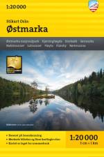
Stikart Oslo: Østmarka er et av fire unike kart i skala 1:20 000 som dekker Oslomarka, utgitt av Calazo Forlag etter innspill fra sentrale tur- og friluftslivsaktører i regionen.Populære turområder som Østmarka har et tett nettverk av stier som ikke tidligere er riktig gjengitt i noen databaser. Disse stiene benyttes flittig av fotturister, løpere og stisyklister som ønsker et bynært friluftsliv.Vi på Calazo vill utvikle bedre og mer detaljerte kart och har lagt ned et stort arbeid i att identifisert og få med alle stier i området. Østmarka-entusiasterna har medvirket med detaljert lokalkunnskap og DNT Oslo og Omegn har bidratt med informasjon om hytter og blåmerkede fotruter. Terrenginformasjonen er basert på laserskanning fra fly, noe som sikrer høy nøyaktighet i detaljene.Kartet er laget for sommerbruk.
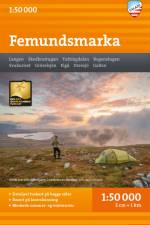
Dette er en del av den moderne kartserien fra Calazo, med unik terrenginformasjon basert på laserskanning fra fly og bedre nøyaktighet i detaljene. Vi har blant annet brukt detaljerte flyfoto til å korrigere stier i området. Vi har også identifisert og lagt til flere nye stier som manglet i de offisielle databasene.Kartet dekker alle de mest populære fjellområdene, hytter, markerte turruter og fungerer like godt om vinteren med merkede vinterruter og preparerte skiløyper.]]>
Stikart Oslo: Nordmarka sør er et av fire unike kart i skala 1:20 000 som dekker Oslomarka, utgitt av Calazo Forlag etter innspill fra sentrale tur- og friluftslivsaktører i regionen.Populære turområder som Nordmarka har et tett nettverk av stier som ikke tidligere er riktig gjengitt i noen databaser. Disse stiene benyttes flittig av fotturister, løpere og stisyklister som ønsker et bynært friluftsliv.Vi på Calazo vill utvikle bedre og mer detaljerte kart och har lagt ned et stort arbeid i att identifisert og få med alle stier i området. DNT Oslo og Omegn har bidratt med viktige opplysninger om hytter og gjeldende merking av blåmerkede fotruter. Terrenginformasjonen er basert på laserskanning fra fly, noe som sikrer høy nøyaktighet i detaljene.Kartet er laget for sommerbruk.
Populære turområder som Nordmarka har et tett nettverk av stier som ikke tidligere er riktig gjengitt i noen databaser. Disse stiene benyttes flittig av fotturister, løpere og stisyklister som ønsker et bynært friluftsliv.Vi på Calazo vill utvikle bedre og mer detaljerte kart och har lagt ned et stort arbeid i att identifisert og få med alle stier i området. DNT Oslo og Omegn har bidratt med viktige opplysninger om hytter og gjeldende merking av blåmerkede fotruter. Terrenginformasjonen er basert på laserskanning fra fly, noe som sikrer høy nøyaktighet i detaljene.Kartet er laget for sommerbruk.]]>
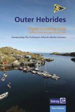
The third edition of Outer Hebrides is the definitive book of sailing directions for those seeking to explore the challenging yet rewarding waters of this remote archipelago, one of the wildest corners of the British Isles.
The Grand Canyon State abounds in natural beauty and outdoor recreation possibilities. Completely reworked with new Landscape Maps and a comprehensive Recreation Guide, our Arizona Road and Recreation Atlas is an invaluable resource for adventure planning and exploration.
Imray's third edition of Irish Sea Pilot is a comprehensive guide to this enchanting cruising ground, taking sailors on a guided journey around the shores of the five countries
Updated 3rd edition of Bikers' Britain with updated content and new maps in a handy format and wiro binding allow the book to fit into a motorcycle tank bag. Clear routes based on mapping from the experts at the AA, excellent coverage of the whole of Great Britain, including North Coast 500 and South Coast 500.
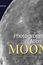
"Photographic Atlas of the Moon explains how the Earth and the Moon are locked together in a co-dependent embrace, each affecting the other in ways that affect our lives on this planet. The reader will learn in an understandable jargon-free narrative the differing geologic details of the Moon, some of which can be seen with the naked eye, allowing an appreciation of the diversity of lunar landforms. Although the author is an accomplished deep sky astrophotographer, his current passion is re-popularizing the Moon within the amateur astronomy community by explaining the origin of the Moon, the evolution of its face, and introducing its geology to Moon lovers everywhere. Robert has perfected image processing techniques that allow the amateur astronomer, using modest equipment, to exceed the quality of Earth-based professional lunar photographs taken during the Apollo era. In addition to a complete photographic guide to the surface of the Moon in 32 distinct regions, sections of this book include: The Moon We See (Phases, Libration, Eclipses), the Moon's Orbit, the Moon's Surface (creation, age, composition and appearance), the Geology of the Moon and more"--
Sprachen: Isländisch, Englisch
Explore Britain with easy-to-read mapping from Collins.
Explore Britain with easy-to-read mapping from Collins.
Explore Britain with easy-to-read mapping from Collins.
Navigate your way around Great Britain with this detailed and easy-to-use A-Z Road Atlas
Navigate your way around Great Britain with this detailed and easy-to-use A-Z Road Atlas
Abonner på vårt nyhetsbrev og få rabatter og inspirasjon til din neste leseopplevelse.
Ved å abonnere godtar du vår personvernerklæring.