
Gjør som tusenvis av andre bokelskere
Abonner på vårt nyhetsbrev og få rabatter og inspirasjon til din neste leseopplevelse.
Ved å abonnere godtar du vår personvernerklæring.Du kan når som helst melde deg av våre nyhetsbrev.
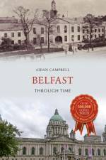
Belfast (Irish: Beal Feirste 'mouth of the sandbank ford') is the capital city of Northern Ireland. The site of Belfast has been described as 'not built on a perfect site' given that the original settlement was located on low-lying land on the Co. Antrim side of the River Lagan. It was during the Victorian period that wealthy business owners moved out of the old town and built grand villas on the hills surrounding the city. There are views of big houses, grand public buildings and churches, schools, public transport including trams, trolleybuses and steam trains, factories and suburbia. Many of these scenes are remarkably unchanged and much of the character of the bustling industrial city remains, while many locations have been swept away and are unrecognisable following recent redevelopments.
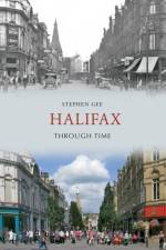
The town of Halifax is full of magnificent buildings designed by famous architects such as Sir Charles Barry, John Carr, Sir George Gilbert Scott and other buildings designed by the town's own talented architects. The town has altered quite dramatically during the last 150 years. Some of the earlier views dating from the Victorian period would be unrecognisable without more recent pictures to compare against. Changes to transport from the days of horse and carts, to trams and motorisation have brought other more noticeable changes in terms of traffic schemes and street signs in abundance and of course, the 'one way systems'. Halifax Through Time brings these changes to life contrasting the 'old' and 'new' and if the reader was so inclined, by following the structured sequence of photographs, provides a fascinating reference for a stroll around the town.
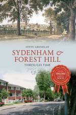
For centuries, Sydenham was a small hamlet on the edge of a large tract of common land, known as Sydenham Common, in the parish of St Mary's, Lewisham. London was more than an hour's travel away. Over little more than half a century, three events radically altered Sydenham, turning it from a rural hamlet into a populous, even fashionable, suburb of London: the enclosure of Sydenham Common, the coming of the railway in 1839 and the construction of the Crystal Palace on Sydenham Hill. Today, Sydenham and Forest Hill are attractive and popular places to live, with good access to green spaces and local amenities. Join local historian Steve Grindlay on a photographic tour of Sydenham and Forest Hill past and present, showcasing points of interest such as the Horniman Museum, the Kirkdale Building and Jews Walk. Sydenham and Forest Hill Through Time is an essential volume for anyone who knows and loves these leafy suburbs.
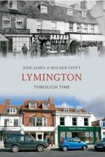
Lymington has long been in need of an illustrated history worthy of its past. From a Saxon settlement onwards as an internationally famous yachting centre, Jude James and Roland Stott present a beautiful and unique historical journey. This comparative volume looks at the contrasts between the industrial past of Lymington as a salt town, its ship building and local fishing industry, and the changes up to the present day. The important role of the Solent is examined, and also surrounding areas. Lymington Through Time not only provides a guide to the industrial past but also a record of the everyday, shops, businesses, and residents at work and play. This fascinating and colourful journey back in time will surprise and delight residents and visitors alike.
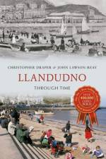
'Llandudno is more stylish than either Rhyl or Blackpool and not dearer', observed Edwardian author Arnold Bennett. Prime Minister Lloyd George considered the resort a perfect tonic, advising colleagues 'to come to Llandudno is a great pick-me-up'. An 1890 visit by romantic novelist and erstwhile Queen of Romania, Carmen Sylva prompted a description so apt it was adopted as the town's official motto, 'A Beautiful Haven of Peace'. To everyone Llandudno evokes an era of quiet traditional seaside pleasures but has the town entirely escaped the destructive winds of change? The 1933 Official Guide to Llandudno advised prospective holidaymakers, As a holiday centre Llandudno has no rival. All the glorious scenery of North Wales is easily accessible by train, coach, motor or steamerA"e; and the Broadway Garage, Craig-y-don was at hand to supply motors or drivers as required. Times change and Broadway Garage no longer supplies Rover cars, charabancs or chauffeurs but instead sells German and Japanese cars and self-service petrol. This collection of then and now photographs meticulously compiled and researched by the Chairman and Vice-Chairman of Llandudno & Colwyn Bay History Society offers a unique insight into the changing fortunes of 'The Queen of the Welsh Resorts'.
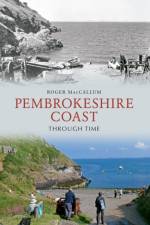
Pembrokeshire contains some of the finest coastal scenery in Britain. There are great contrasts, from sandy beaches to tall cliffs, and from offshore islands to estuarine creeks. Parts have remained little changed and would probably be recognisable to our Neolithic ancestors but around Milford Haven and some of the coastal villages many changes have occurred. The coast is a classic area of study for both scientists and historians. Work on the area has been published in fields from geology to ornithology. It illustrates not only changes, but how ideas about the science and history of the area have altered. Much of the coast is within the Pembrokeshire Coast National Park, with a coast path running for 183 miles. This is a magnet to visitors from all over the world.
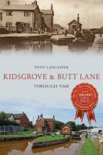
At the northern end of the borough of Newcastle-under-Lyme, Kidsgrove and Butt Lane were quiet and rural areas of scattered settlements that became an industrial centre of great importance in the economy of North Staffordshire. Today, the areas are largely residential, with housing belonging mainly from the post-war era onwards. Coal mines and ironworks changed the landscape and population and housing increased; development by the Trent and Mersey Canal and the arrival of the railway allowed the area to flourish. Nowadays, most of the heavy industry has declined and many once-familiar sights have been swept away. However, it is possible to recreate something of the atmosphere of this industrial past and its social consequences through the illustrations and detail that accompany them. Drawing on a rich store of photographs and historical information, this book reveals a fascinating past for readers to enjoy as local author Tony Lancaster guides us through the streets, revealing the changing faces of Kidsgrove and Butt Lane.
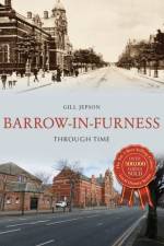
Barrow-in-Furness is a small post-industrial town at the end of a long peninsula in the north of England. Its isolated location has produced a stalwart and close population. It started life as a small hamlet and grew to become an industrial leader, first in iron and steel and later in ship-building and engineering, drawing a workforce from all over the country. The ship-building industry continues to be a major employer but today there is less diversity than in Barrow's heyday. Although the town is known for its industry, it sits in one of the most beautiful areas of Cumbria. It boasts a rich heritage and spectacular views to the Lake District and across Morecambe Bay and, surrounded on three sides by the sea, it enjoys its own temperate climate. Furness Abbey was a great influence on the area in the medieval period and there are castles, churches, monuments and memories just waiting to be discovered by the unsuspecting visitor.
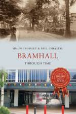
Bramhall is a thriving, bustling and leafy suburb of Stockport, close to Manchester. It has been voted the least 'lonely place' in Britain; according to research from the University of Sheffield, Bramhall came bottom of the loneliness index nationwide. It has a rich history stretching back to the Anglo-Saxon period. This book takes us back to Bramhall's early days to meet Saxons Brun and Hacun, whose lands were given by Willliam the Conqueror to Hamon de Massey, who eventually became 1st Baron of Dunham Massey. The Edwardian shops and businesses in the village centre have been replaced by trendy boutiques and cool bars, but old Bramhall is still characterised by the grand Bramall Hall, with its beautiful park, as well as the town's many farms and old pubs. The book also takes in neighbouring Cheadle and Cheadle Hulme, Gatley, Hazel Grove and Manchester International Airport in Ringway, where old and new pictures are juxtaposed to show how things have changed in these communities.
This fascinating selection of photographs traces some of the many ways in which Central Leeds has changed and developed over the last century.
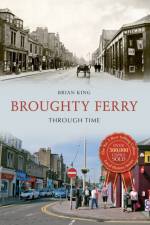
Broughty Ferry has gone through many changes since its origins as a small fishing village nestled in the shadow of a fifteenth-century castle. The industrial age saw wealthy jute barons arrive and build their grand residences there, while the coming of the train saw the town become a popular destination for holidaymakers. The twentieth century and beyond has seen Broughty Ferry evolve into a popular and affluent suburb. This compilation of images follows Broughty Ferry through all of these changes and shows how, despite officially becoming part of Dundee in 1913, 'the Ferry' has always maintained an independent air.
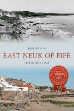
Neuk is the Scots word for nook or corner, and the delightful East Neuk, with its string of picturesque fishing and farming villages, is one of the most attractive parts of the country to investigate. Few regions present a greater number of attractions than the East Neuk with its sandy beaches, wild and precipitous cliffs, remarkable caves, celebrated golf links, notable churches, historic castles and historical associations. These villages, running from from Crail to Largo, are quite distinct from those of any other part of Scotland and have stood almost unchanged for centuries and thus present, in their uneven, angular streets, red-tiled roofs and crow-stepped gables, an accurate representation of the ancient burghs of our past.
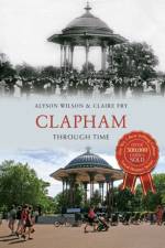
In ancient times Clapham was a secluded Surrey village, clustered round a manor house and church. By the seventeenth century, the wealthy of London were building houses here as rural retreats and, by 1800, their mansions in extensive grounds surrounded Clapham Common, which was becoming a place of recreation. The development of the railways in the nineteenth century meant that families who could afford large houses moved further out to the countryside, selling off their ground to developers who built the terraced houses which cover the area today. Around forty years ago, after a period of neglect and bomb damage from the Second World War, the area started to become 'gentrified' and is now a desirable London suburb. Clapham Through Time traces these changes over the years. A few mansions have survived and been put to new uses, several churches lost during the war have been replaced, Clapham Common is recognisable though used quite differently, but the greatest change is in the appearance of the ordinary streets - the shop fronts, vehicles and people. Many who have arrived in Clapham during the last few years will be amazed by its former appearance!
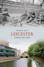
Leicester Through Time is a unique insight into the illustrious history of this part of the country. Reproduced in full colour, this is an exciting examination of Leicester, the famous streets and the famous faces, and what they meant to the people of Leicester throughout the 19th and into the 20th Century. Looking beyond the exquisite exterior of these well-kept photos, readers can see the historical context in which they are set. Through the author's factual captions for every picture, and carefully-selected choice of images, the reader can achieve a reliable view of the city's history. Readers are invited to follow a timeline of events and watch the changing face of Leicester, as the author guides us through the city's streets. There is something for everyone here, whether they have lived in Leicester all their lives, or whether they are just visiting this vibrant city. It also shows how photography has continually evolved to keep up with an ever changing society.
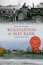
The impact of people and places in Wolstanton and May Bank is recorded in this pictorial record that recognises the contribution of village notables, dear old friends and long-gone institutions. A wealth of photographs depicting the joys of community life mingle with contemporary pictures, showing, often with dramatic impact, the shocking demolition of facilities we perhaps took for granted, such as The Plough, the Oxford Arms and The Marsh Head. Elsewhere, images of former shops such as Holdridge's, Swettenham's and the Spinning Wheel show how High Street shopping patterns have changed. Author Mervyn Edwards has only ever lived in Wolstanton and May Bank, and through this unique selection of old and new images, he presents a tribute to the place he happily calls home.
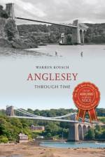
This fascinating selection of photographs traces some of the many ways in which Anglesey has changed and developed over the last century.
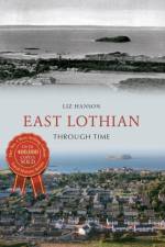
East Lothian, previously known as Haddingtonshire, has both benefitted and suffered from its strategic location between Scotland's capital city and England's northernmost county. Prior to 1707, the region bore the brunt of battles between the two countries, not only on land but along 32 miles of coastline. The rich, fertile soils, on the other hand, have produced wealth through agriculture and the patchwork of large, neat fields are synonymous with the landscape of East Lothian today. The proximity to Edinburgh makes it a prime location from which to commute. Attractive pantiled properties abound throughout the villages and countryside, all within short distances of the clean beaches or links golf courses, while tranquillity can also be found in the woodlands or gentle moorland slopes of the Lammermuir Hills. The reminders of troubled times can be viewed today by a stroll around a castle, but twenty-first-century East Lothian is thriving.
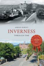
Inverness, known as the capital of the Highlands, was designated a Millennium city in 2000. This Royal and Ancient Burgh is recorded going back thousands of years, but it doesn't look like an old town because it was sacked and burned so many times that little remains of its long history. There are exceptions, including a house which dates from 1592 and Dunbar's Hospital of 1688. Also nearby is the site of the Battle of Culloden, the last battle fought on British soil. Situated at the head of the Moray Firth and the mouth of the Great Glen, Inverness is a terminus and starting point for travel and traffic, living up to its other nickname as the Hub of the Highlands. In the words of Neil M. Gunn: 'No one can say he has seen Scotland who has not seen the Highlands, and no one can say he has been to the Highlands who has not stopped to sample its spirit in Inverness.'
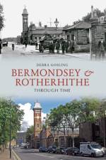
This fascinating selection of photographs traces some of the many ways in which Bermondsey & Rotherhithe have changed and developed over the last century
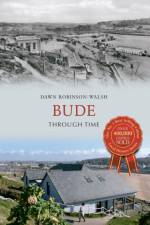
This fascinating selection of photographs traces some of the many ways in which Bude has changed and developed over the last century.
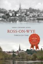
Ross-on-Wye sits high on a sandstone cliff overlooking a horseshoe bend in the beautiful River Wye. The birthplace of tourism, it boasts a rich tapestry of heritage and a unique landscape. Ross-on-Wye Through Time highlights the rich gems Ross has to offer. St Mary's church is its best-known landmark and can be seen from all approaches, housing notable tombs of past stalwarts of the town. John Kyrle was just one of these figures and his name was given to the local high school and an inn. In more recent years, names associated with the town have included Dennis Potter and Richard Hammond. Today Ross is known for its independent shops, picturesque streets, the Market Square and Market Hall. This fascinating collection of old and new photographs shows how much and, in some cases, how little this historic market town has changed.
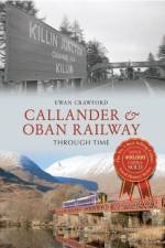
This fascinating selection of photographs traces some of the many ways in which Callander & Oban Railway has changed and developed over the last century.
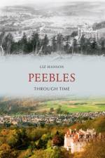
Peeblesshire and its attractive county town are situated in Upper Tweeddale, an area of great beauty and tranquillity. Tucked into the Borders Hills, with the River Tweed at its heart, Peebles has much to offer both tourists and residents, including walking, fishing and cycling or simply strolling along the river banks or exploring the charming high street. The city of Edinburgh is a mere 22 miles north but Peebles retains its market town identity and is very much part of The Borders. Peebles was created a Royal Burgh in 1367 by David II. Some remnants of its past are easily seen such as the thirteenth century Neidpath Castle, dramatically towering above a meander in the gorge; others remain only as traces, like the east port of the sixteenth-century town wall. This collection of photographs portrays some of the changes that have taken place to Peebles and its environs as the town has developed and grown.
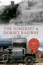
The Somerset & Dorset Railway, known as the S&D (said to also stand for 'Slow and Dirty' or 'Serene and Delightful'), ran from Bath across the Mendip hills to Bournemouth on the south coast. Never a high-speed line, the main traffic for the Somerset & Dorset during the winter months was freight and local passenger traffic. In the summer, however, there was heavy traffic as Saturday holiday services from the northern industrial towns passed along the line. In 1962, John Betjeman travelled along the Somerset & Dorset from Evercreech Junction to Highbridge and Burnham-on-Sea, making a BBC documentary called Branch Line Railway, in which he pleaded for the line to be spared from the Beeching cuts. However, despite an active campaign to save it, and the promise by the new Labour government that there would be no more railway cutbacks, on 7 March 1966 the whole line was closed. 2016 will see the fiftieth anniversary of the closure of this much-mourned railway; here in this well-illustrated book, the history of the line is preserved.
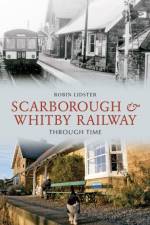
The Scarborough & Whitby Railway was opened in July 1885. The 21 miles of line traversed the picturesque coast between the two towns for eighty years. There were eight stations on the line all with their own distinctive character and serving the different needs of visitors and local people. All of the stations along the route are fully illustrated in this book. The line closed in March 1965 and the buildings were later sold into private ownership and have been put to a variety of uses since that time. The aim of this book is to illustrate the changes both before and after closure along this fascinating and historical railway which has become a very popular walking and cycling trail that passes through the spectacular and varied scenery of the North Yorkshire coast.
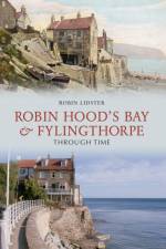
Robin Hood's Bay and Fylingthorpe Through Time is a unique insight into the illustrious history of this part of Yorkshire. Reproduced in full colour, this is an exciting examination of well-known streets and famous faces, and what they meant to the people of this area throughout the 19th and into the 20th Century. Looking beyond the exquisite exterior of these well-kept photos, readers can see the historical context in which they are set, and through the author's factual captions for every picture, and carefully-selected choice of images, the reader can achieve a reliable view of the local history. There is something for everyone here, whether they have lived in the area all their lives, or whether they are just visiting for the first time. Robin Hood's Bay and Fylingthorpe Through Time also shows how photography has continually evolved to keep up with an ever changing society.
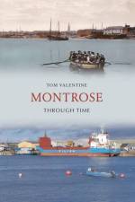
This fascinating selection of photographs traces some of the many ways in which Montrose has changed and developed over the last century.
Abonner på vårt nyhetsbrev og få rabatter og inspirasjon til din neste leseopplevelse.
Ved å abonnere godtar du vår personvernerklæring.