
Gjør som tusenvis av andre bokelskere
Abonner på vårt nyhetsbrev og få rabatter og inspirasjon til din neste leseopplevelse.
Ved å abonnere godtar du vår personvernerklæring.Du kan når som helst melde deg av våre nyhetsbrev.
CONTENTS: Abdol Rauh Yaccob, British policy on Arabia before the First World War: an internal argument; Adrian G. Parker &. Jeffrey I. Rose, Climate change and human origins in southern Arabia; Alexandrine Guerin & Faysal Abdallah al-Na'imi, Nineteenth century settlement patterns at Zekrit, Qatar: pottery, tribes and territory; Anthony E. Marks, Into Arabia, perhaps, but if so, from where?; Audrey Peli, A history of the Ziyadids through their coinage (203- 442/818-1050); Aurelie Daems & An De Waele, Some reflections on human-animal burials from pre-Islamic south-east Arabia (poster); Brian Ulrich, The Azd migrations reconsidered: narratives of 'Amr Muzayqiya and Malik b. Fahm in historiographic context; Christian Darles, Derniers resultats, nouvelles datations et nouvelles donnees sur les fortifications de Shabwa (Hadramawt); Eivind Heldaas Seland, The Indian ships at Moscha and the Indo-Arabian trading circuit; Fabio Cavulli & Simona Scaruffi, Stone vessels from KHB-1, Ja'lan region, Sultanate of Oman (poster); Francesco G. Fedele, Wadi al-Tayyilah 3, a Neolithic and Pre-Neolithic occupation on the eastern Yemen Plateau, and its archaeofaunal information; Ghanim Wahida, Walid Yasin al-Tikriti & Mark Beech, Barakah: a Middle Palaeolithic site in Abu Dhabi Emirate; Jeffrey I. Rose & Geoff N. Bailey, Defining the Palaeolithic of Arabia? Notes on the Roundtable Discussion; Jeffrey I. Rose, Introduction: special session to define the Palaeolithic of Arabia; Julie Scott-Jackson, William Scott-Jackson, Jeffrey Rose & Sabah Jasim, Investigating Upper Pleistocene stone tools from Sharjah, UAE: Interim report; Krista Lewis & Lamya Khalidi, From prehistoric landscapes to urban sprawl: the Masn'at Maryah region of highland Yemen; Michael J. Harrower, Mapping and dating incipient irrigation in Wadi Sana, Hadramawt (Yemen); Mikhail Rodionov, The jinn in Hadramawt society in the last century; Mohammed A.R. al-Thenayian, The Red Sea Tihami coastal ports in Saudi Arabia; Mohammed Maraqten, Women's inscriptions recently discovered by the AFSM at the Awam temple/Mahram Bilqis in Marib, Yemen; Nasser Said al-Jahwari & Derek Kennet, A field methodology for the quantification of ancient settlement in an Arabian context; Remy Crassard, The "Wa'shah method" an original laminar debitage from Hadramawt, Yemen; Saad bin Abdulaziz al-Rashid, Sadd al-Khanaq: an early Umayyad dam near Medina, Saudi Arabia; Ueli Brunner, Ancient irrigation in Wadi Jirdan; Vincent Charpentier & Sophie Mery, A Neolithic settlement near the Strait of Hormuz: Akab Island, United Arab Emirates; Vincent Charpentier, Hunter-gatherers of the "empty quarter of the early Holocene" to the last Neolithic societies: chronology of the late prehistory of south-eastern Arabia (8000-3100 BC); Yahya Asiri, Relative clauses in the dialect of Rijal Alma' (south-west Saudi Arabia); Yosef Tobi, Salom (Salim) al-Sabazi's (seventeenth-century) poem of the debate between coffee and qat; Zaydoon Zaid & Mohammed Maraqten, The Peristyle Hall: remarks on the history of construction based on recent archaeological and epigraphic evidence of the AFSM expedition to the Awam temple in Marib, Yemen
Contents: The Paleolithic archaeology of Shirak Province and the open-air site of Aghvorik; Newly discovered Early and Middle Bronze Age tombs in Shirak, Armenia; On some Late Helladic migrants into Anatolia named in Hittite and Luwian sources, their migration to Iron Age Cilicia and their return to Greece in legend; On the origin and meaning of the Assyrian toponym Tabal; Die Mar vom griechischen und/oder wolfischen Ursprung von Lykiern, Lykaonen, Lukka und Luwija; A recently discovered Urartian stele dedicated to the god Ua from Avnik/Erzurum in East Turkey; A metal belt in the Orumiyeh museum, Iran; New observations on Urartian quarrying in Lake Van Basin; Achaemenid ceramics from the site Beniamin II (Shirak, Armenia): the end of the 6th to the mid 4th centuries BC
This volume presents a study of the tomb of Kha-em-hat TT 57 at Qurna, West Luxor, which dates back to the 18th Dynasty - the reign of King Amenhotep III. It is considered one of the most important Egyptian tomb discoveries, containing rare scenes and revealing development of the religious rituals of the time. The tomb is still in very good condition and today is open to visitors.
Schinkel 'in Athens': Meta-Narratives of 19th-Century City Planning proposes a fresh appraisal of Karl Friedrich Schinkel's urban design legacy and his involvement in the design of modern Athens in the 1830s. From the 1830s onwards, the incompatibility between Schinkel's position as a civil servant and his vocation as a scholar inspired by Fichte led him along a transcendental path of life. Transcendentalism set its own terms and conditions under which Schinkel's project of a palace atop the Acropolis of Athens (1834) might be understood. The 'contextual analysis' of Schinkel's work in this book challenges the view of this proposal as a utopian scheme, detached from the realities of nineteenth-century Greece. On the other hand, the first plan of Athens, supposedly the work of two of his former Bauakademie students, ratified a year earlier, in 1833, proposed the location of the royal residence in the new town at a few hundred metres north of the Acropolis. But, though the two options for Otto's palace were topographically dissimilar they did retain a common strong, topological significance - which, along with other factors analysed in this book, provides ample evidence for re-thinking the authorship of the new plan of the capital city of Greece. Schinkel 'in Athens', by all means!
Matriarchy in Bronze Age Crete: A Perspective from Archaeomythology and Modern Matriarchal Studies offers a very different perspective of Crete than is usually found in academic writing; making a compelling case for a matriarchal Bronze Age Crete. Bronze Age Crete evokes for many the image of an exceptionally sophisticated civilization: peaceful, artistic, and refined; a society in which women were highly visible and important, and the supreme deity was a Goddess. Yet, despite the fact that authorities acknowledge that the preeminent deity of Crete was a Female Divine, and that women played a major role in Cretan society, there is a gap in the scholarly literature, and a lively, ongoing debate regarding the centrality of women and the existence of matriarchy in Bronze Age Crete. The purpose of this work is to fill that gap, and to advance the debate over whether or not ancient Crete was a woman-centered and matriarchal society toward a more complex, detailed, and certain conclusion. To that end this publication utilises the field of modern matriarchal studies, with its carefully elucidated definition of the term matriarchy, and employs the methodology of archaeomythology - the use of historical, mythological, linguistic, and folkloric as well as archaeological sources. Given its scope, the volume will be of interest to scholars and students in the fields encompassed by archaeomythology, as well as the fields of women's studies, women's history, women's spirituality, and modern matriarchal studies.
St Swithun was an obscure ninth-century bishop of Winchester about whom little was, and is, known. But following the translation of his relics from a conspicuous tomb into the Old Minster, Winchester, on 15 July 971, the massive rebuilding of the cathedral, and a vigorous publicity campaign by Bishop Aethelwold (963-84), St Swithun became one of the most popular and important English saints, whose cult was widespread not only in England but also in Ireland, Scandinavia, and France. The present volume includes new and full editions of all the relevant texts - hagiographical, liturgical, and historical - in Latin, Old English, and Middle English, many of which have never been published before: these illuminate the origins and development of St Swithun's cult. No dossier of an important English saint has been published on this scale until now: the wealth of this volume sheds new light not only on St Swithun himself, but also on the times during which his cult was at the peak of its popularity.
Gallaecia Gothica offers a new interpretation of the Argimundus rebellion, one of the most difficult challenges of Reccared's reign. There are no specific details of how the conspiracy came about, but the throne was seriously threatened. The Chronicle of John of Biclaro underlined the gravity of this menace in his description of the punishment suffered by the rebel and his collaborators. His categorical condemnation of the attempted overthrow of the monarch is unlike that given to any other uprising narrated in the Chronicle, and it shows the importance that the abbot of Biclaro gave it in his narration. The fact that the Chronicle notes that Argimundus was not only a member of the Aula Regia but also a dux prouinciae (duke of a province), combined with the status of Gallaecia as a newly conquered province, suggests that this was not just a palace conspiracy, but a genuine provincial revolt which could have ruined the political settlement established by Leovigild and Reccared. However, it is difficult to prove Argimundus' ultimate aim: to replace Reccared on the Visigothic throne or, on the contrary, to restore the old Suevic kingdom in Gallaecia. This book uses numismatic and archaeological evidence seems to suggest the latter view.
Vol. 20 of Antiguo Oriente for 2022. AntOr is the annual, peer-reviewed, scholarly journal published by the Center of Studies of Ancient Near Eastern History (CEHAO). The journal publishes manuscripts related to the history of societies of the Ancient Near East and the Eastern Mediterranean from the Paleolithic to the Early Islamic Period. Antiguo Oriente publishes articles and book reviews in Spanish, English and French.
Roman Ceramic and Glass Manufactures: Production and trade in the Adriatic region and beyond presents thirty-one papers read at the 4th International Archaeological Colloquium held in Crikvenica, Croatia, 8-9 November 2017. The papers deal with issues of pottery production in relation to landscape and communication features, ceramic building materials, as well as general studies on ceramic production, pottery and glass finds. Additionally, an invited contribution explores finds relating to clothing from the Roman pottery workshop at Crikvenica. Several papers are devoted to restoration and archaeological experimentation. Although the majority of papers tackle research conducted in the wider Adriatic area, several contributions deal with other provinces of the Roman world.
(Trans)missions: Monasteries as Sites of Cultural Transfers focuses on the Catholic tradition of consecrated life (vita religiosa) from the High Middle Ages to the present. It gathers papers by authors from various disciplinary backgrounds, in particular art history, history, anthropology and translation studies. Finally, it includes two short reports on Czech projects on monastic topics. The chronological and geographical scope of the book is focused on the Western tradition from the High Middle Ages up to the present, specifically in the territory of Central Europe and Spain along with its overseas colonies. The region of Central Europe was interconnected with the Spanish Empire through the Austrian and Spanish Habsburgs, allowing the given topic to be studied in a broader international context, and to involve the Central European and Spanish territories in the global flow of information, thus incorporating the regional and national histories of individual European countries into global history. This involvement is also enabled by the study of interconnecting themes, such as cultural transfers within and between the Old and the New World, information flows between the Spanish and Austrian Habsburgs, the processes of individual and social identity formation, representation and othering of women, and the missionary activities of mendicant orders in the New World, together with their translation practices; and by the contextualization of monastic history and related themes within the processes of European internal and external colonization and evangelization.
Proceedings of the Seventh Seminar for Arabian Studies held at the Middle East Centre, Cambridge on 28th and 29th June, 1973.
CONTENTS: (1) Saad A. al-Rashid, The development of archaeology in Saudi Arabia; (2) Laïla Nehmé, Towards an understanding of the urban space of Madāin Salih, ancient Hegra, through epigraphic evidence; (3) Diane Barker & Salah Ali Hassan, Aspects of east coast Hellenism and beyond: Late Pre-Islamic ceramics from Dibbā 76 and Dibbā al-MurabbaΚah, Fujairah, United Arab Emirates; (4) Mark Beech, Richard Cuttler, Derek Moscrop, Heiko Kallweit & John Martin, New evidence for the Neolithic settlement of Marawah Island, Abu Dhabi, United Arab Emirates; (5) Ali Tigani ElMahi & Nasser Said Al Jahwari, Graves at Mahleya in Wādī Κandām (Sultanate of Oman): a view of a late Iron Age and Samad period death culture; (6) Heiko Kallweit, Mark Beech & Walid Yasin Al-Tikriti, Kharimat Khor al-Manāhil and Khor Āl Manāhīl -- New Neolithic sites in the south-eastern desert of the UAE; (7) Jürgen Schreiber, Archaeological survey at Ibrām in the Sharqīyah, Sultanate of Oman; (8) Donatella Usai, Chisels or perforators? The lithic industry of Ras al-Hamra 5 (Muscat, Oman); (9) Paul Yule, The Samad Culture -- Echoes; (10) Soumyen Bandyopadhyay, Diversity in unity: an analysis of the settlement structure of Hārat al-Κaqr, Nizwā (Oman); (11) Abdulrahman Al-Salimi, Makramid rule in Oman; (12) Valeria Fiorani Piacentini, Sohar and the Daylamī interlude (356-443/967-1051); (12) Alessandra Avanzini & Alexander V. Sedov, The stratigraphy of Sumhuram: new evidence; (13) Lamya Khalidi, The prehistoric and early historic settlement patterns on the Tihāmah coastal plain (Yemen): preliminary findings of the Tihamah Coastal Survey 2003; (14) Krista Lewis, The Himyarite site of al-Adhla and its implications for the economy and chronology of Early Historic highland Yemen; (15) Joy McCorriston, Michael Harrower, Eric Oches & Abdalaziz Bin Κaqil, Foraging economies and population in the Middle Holocene highlands of southern Yemen; (16) Carl S. Phillips, A preliminary description of the pottery from al-Hāmid and its significance in relation to other pre-Islamic sites on the Tihāmah; (17) Eivind Heldaas Seland, Ancient South Arabia: trade and strategies of state control as seen in the Periplus Maris Erythraei; (18) Peter Stein, Once again, the division of the month in Ancient South Arabia; (19); Claire Hardy-Guilbert, The harbour of al-Shihr, Hadramawt, Yemen: sources and archaeological data on trade (20) Ingrid Hehmeyer, Diurnal time measurement for water allocation in southern Yemen; (20) Mikhail Rodionov, "Satanic matters" social conflict in Madūdah (Hadramawt), 1357/1938; (21) Axelle Rougeulle, The Sharma horizon: sgraffiato wares and other glazed ceramics of the Indian Ocean trade (c. AD 980-1140); (22) Yosef Tobi, An unknown study by Joseph Halévy on his journey to Yemen.
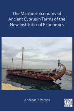
The Maritime Economy of Ancient Cyprus in Terms of the New Institutional Economics deals with the maritime economy of ancient Cyprus from 1450 BC to 295 BC, and comprises three parts which correspond to three distinct economic cycles: first economic cycle during the age of internationalism 1450-1200 BC second economic cycle during political volatility, economic growth and transformation 1200-525 BC third economic cycle in the Persian Empire until annexation into the Ptolemaic kingdom. The principles of New Institutional Economics are used to trace the island's institutions and their continuity and to reconstruct its maritime history. A unique feature is that for the first time a traditional descriptive and cultural approach is complemented by systematic and mathematical analysis and marketing documentation which results in meaningful examination of economic performance. This new approach highlights and explains the maritime economic activity of Ancient Cyprus and the Eastern Mediterranean in general. It brings together, for the first time, three distinct disciplines, that is History, Archaeology and Economic theory, in order to create a balanced explanation and reconstruction of the maritime economy of ancient Cyprus and of the challenges which confronted the ancient seafarers and traders of the Eastern Mediterranean. The approach and methodology is influenced by the author's engineering, business background and training.
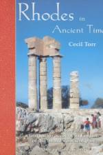
Not the shadow of a smile disturbs the dry exposition of the scholarly Englishman [Cecil Torr] who has given us the best historical monograph on the island... Read him and you will see why... (Lawrence Durrell, "Reflections on a Marine Venus"). Cecil Torr's two 19th-century studies of Rhodes, in the Greek Dodecanese, off the coast of Asia Minor, were the first and most authoritative English guides to the island's multi-layered history. Although more than a hundred years have passed since publication, the reclusive scholar's "Rhodes in Ancient Times" and "Rhodes in Modern Times" remain firmly embedded in related bibliographies. Impeccably qualified - Harrow (Arthur Evans was a class-mate), Trinity Cambridge, and Inner Temple barrister of formidable reputation - Cecil Torr had the true antiquarian's obsession for factual presentation and detailed analyses of primary sources. First published in 1885, "Rhodes in Ancient Times" is an historical and cultural guide to one of the most influential and powerful maritime states in the Mediterranean. Torr's scholarly curiosity leads him to explore the island's history, culture, myths and legends, arts, and contribution to learning in the centuries before Christ. Naturally, the celebrated Colossus is not overlooked!
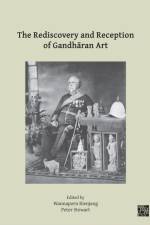
The ancient Buddhist art of Gandhara was rediscovered from the 1830s and 1840s onwards in what would become the North-West Frontier of British India. By the end of the century an abundance of sculptures had been accumulated by European soldiers and officials, which constituted the foundations for a new field of scholarship and internationally celebrated museum collections. Both then and since, the understanding of Gandharan art has been impeded by gaps in documentation, haphazard excavation, forgery, and smuggling of antiquities. Consequently, the study of Gandharan archaeology often involves the evaluation and piecing together of fragmentary clues. In more subtle ways, however, the modern view of Gandharan art has been shaped by the significance accorded to it by different observers over the past century and a half. Conceived in the imperial context of the late nineteenth century as 'Graeco-Buddhist' art - a hybrid of Asian religion and Mediterranean artistic form - Gandharan art has been invested with various meanings since then, both in and beyond the academic sphere. Its puzzling links to the classical world of Greece and Rome have been explained from different perspectives, informed both by evolving perceptions of the evidence and by modern circumstances. From the archaeologists and smugglers of the Raj to the museums of post-partition Pakistan and India, from coin-forgers and contraband to modern Buddhism and contemporary art, this fourth volume of the Classical Art Research Centre's Gandhara Connections project presents the most recent research on the factors that mediate our encounter with Gandharan art.
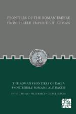
The frontiers of the Roman empire together form the largest monument of one of the world's greatest states. They stretch for some 7,500km through 20 countries which encircle the Mediterranean Sea. The remains of these frontiers have been studied by visitors and later by archaeologists for several centuries. Many of the inscriptions and sculpture, weapons, pottery and artefacts created and used by the soldiers and civilians who lived on the frontier can be seen in museums. Equally evocative of the lost might of Rome are the physical remains of the frontiers themselves. The aim of this series of books is not only to inform the interested visitor about the history of the frontiers but to act as a guidebook as well. The province of Dacia had a relatively short life being abandoned due to economic and strategic reasons in the 260s. It was heavily militarized and therefore the role of the army was crucial in Its development and life. The Roman frontier In Dacia combined several elements, each relating to the landscape: there were riverain and mountain borders, some supplemented by linear barriers, and all connected by roads. Everywhere, the complex system of the border consisted primarily of a network of watchtowers, smaller or larger forts and artificial earthen ramparts or stone walls.
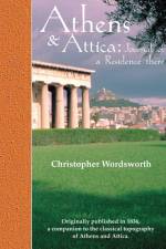
Christopher Wordsworth (1807-85), the "Great Christopher" of Winchester and Trinity College, Cambridge, was a nephew of William the poet, and brother to the student who launched the University Boat Race. In 1832 he took a gap-year, after his brilliant studies in ancient Greek and Latin classics, to travel back in time over two thousand years to Pericles' Athens. The account of his tour, Athens and Attica (1836), is still the perfect scholarly companion to the history, topography, and myths of an area compact in dimension yet vast in terms of its contribution to Western civilization. "The Bazaar or Market at Athens is a long street. Looking up you command a view of the commodities. Barrels of black caviar, small pocket-looking-glasses in red pasteboard cases, onions, tobacco piled up in brown heaps, black olives, figs strung together upon a rush, pipes with amber mouthpieces and brown clay bowls, silver-chased pistols, dirks, belts, and embroidered waistcoats. Such is the present state of Athens...a few Turks still doze in the archways of the Acropolis, or recline while smoking their pipes, and leaning with their backs against the rusty cannon. A few days ago the cannon of the Acropolis fired the signal of the conclusion of the Turkish Ramazam - the last which will ever be celebrated in Athens." - Christopher Wordsworth, 1832
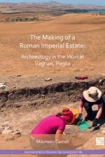
The Making of a Roman Imperial Estate presents excavations and analysis of material remains at Vagnari, in southeast Italy, which have facilitated a detailed and precise phasing of a rural settlement, both in the late Republican period in the 2nd and 1st centuries BC, when it was established on land leased from the Roman state after Rome's conquest of the region, and when it became the hub (vicus) of a vast agricultural estate owned by the emperor himself in the early 1st century AD. This research addresses a range of crucial questions concerning the nature of activity at the estate and the changes in population in this transitional period. It also maps the development of the vicus in the 2nd and 3rd centuries AD, shaping our understanding of the diversity and the mechanics of the imperial economy and the role of the vicus and its inhabitants in generating revenues for the emperor. By contextualising the estate in its landscape and exploring its economic and social impact on Apulia and beyond, archaeological research gives us extremely valuable insight into the making of a Roman imperial estate.
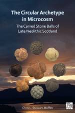
The Circular Archetype in Microcosm is the culmination of seven years research into the Carved Stone Balls of Late Neolithic Scotland. It is the first study of these enigmatic artefacts since that undertaken by Dorothy Marshall in 1977 and includes all currently known examples in both museums and private hands, described and analysed in considerable detail. For the first time, visual geological characterisation has been undertaken on approximately a third of carved stone balls, which has enabled a more detailed analysis of their potential origin and the landscapes in which they were found. The book offers a revised classification/typology of these artefacts which, following careful analysis, suggests that it is possible to determine individual craftspeople with a wide range of skills. It suggests that carved stone balls were used as unique and distinctive gestalts that represented the ideology of the core area of Aberdeenshire and enabled disparate groups to recognise one another.
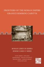
The frontiers of the Roman empire together form the largest monument of one of the world's greatest states. They stretch for some 7,500km through 20 countries which encircle the Mediterranean Sea. The remains of these frontiers have been studied by visitors and later by archaeologists for several centuries. Many of the inscriptions and sculpture, weapons, pottery and artefacts created and used by the soldiers and civilians who lived on the frontier can be seen in museums. Equally evocative of the lost might of Rome are the physical remains of the frontiers themselves. The aim of this series of books is not only to inform the interested visitor about the history of the frontiers but to act as a guidebook as well. The aim of this publication is not only to inform about historical and archaeological facts on the Limes in Serbia but also to act as a guidebook as well through the Danubian Limes.
Lo studio e un'analisi storico archeologica di un'area territoriale comprendente l'Isola d'Elba, il Monte Pisano e la pianura limitrofa, attraverso la metodologia propria dell'archeologia "leggera" lettura stratigrafica degli elevati e lettura del paesaggio storico. Lo scopo dello studio era quello di analizzare, all'interno del territorio preso in esame, la diffusione di un edificio di tipo religioso (TE 1) e comprendere le motivazioni alla base della scelta di un preciso linguaggio architettonico, anche in contesti politici e culturali molto diversi tra loro, da parte di committenti sia religiosi che laici che scelsero di rappresentare cosi il loro prestigio.
The Archaeology of Tanamu 1 presents the results from Tanamu 1, the first site to be published in detail in the Caution Bay Studies in Archaeology series. In 2008-2010, the Caution Bay Archaeological Project excavated 122 stratified sites 20km northwest of Port Moresby, south coast of Papua New Guinea. This remains the largest archaeological salvage program ever undertaken in the country. Yielding well-provenanced and finely dated assemblages of ceramics, faunal remains, and stone and shell artefacts, this remarkable set of sites has extended the geographical range of the Lapita cultural complex to not only the mainland of Papua New Guinea, but more remarkably to its south coast, at Australia's doorstep. At least as important has been the discovery of rich and well-defined layers deposited up to c. 1700 years before the emergence of Lapita in the Bismarck Archipelago, providing insights into pre-ceramic cultural practices on the Papua New Guinea south coast. Sites and layers interdigitate across the Caution Bay landscape to reveal a 5000-year story, each site contributing unique details of the grander narrative. Positioned near the coast on a sand ridge, Tanamu 1 contains three clear occupational layers: a pre-Lapita horizon (c. 4050-5000 cal BP), a Late Lapita horizon (c. 2750-2800 cal BP), and sparser later materials capped by a dense ethnohistoric layer deposited in the past 100-200 years. Fine-grained excavation methods, detailed specialist analyses and a robust chronostratigraphy allows for a full and transparent presentation of data to start laying the building blocks for the Caution Bay story.
Winchester Studies 10: This wide-ranging study uses historical and archaeological evidence to consider humanity's interactions with the environment, fashioning agricultural, gardening and horticultural regimes over a millennium and a half. The discussions of archaeological finds of seeds from discarded rubbish including animal fodder and bedding show the wide range of wild species present, as well as cultivated and gathered plants in the diet of inhabitants and livestock. Pollen analyses, and studies of wood, mosses, and beetles, alongside a look at the local natural environment, and comparison with medieval written records give us a tantalizing picture of early Winchester. The earliest record is by Aelfric of Eynsham in his 11th-century Nomina Herbarum. From medieval records come hints of gardens within the city walls, and considerable detail about agriculture and horticulture, and produce brought into the city. Wild fruit and nuts were also being gathered from the countryside for the town's markets and mills. At St Giles' Fair exotic imported spices and fruits were also sold. All these sources of evidence are brought together to reveal more fully the roles of agriculture and the environment in the development Winchester.
By the fourteenth century Winchester had lost its former eminence, but in trades, manufactures, and population, as well as by virtue of its administrative and ecclesiastical role, the city was still one of the major provincial centres in England. This Survey is based on a reconstruction of the histories of the houses, plots, gardens, and fields in the city and suburbs between c. 1300 and c. 1540, although in many instances both earlier and later periods are also covered. The reconstruction takes the form of a gazetteer (Part ii) of 1,128 histories of properties, together with accounts of 56 parish churches and the international fair of St. Giles, all illustrated by detailed maps. There is also a biographical register (Part iii) concerning more than 8,000 property-holders, most of whom lived in Winchester. This is the first time that it has been possible to piece together such a precise and detailed picture of both the topography and the inhabitants of a medieval town. Part i of the book contains a full discussion of the significance of this material and, in a manner relevant to an understanding of life in medieval towns in general, describes and defines such matters as the evolution of the physical environment, housing, land-tenure, property values, the parochial structure, the practice and organization of trades, and the ways in which the citizens of Winchester adapted to the declining status of their city.
London and Winchester were not described in the Domesday Book, but the royal properties in Winchester were surveyed for Henry I about 1110 and the whole city was surveyed for Bishop Henry of Blois in 1148. These two surveys survive in a single manuscript, known as the Winton Domesday, and constitute the earliest and by far the most detailed description of an English or European town of the early Middle Ages. In the period covered Winchester probably achieved the peak of its medieval prosperity. From the reign of Alfred to that of Henry II it was a town of the first rank, initially centre of Wessex, then the principal royal city of the Old English state, and finally `capital' in some sense, but not the largest city, of the Norman Kingdom. This volume provides a full edition, translation, and analyses of the surveys and of the city they depict, drawing on the evidence derived from archaeological excavation and historical research in the city since 1961, on personal- and place-name evidence, and on the recent advances in Anglo-Saxon numismatics.
The People of Early Winchester traces the lives, health, and diseases of Winchester's inhabitants as seen in their skeletal remains from the mid-third century to the mid-sixteenth century, a period of over 1,300 years. Although the populations of other British urban areas, York and London in particular, have been studied over an extended period, this volume is unique in providing a continuous chronological window, rather than a series of isolated studies. It is particularly notable for the large sample of Anglo-Saxon burials dated to the 8th - 10th centuries, which provide a bridge between the earlier Romano-British material and the later medieval samples. This study includes information on demography, physical characteristics, dental health, disease, and trauma collected from over 2,000 skeletons excavated from the Roman Cemetery at Lankhills and the Anglo-Saxon and medieval cemeteries of the Old and New Minster and Winchester Cathedral, as well as other Early Anglo-Saxon sites in neighbouring areas of Hampshire. The study establishes the underlying continuity of the population in spite of massive culture change between the Roman and Early Saxon periods, and delineates the increasing tendency to rounder skulls seen in the medieval period, a trend which is found in continental Europe at the same time. There were also significant differences through time in disease patterns and trauma. Leprosy, for example, is found only in post-Roman skeletons, while decapitations are seen only in Roman skeletons. Weapons injuries are confined to Anglo-Saxon and medieval individuals, although broken bones were common during the Roman period.
Edited by Martin Biddle with a catalogue of the known coins of the mint by Yvonne Harvey, this volume records and illustrates the minting of silver pennies in Winchester between the reigns of Alfred the Great and Henry III, a period of three and a half centuries. At the Mint, which was situated in the area of the High Street to the east of where the city's cross now stands, at least 24 million silver pennies (possibly as many as 50 million) were struck. Five and a half thousand survive in museums and collections all over the world. These have been sought out and photographed (some 3200 coins in 6400 images detailing both sides), and minutely catalogued by Yvonne Harvey for this volume. During the period from late in the reign of Alfred to the time of Henry III, dies for striking the coins were produced centrally under royal authority in the most sophisticated system of monetary control at the time in the western world. In this first account of a major English mint to have been made in forty years, a team of leading authorities have studied and analysed the use the Winchester moneyers made of the dies, and together with the size, weight, and the surviving number of coins from each pair of dies, have produced a detailed account of the varying fortunes of the mint over this period. Their results are critical for the economic history of England and the changing status of Winchester over this long period, and provide the richest available source for the history of the name of the city and the personal names of its citizens in the later Anglo-Saxon period.
This book explores pottery making and communities during the Bakun period (c. 5000 - 4000 BCE) in the Kur River Basin, Fars province, southwestern Iran, through the analysis of ceramic materials collected at Tall-e Jari A, Tall-e Gap, and Tall-e Bakun A & B. Firstly, it reconsiders the stratigraphy and radiocarbon dates of the four sites by reviewing the descriptions of excavation trenches, then presents a new chronological relationship between the sites. The book sets out diachronic changes in the the Bakun pottery quantitatively, namely the increase of black-on-buff ware and the gradual shift of vessel forms. It also presents analyses of pottery-making techniques, painting skills, petrography, and geochemistry and clarifies minor changes in the chai^nes ope'ratoires and major changes in painting skill. Finally, the book discusses the organisation of pottery production from a relational perspective. It concludes that the more fixed community of pottery making imposed longer apprenticeship periods and that social inequality also increased.
Outside the north gate of Venta Belgarum, Roman Winchester, a great cemetary stretched for 500 yards along the road to Cirencester. Excavations at Lankhills from 1967 to 1972 uncovered 451 graves, many elaborately furnished, at the northern limits of this cemetery, and dating from the fourth century A.D. This book, the second in a two-part study of Venta Belgarum, which forms the third volume of Winchester Studies, describes the excavations of these burials and analyses in detail both the graves and their contents. There are detailed studies and important re-assessments of many categories of object, but it is the information about late Roman burial, religion, and society which is of special interest.
The Plague Cemetery of Alghero (Sardinia, Italy, 1582-1583) presents a bioarchaeological analysis of the individuals exhumed from the cemetery of Alghero, which is associated with the plague outbreak that ravaged the city in 1582-1583. This cemetery revealed a particular burial typology, consisting of long and narrow trenches, each containing multiple inhumations, which attests to a catastrophic event, such as an epidemic with high mortality in a short period of time. Given the rarity of human remains from epidemic contexts buried in trenches, the skeletal sample from Alghero represents valuable material. In fact, no other Italian plague cemeteries have been examined through a detailed bioarchaeological analysis, and the study thus serves as a model for future research. The author examines a series of parameters, starting from the demographic profile of the sample -181 individuals from 15 trenches - and taphonomic analysis, and then analysing stature, dental pathologies, stress indicators, degenerative joint disease, entheseal changes and other pathologies. The study is intended to illuminate a cross section of 16th century Sardinian society in a coastal city through a holistic view, which interweaves the documentary evidence for plague, funerary responses and the health status of the population. The main objective is therefore to shed light on a population which lived during a period of plague, revealing lifestyles, activity patterns and illnesses and providing a significant contribution to the bioarchaeology, palaeopathology, and archaeology of the Italian territory.
Abonner på vårt nyhetsbrev og få rabatter og inspirasjon til din neste leseopplevelse.
Ved å abonnere godtar du vår personvernerklæring.