

Gjør som tusenvis av andre bokelskere
Abonner på vårt nyhetsbrev og få rabatter og inspirasjon til din neste leseopplevelse.
Ved å abonnere godtar du vår personvernerklæring.Du kan når som helst melde deg av våre nyhetsbrev.
A detailed study of ceramics from the Iberian sites commonly known as 'Las Motillas' - arguably the most singular form of prehistoric settlement on the Iberian Peninsula. Located in the central area of Spain called 'La Mancha' they date to the Bronze Age (2200-1500 cal. BC), with the sites characterised by artificial tells produced by the destruction of complex fortifications with concentric stone walls. These sites were believed to be funerary barrows until the 1970s, when the systematic excavation of La Motilla del Azuer (near Daimiel (Ciudad Real), on the left bank of the Azuer River) was undertaken. From the beginning of the fieldwork, the nature of the fortified settlement quickly appeared, clearly defined thanks to the documentation of a central fortification surrounded by a small settlement and its necropolis. This study assesses the Bronze Age pottery assemblages from the site, presenting a typological and technological classification.
Young Lukanian Archaeologists 2The second volume in the Lukanian Young Archaeologists series concentrates on the processing of data obtained from archaeoichthyology and archaeomalacology finds from one of the most important prehistoric sites in the Mediterranean. The proto-historic settlement of Mursia (on the island of Pantelleria, Trapani, Italy) was soon integrated within the dense network of sea routes that affected the populations at the height of the Bronze Age. Chronologically, the settlement dates from the last two centuries of the first half of the second millennium BC. The town is on two terraced plateaus, of similar size, which today we call the 'Upstream Plateau' (or 'internal': excavation areas B and C) and 'Sea Plateau' (or 'headland': areas of excavation A and D). Significant information is presented on the species fished, fishing techniques, and the economic importance of these resources within the village of Mursia. The current archaeozoological research is not limited to the recognition and description of animal species but also focuses on the need to obtain information for cultural and environmental analyses and to try and reconstruct the ancient relationships between man and his natural resources generally. Through the analysis of the ichthyic and malacological samples from Mursia an attempt is made not only to identify the species present but also to process the data obtained from the taphonomic data for a reconstruction of this culturally isolated site within the context of marine resources.
The Egyptians were the only ancient civilization to intentionally preserve their animal dead using artificial mummification techniques. This practice formed part of a complex belief system which required that the physical remains of the body were preserved in order to ensure continuity of life in the next world. Consequently many thousands of animal mummies survive in the archaeological record, either at the numerous animal necropolises dedicated to the animal gods, or in the collections of museums and private collectors around the world. 127 mummified animals from four museums in Great Britain were studied using conventional radiography (X-ray) and computed tomography (CT) in order to assess the validity and potential of the techniques. The study collection was found to contain the skeletal remains (either partial or complete) of birds, cats, dogs, fish, crocodiles, snakes and rodents, the majority of which are believed to have been manufactured as votive offerings. The radiographic examination of the mummies revealed a wealth of information on both the animals themselves and the techniques which the embalmers had used in order to preserve them. Limited evidence was found to suggest evisceration, evidence of pathological conditions or cause of death; however a great deal of information regarding the positioning of the skeleton, the form of the resulting mummy bundle and the methods of wrapping were highlighted. In conclusion, the study identified the enormous potential of non-destructive radiographic techniques in the investigation of mummified animal material.
Volume 1 (BAR S1548, 2006) of the archaeological excavations conducted by the University of Arizona at the site of Mezzomiglio in the town park area of Chianciano Terme, Tuscany, dealt with the excavation results up to the year 2001. This volume by Paola Mecchia deals with the material culture which resulted from the limited soundings made from 2003 through 2006. The site at Mezzomiglio was an ancient rural spa. How close the nearest town may have been is not known; there may have been a significant settlement at Chianciano Terme itself but to date nothing other than evidence of rural occupation has presented itself. The spa certainly functioned from at least late Etruscan times and material has been recovered which allows the tracing back of the site to at least the 2nd century B.C., with the possibility of frequentation of a simple nature earlier than that.
This publication deals with the archaeological and documentary evidence for mans' activities in Binsted and Kingsley (Hampshire/Surrey, S. England) during this period between the last Ice Age and the post-medieval period. An interim publication on the Alice Holt Roman potteries contains a short section on the contemporary landscape, accompanied by a rather rudimentary map of the distribution of Roman sites in Binsted and Kingsley parishes between Alton and the Hampshire/Surrey county boundary in north-east Hampshire. The ten years following this publication saw an intensive programme of landscape study in order to explore and understand the changing pattern of human settlement and land utilisation within the area over the last 10000 years or so. Conclusions of the current research reported in this volume are based on seven years of field-walking between 1981 and 1988, as well as some carried out during the early 1970s. All but about half a dozen of the arable fields within the 42 square kilometres of land encompassed by the two parishes were walked and most of the permanent pasture and woodland was also examined. This fieldwork was backed up by the survey of a number of vernacular buildings dating from before AD 1300 to c. AD 1700. Five flights were also carried out between 1981 and 1983 for the purpose of air photography. Excavations were carried out on Alice Holt Roman pottery waste dumps and other sites of all periods in and around the forest.Contributions by C.R. Cartwright, A.J. Clark, A. Graham, D. Graham, D.F. Mackreth and D.F. Williams.
The Acheulean is the longest archaeological period in history, and was produced by different hominin species such as Homo erectus and Homo heidelbergensis. In this book the author examines the diagnostic stone tools of the Acheulean period, handaxes and cleavers, from the Hunsgi-Baichbal Valley in India. At the 1.2-million-year-old site of Isampur Quarry, the author reconstructs the manufacturing process for these tools and uses it to infer some of the social and cognitive faculties of their makers. The Isampur Quarry tools are then compared with those from other sites in the Valley, including one around a million years younger, and the author deduces some of the changes in social interaction and cognition that occurred over the vast timespan of the Acheulean.
This study deals with the significance of ritual scenes on 21st Dynasty coffins. The images on these coffins are studied as texts referring to the passage of the deceased to the next life. The aim of this study is also to argue how the Middle Kingdom Coffin Texts were replaced at this later date by such images on coffins. The work focusses on a group of coffins belonging to the priest known as PA-dj-imn, and date to the reign of the High Priest Pinudjem II. They were found in 1891 at the tomb of Bab el-Gassus, as part of the find generally known as the Second Find of Deir el-Bahri.
The present work is an attempt to give a comprehensive overview of turquoise and its role in Ancient Egypt. Turquoise was mined mainly in Sinai, at Maghara and at Serabit el Khadim, where the stone occurs in the sandstone rock. Ancient Egyptian mineralogical studies have neglected turquoise, focussing instead on the study of other minerals and metals such as gold, silver, and copper.
This work, focusing on specific categories of royal estates, concentrates on the later Anglo-Saxon period in England (the mid-ninth century to the mid-eleventh AD). These centuries were a formative period in early medieval history, in which a state can be seen to have developed from a small kingdom to take control of lowland Britain, and, indeed, exert political influence over much of the rest of Britain. The area of this study consists of royal lands in the two shires of Hampshire and Dorset as set out in the folios of Domesday Book. Royal estates were lands used to support kings and their immediate retinue, and lands granted by kings to members of the royal family. Lands of royal agents are also examined in this work.
The genesis for this conference, and its subsequent proceedings, came from discussions held in the newly formed Archaeological Discussion group, a subgroup of the American Institute for Conservation of Historic and Artistic Works' Objects specialty group, about the definition of an archaeological conservator and the directions in which the field was evolving.
Proceedings of the 19th Meeting of the European Association of South Asian Archaeology in Ravenna, Italy, July 2007.
This book is intended as an introduction to the archaeology of the easternmost regions of Greek settlement in the Hellenistic period, from the conquests of Alexander the Great in the late fourth century BC, through to the last Greek-named kings of north-western India somewhere around the late first century BC, or even early first century AD. The 'Far East' of the Hellenistic world - a region comprising areas of what is now Afghanistan, Pakistan, Iran and the former-Soviet Central Asian Republics - is best known from the archaeological remains of sites such as Ai Khanoum, which attest the endurance of Greek cultural and political presence in the region in the three centuries following the conquests of Alexander the Great. The 'Hellenistic Far East' has become the standard catch-all term for a network of autonomous and semiautonomous Greek-ruled states in the region east of the Iranian Plateau, which remained in only intermittent political contact with the rest of the Hellenistic world to the west - although cultural and commercial contacts could at times be very direct. These states, their rulers and populations, feature only occasionally in Greek and Latin historical sources. The two great challenges of HFE studies lie in integrating scholarship on this region into work on the Hellenistic world as a whole in a more than superficial way; and in understanding the complex cultural and ethnic relationships between the dominant Greek elites of the region and their neighbours, both within the Greek kingdom of Bactria and in its Central Asian hinterland.
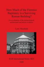
Many people have said none, but Larry Shenfield's title answers that question. He undertakes a re-evaluation of the archaeological, architectural and artistic evidence for building, and concludes that there is - as seems intrinsically likely - a Rome core to its structure.
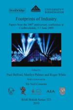
This volume contains a selection of papers which were presented at the Fe09 Conference in June 2009. The conference was held as part of the 'Coalbrookdale 300' celebrations (Shropshire, England), commemorating the tercentenary of Abraham Darby's success with coke-smelted iron. This momentous event was a truly world-changing moment in human history; and its origins, consequences and wider impacts were the subject of debate and discussion throughout the conference.Foreword by Sir Neil Cossons
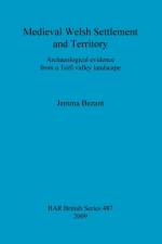
Principally through the use of landscape archaeology, this work explores the medieval landscape of west Wales, particularly the 'cwmwd' of Gwinionydd in the central Teifi valley, Ceredigion. The main focus of the study is to recreate the 'cwmwd-maenor-tref', territorial system administered by a pre-conquest Welsh aristocracy and locate native tenures along with their specific agricultural regimes. A retroactive analysis of estate structures, such as those at Llanfair and Llanllyr, establishes their medieval antecedence and they are considered alongside the monastic granges of Whitland, Strata Florida and Talley abbeys. This project draws upon techniques including field survey, remote sensing, geophysics, mapping and terrain modelling using Geographic Information Systems and Lidar data. These are complemented by excavation to target and clarify the interpretation of the survey results. The work can be viewed as a trans-disciplinary landscape analysis that has implications for future approaches to the study of rural Wales: this successful study of an apparently inscrutable rural landscape is relevant for research and curatorial disciplines alike.
This monograph although concentrating on the Southern High Plains area (USA) represents a tremendous step forward in understanding fire technology and hot rock technology and their role and relationship within hunter-gatherer societies. It not only elevates the status of hearths and hearthstones as worthy of study within hunter-gatherer research but equally important, also presents new avenues for that research.
The description of Kent contained in "Domesday Book" does not stand alone. At the time of the "Survey of the whole of England" - the survey conducted in 1086 by order of king William I - there were four ancient churches existing in Kent: Christ Church and Saint Augustine's in Canterbury, Saint Andrew's in Rochester, Saint Martin's in Dover. From the archives of three of them (all except Dover) copies of documents survive which are more or less closely related to the Survey. The aim of the present book is to bring together all the relevant written evidence, so as to enable a better understanding of it. A few documents are printed here which have not been printed before. For those which have, this book provides a more accurate text than any previous edition. For example, the transcription of the "Domesday Book" text given here includes a few words which have become undecipherable in the original, but which were still legible when a copy was made in the 1760s. That is the same copy used by Edward Hasted, whose "History of Kent" (1778-99) was the first serious attempt to reconnect the written evidence with the actual landscape. For anyone interested in the workings of the Survey, or in the topography of medieval Kent, this book will be indispensable.
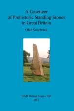
A Gazetteer representing practical field observations of most of the prehistoric Standing Stones in Great Britain and some 'Other Stones' which post-date AD 1. The list also includes 34 prehistoric Standing Stones known to be extant but which the author was unable to visit, a list of Standing Stones of unknown provenance, and of interesting 'Other Stones'. The motivation for this work was the Wimblestone (Somerset, ST434585) which is an extant prehistoric Standing Stone close to the author's childhood home and which started his interest in these monuments. In September 1996 the author set out to find, visit and sketch the prehistoric Standing Stones in Great Britain and soon discovered that there was no readily available, and comprehensive list or lists of Standing Stones and their exact locations. Therefore, with numerous Standing Stones unknown to the author and others which were very difficult to find, the author decided to attempt to produce a readily usable gazetteer of as many as possible of the prehistoric Standing Stones in Great Britain (with the National Grid reference number for each) together with colour sketches, photographs, field records and relevant information gathered from various sources; deliberately excluded were stone circles, long stone rows, burial chambers and dolmens. Some Standing Stones were not visited because they were inaccessible for various reasons and these are separately listed. These and the other Standing Stones and some other stone monuments which postdate AD 1 are recorded in the gazetteers but are excluded from the analysis. Apparently unrecorded Standing Stones continue to be found, making the production of a totally comprehensive gazetteer of all the prehistoric Standing Stones in Great Britain the work of many lifetimes.
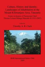
Essays in Honour of Paramount Chief Thomas Lenana Mlanga Marealle II (1915-2007)
18 papers from the 1st Red Sea Project, held at the British Museum in October 2002.
This study highlights a range of theoretical problems concerning Levantine Iron Age archaeology. Following the introduction, Chapter 2 provides the background for the study as a whole, tracing the archaeological study of the Iron Age southern Levant from the early nineteenth century to the present day. This highlights how and why archaeologists have changed their ideas about the narrative in question through time whilst also retaining a number of key ideas. Chapter 3 traces the archaeological study of 'Edomite' archaeology in the southern Levant in particular. Chapter 4 begins the critique of the key ideas and assumptions that underpin 'Edomite' archaeology by demonstrating that the individual historical sources used as evidence when discussing the 'Edomites' are not simply sources of factual information about the Iron Age. Chapter 5 takes a similarly critical approach to the methods of archaeological excavation, interpretation, and analysis used in south Levantine Iron Age archaeology. Chapter 6 completes the critique of the central ideas that form the basis of 'Edomite' archaeology by discussing the central tenets of archaeological theory concerning the relationship between material culture and identity that are required to support this idea. Chapter 7 outlines the methodology used in this study, which was designed to test whether specific ceramic types do in fact support the present interpretation of the late Iron Age southern Levant. The results of the analysis using this methodology are presented in Chapter 8. In Chapter 9 the implications of the preceding chapters are discussed and an interpretation of the evidence which does not rely on traditional problematic assumptions will be presented. Final conclusions are drawn in Chapter 10.
Limina/Limites: Archaeologies, histories, islands and borders in the Mediterranean (365-1556) 1Volume 1 of a new BAR series entitled 'Limina/Limites: Archaeologies, histories, islands and borders in the Mediterranean (365-1556)' which seeks to invite editors of proceedings of conferences and workshops, authors of individual monographs and collective studies which, regardless of their discipline, are targeted at the integration of diverse data sources and systems oriented at a global reconstruction, and geared to long-term trends and to Mediterranean-wide spatial dimensions. This first volume in the 'Limina/Limites' presents the proceedings of the conference 'Transjordan in 12-13th Centuries and the Frontiers of the Medieval Mediterranean', held in Florence between 6-8 November 2008.
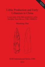
This work investigates the contribution of economic activity to Chinese early urbanization, through a case study of the lithic production at the Neolithic Taosi site in Shanxi, China (c. 2500-1900BCE). The analysis is based on information collected from fieldwork experiments with replicating stone tool manufacture. Lithic production played an important role in the urbanization at Taosi, which developed into the primary political, economic and ceremonial centre in the Linfen Basin. Due to its central position in the region, a high level of social complexity, and its spatial layout with a rammed-earth enclosure, Taosi represents a milestone in the process of early urbanism in ancient China.
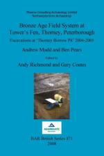
Archaeological excavation of about 11ha of land at Tower's Fen, Thorney, Peterborough (England), investigated part of an extensive pattern of ditched enclosures and fields associated with several waterholes and two ponds. One large pit, which may have been a waterhole, yielded Early Bronze Age pottery and is radiocarbon dated to the terminal 3rd millennium BC. Two other dates from the ponds came out at around 1500-1300 BC. The other features were probably also Middle to Late Bronze Age although the limited quantity of pottery was not datable precisely. Waterlogged material recovered from the deeper features included most of an unusual wooden tub or bucket, as well as other pieces of worked wood. The palaeo-environmental evidence from pollen, plant macro-fossils, insects and charred plant remains indicated that the land supported a mosaic of woodland, scrub, arable fields, meadow and short grazed grassland. A wide variety of trees was present, particularly wet-loving species such as willow and alder, and there was abundant evidence for coppicing. Nearby excavations at Pode Hole, and the wider picture provided by plotted cropmarks, indicate that the site formed part of an extensive prehistoric landscape. It is suggested that the Bronze Age agricultural landscape developed piecemeal and was based upon a mixed arable and pastoral economy. This contrasts with Fengate and other landscapes of this period where large-scale land divisions have been related to intensive livestock management. The sparse evidence for contemporaneous settlement is typical of many sites of this period.Written by Andrew Mudd and Ben Pears.Edited by Andy Richmond, Gary Coates, Andy Chapman and Pat ChapmanWith contributions from Maisie Taylor, Nick Branch, Barbara Silva, Christopher Green, Scott Elias, Alys Vaughan-Williams, Iñaki Valcarcel, Imogen Poole, Karen Deighton, Stuart Needham, Andy Chapman, Pat Chapman and Steve Critchley.Illustrations by Jacqueline Harding and Pat Walsh with Steven J. Allen.
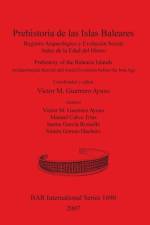
Registro Arqueológico y Evolución Social Antes de la Edad del Hierro / Archaeological Record and Social Evolution before the Iron AgeA study of the prehistory of the Balearic Islands, Spain, with regard to the archaeological record of the region and its social evolution before the Iron Age.Authors: Víctor M. Guerrero Ayuso, Manuel Calvo Trias, Jaume García Rosselló and Simón Gornés Hachero
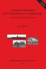
This study is primarily concerned with computer-generated reconstruction models of architecture. It offers a collection of possible methodologies for dealing with individual problems concerning visualisation aims and highlights methods of adding value to virtual models in archaeology. Several avenues of enquiry are therefore explored, such as: What use have virtual models in archaeology?; How are they perceived?; Who is the intended audience?; Which applied ethical issues exist?; How can ethical awareness lead to added value? How are these models created? There is no easy answer to any of these but this work approaches the issues through a series of projects. These are international, but exhibit a European focus, which is also mirrored by the three case studies. The three case studies were selected because of their differences but they also have two properties in common: they were all begun at approximately the same time (2001) and they all pay attention to ethical issues. Otherwise an effort was made to find projects which were produced and concerning sites in three different countries: Casa del Centenario in Pompeii (Italy), Ename (Belgium) and Avebury (U.K.). The projects are concerned with architecture from three different periods, i.e. a Roman house, a medieval settlement (with the focus on St. Lawrence's church) and a Neolithic monument complex. The projects also had different aims: while the Casa del Centenario was primarily intended as a museum application and as a visualisation tool for the restorers, in the Ename 974 project the reconstructions were to illustrate the work and interpretation in progress for the local population while the church was closed due to excavation and building research. The model of Avebury was designed for research purposes and not intended for public display. So far, no comprehensive synopsis of different approaches with a critical stance on computer-generated visualisations has ever been attempted and this work provides a detailed and stimulating overview and analysis and serves as a foundation for further research.
Pottery Workshop or Pottery Style?Recent excavations in the region of Achaea in the northern Peloponnese (Greece) have brought to light new evidence on the Thapsos-class of vases. Their identification amongst the grave goods as well as the dedications in the two important sanctuary sites of the area provide a starting point for reassessing the question of this particular ware's identity and its main production centre. After a brief introduction on the aims and scope of the study, the history of the research, the distribution of Thapsos-class ware in Achaea, its technical features and a short discussion on chronological issues, the various fabrics of the Thapsos-class ware attested in Achaea are first presented and analyzed, and then examined and discussed with particular respect to their resemblance with the Achaean Late Geometric workshops producing the impressed and fine painted wares. Next the similarities, as well as the differences, of vases of this class recovered mainly from Ithaca, Delphi and Thera but also from other areas of mainland Greece are set out. A full catalogue of the Thapsos class ware data derived so far from Achaea is submitted with photographs and drawings of almost every sherd and vase. Finally the results of a non destructive elemental ceramic analysis using micro X-RAY fluorescence spectroscopy (m-XRF) applied to various fabrics and wares from Achaean pottery of the Late Geometric period is published in the Appendix. A more fundamental aim of the present study is to bring forward new aspects for investigation concerning this ceramic group, so closely associated as it is with the foundation and life of the Greek colonies in the west.With a contribution by A. Sakalis, D. Tsiafakis and N. Tsirliganis titled 'Non destructive elemental ceramic analysis from Achaea using X-Ray fluorescence spectroscopy (m-XRF)'.
It seems that, over recent years, the term landscape has received much discussion, albeit based on the mechanics of landscape. What has been omitted is the construction of landscape in terms of aesthetics, knowledge, emotion, interpretation and application. Although landscape is 'there', we control the imagination and cognitive construction of it. Fundamentally, landscape can be defined as a series of 'spaces' that become 'places', and, within this volume (the product of a number of conference sessions run between 1997-99 by the Theoretical Archaeology Group), 17 contributors re-address the importance of space/place and suggest both may be considered as part of an archaeological assemblage. Some chapters also attempt to place rock art into a narrative, placing its historical value into a prehistoric context.
An environmental and archaeological multiproxy study of burial mounds in the Eurasian steppe zoneThis volume presents a series of archaeological and scientific studies focusing on Kurgans in Hungary and Russia. Kurgans are the burial mounds of Bronze and Copper Age societies that can be traced back to the 4th Millennium cal BC. The Kurgans of the Eurasian steppe zone preserve palaeosoils and represent a fantastic resource for investigating Holocene environmental changes. The studies presented in this volume principally focus on the Lyukas-halom and Csíp?-halom kurgans in Hungary and the Skvortsovsky and Labazovsky kurgans in Russia, though there are also several papers that explore the 'wider world' of the Kurgans. On the whole, this volume brings together papers on a multi- and interdisciplinary scale, and sheds light on the current status and state-of-art of kurgan studies.
Despite the great fascination that the collapse of past civilizations holds for the public, the process of decreasing social complexity has received surprisingly little attention from archaeologists, especially when compared to the voluminous research on increasing complexity. And most studies of the process have been oriented toward understanding complexity by seeing how it fails, not toward understanding how a different, "simpler" society emerged from a more complex society. But if there are specific motivations and particular processes for decreasing complexity - if "collapse" is a solution rather than a problem - then clearly there is much to be learned from examining the societies that develop during periods of seeming decline. This research study examines how one complex society reorganized to a relatively simple society, recognizing the simultaneously constructive and destructive aspects of the process. The study focuses on the developments during the late Roman Empire through late Antiquity, a time of decreasing social complexity in the ancient Mediterranean world beginning in the late 2nd and continuing to the mid 6th centuries AD, on the basis of a detailed archaeological study of one city and its territory, Volterra, in Tuscany, Italy.
Abonner på vårt nyhetsbrev og få rabatter og inspirasjon til din neste leseopplevelse.
Ved å abonnere godtar du vår personvernerklæring.