


Gjør som tusenvis av andre bokelskere
Abonner på vårt nyhetsbrev og få rabatter og inspirasjon til din neste leseopplevelse.
Ved å abonnere godtar du vår personvernerklæring.Du kan når som helst melde deg av våre nyhetsbrev.
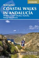
A guidebook to 40 half and full day coastal walks in Andalucia. The graded routes, which are suitable for any reasonably fit walker, range from 6km to 19.5km and can be walked all year round. The walks are located in seven of the region's most beautiful National Parks and protected areas (including La Brena y las Marismas, Los Alcornocales y del Estrecho, La Sierra de las Nieves and Nijar-Cabo de Gata) and are mostly circular in nature, negating the need for any logistical legwork. Step-by-step route descriptions for each walk are accompanied by 1:50,000 mapping, together with information about points of interest en route. Also included is a useful glossary and route summary table, plus all the practical information needed to explore Andaluca's coast on foot - equipment, safety, when to go, refreshments, accommodation and more. The picturesque coastline of Andaluca is a walker's dream. Sandwiched between mountain and sea, walkers are rewarded with both dazzling mountain vistas and stunning seascapes. The sense of history embedded in these ancient coastal byways - which dates back to ages past - is an added delight, making the walking all the richer.
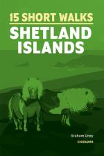
Graham Uney has chosen 15 of the best short walks on the Shetland Islands. Each walk comes with easy-to-read Ordnance Survey maps, clear route description and lots of images, plus information on beauty spots and refreshment stops. No challenging terrain or complicated navigation means walks can be enjoyed by everyone.
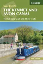
Guidebook to walking along the Kennet & Avon Canal. The 94 mile route from Reading to Bristol is split into 7 stages of fairly easy walking and includes the UNESCO World Heritage Site of Bath and Bristol's Floating Harbour. 20 circular walks are also included, ranging from 41/4 to 9 miles, taking in the best sections of the canal.
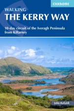
Guide to Ireland's 190km Kerry Way. Described anti-clockwise from Killarney, the circular route is presented in 10 stages and offers view of Killarney National Park and the Beara and Dingle peninsulas. Optional side trips include Carrauntoohill, Skellig Michael and Valentia Island.
Terry Marsh has chosen 15 of the best short walks on the Isle of Mull, including Ulva and Iona. Each walk comes with easy-to-read Ordnance Survey maps, clear route description and lots of images, plus information on beauty spots and refreshment stops. No challenging terrain or complicated navigation means walks can be enjoyed by everyone.
Vivienne Crow has chosen 15 of the best short walks around Wooler, Rothbury, Alnwick and the Northumberland coast. Each comes with easy-to-read Ordnance Survey maps, route description and lots of images, plus information on beauty spots and refreshment stops. No challenging terrain or complicated navigation means walks can be enjoyed by everyone.
Official guidebook to the Wye Valley Walk. Following the River Wye for 136 miles (219km) from the mouth of the river at Chepstow to the slopes of Plynlimon in Powys, the Wye Valley offers a perfect mix of river and hill walking. The walk can be completed in about ten days, or seven days by the very fit and determined. Devised by the Wye Valley Walk Partnership, the way explores the superb scenery of the Wye Valley Area of Outstanding Natural Beauty. Several historic market towns including Chepstow, Monmouth, Ross-on-Wye, Hereford, Hay-on-Wye, Builth Wells and Rhayader can be visited along the route, as well as many small villages and pretty hamlets. Illustrated with colour photographs and OS 1:25,000 map extracts, and also includes a Wye Valley Walk passport, for walkers to collect stamps along the route for a permanent record of their journey. The walk leads through a dramatic limestone gorge, dense woodland beneath limestone crags and past peaceful river meadows in some of the most superb scenery in the heart of the Wye Valley.
Guidebook describing 50 walking routes on Scotland's beautiful Isle of Mull, as well as neighbouring Coll, Tiree, Iona and Erraid. Walks range from 1 to 12 miles and from short circuits to demanding mountain traverses, but without technical difficulties. The Isle of Mull is wild, rugged and great for wildlife spotting.
Guidebook to trekking the 225km (140 mile) Cami dels Bons Homes, the Cathar trail, through the French and Spanish Pyrenees. The GR107 cross-border route between Foix in Ariege and Berga in Catalonia is described in 10 stages and includes detailed maps, profiles, accommodation listings and facilities.
This guidebook describes the 12-day Alta Via 2 trek, which covers over 140km of rugged mountains and valleys between Chardonnay and Courmayeur, the gateway to Mont Blanc.
Phil Turner has chosen 15 of the best short walks around Land's End and Penwith. Each walk comes with easy-to-read Ordnance Survey maps, clear route description and lots of images, plus information on beauty spots and refreshment stops. No challenging terrain or complicated navigation means walks can be enjoyed by everyone.
Guidebook to 40 day walks in the South Downs National Park. The walks, which are designed to suit all abilities, are dotted all over the National Park and range from 4 miles (7.5km) to 11 miles (17.5km). Each walk is circular, and where possible begins and ends at a place accessible by public transport. With some of the most iconic landscapes in southern England, including the white chalk cliffs of Beachy Head and the Seven Sisters, and such well-loved landmarks as Ditchling Beacon and atmospheric ancient monuments like the Cissbury Ring, walking in the park proves a delightful experience mile after mile. Step-by-step route descriptions are accompanied by 1:50,000 OS mapping. Also included is information on the plants and wildlife of the Downs, as well as handy practical tips on accommodation, car parking and public transport.
Graham Uney has chosen 15 of the best short walks on the Orkney Islands. Each walk comes with easy-to-read Ordnance Survey maps, clear route description and lots of images, plus information on beauty spots and refreshment stops. No challenging terrain or complicated navigation means walks can be enjoyed by everyone.
Guidebook to the Sarsen Way (79km) from Coate Water Park to Salisbury and the Cranborne Droves Way (28km) connecting Salisbury to Wessex Ridgeway at Win Green. These long-distance paths are part of the Great Chalk Way. Suggested 2-8 day itineraries, OS maps, accommodation options, and reverse route descriptions are included.
Guidebook describing graded day walks in Arolla and Zinal, Switzerland. Covers the Val d'Herens and Val d'Annivers in the Swiss Valais.
Map booklet with 1:25,000 IGN mapping for hiking the Tour du Mont Blanc, one of the world's classic treks. The 170km (105 mile) TMB route typically takes 11 days and can be walked in anti-clockwise and clockwise directions. Trek planning resources, accommodation guide and 5, 7 and 9-day options. Companion Cicerone guidebook available separately.
This compact booklet of maps shows the full route of the 95 mile West Highland Way Scottish Long Distance Route, via Loch Lomond and Rannoch Moor. This booklet is included with the Cicerone guidebook to the trail, and shows the full route on Ordnance Survey 1:25,000 maps.
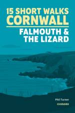
Phil Turner has chosen 15 of the best short walks around Falmouth and the Lizard. Each walk comes with easy-to-read Ordnance Survey maps, clear route description and lots of images, plus information on local beauty spots and tasty refreshment stops. No challenging terrain or complicated navigation means walks can be enjoyed by everyone.
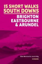
Our authors have chosen 15 of the best short walks around Brighton, Eastbourne and Arundel. Each walk comes with easy-to-read Ordnance Survey maps, clear route description and lots of images, plus information on local beauty spots and tasty refreshment stops. No challenging terrain or complicated navigation means walks can be enjoyed by everyone.
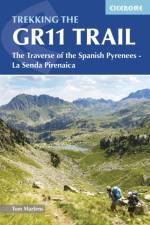
The GR11 traverses the Spanish Pyrenees from Irun on the Atlantic coast to Cap de Creus on the Mediterranean, and often enjoys better weather than its French counterpart, the GR10. Leading over high passes and through sweeping valleys, the 820km route is presented in 47 stages. Trekkers require experience of high mountains.
Three of the most popular high-altitude treks in Pakistan's Karakoram, among some of the world's highest mountains: Snow Lake and the Biafo and Hispar Glaciers; the K2 Base Camp Trek; and Gondogoro La via Concordia. Also includes two shorter treks in the shadow of Nanga Parbat: Fairy Meadows and Rakhiot Base Camp Trek; and a trek to Diamir Face.
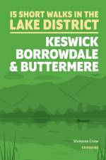
Vivienne Crow has chosen 15 of the best short walks around Keswick, Borrowdale and Buttermere. Each walk comes with easy-to-read Ordnance Survey maps, clear route description and lots of images, plus information on local beauty spots and tasty refreshment stops. No challenging terrain or complicated navigation means walks can be enjoyed by everyone.
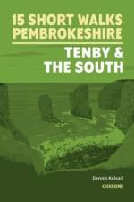
Dennis and Jan Kelsall have chosen 15 of the best short walks in south Pembrokeshire, including Tenby. Each walk comes with easy-to-read Ordnance Survey maps, clear route description and lots of images, plus information on beauty spots and refreshment stops. No challenging terrain or complicated navigation means walks can be enjoyed by everyone.
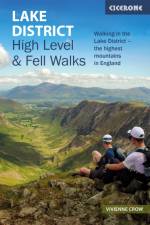
This guidebook describes 30 graded fell walks on the ridges and high peaks of the English Lake District, the UK's most popular national park. Reaching some of England's finest and highest mountain scenery, this guide leads readers to classic horseshoes and traditional ascents as well as lesser-known routes to quieter summits.
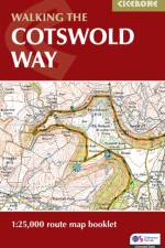
Map of the 102 mile (163km) Cotswold Way National Trail, between Chipping Camden and Bath. This booklet is included with the Cicerone guidebook to the trail, and shows the full route on OS 1:25,000 maps. The trail typically takes two weeks to walk, and is suitable for walkers at all levels of experience.
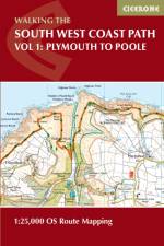
This guidebook describes the Pembrokeshire Coast Path National Trail. The scenic 180 mile (291km) long-distance walk from Amroth to St Dogmaels takes around 2 weeks to walk, with soaring rugged cliffs, tranquil inlets and broad sandy beaches. With planning schedules, route description and accommodation guidance. Includes a 1:25,000 OS map booklet.
Guidebook to 32 day walks in the Sierras de Tejeda, Almijara and Alhama mountains of southern Spain. Easily accessible from Nerja and Velez-Malaga, the routes range from easy strolls to strenuous climbs, including the peaks of La Maroma, El Cielo and Cisne. The mountains are largely limestone, with some summits reaching over 2000m.
Guidebook to cycling the 528 mile NC500 circular cycle tour around northern Scotland, starting and finishing in Inverness. The route follows quiet main roads and minor country roads, and is easily accessed and well provisioned. It can be comfortably completed within a fortnight and boasts stunning scenery and rich historical interest.
Abonner på vårt nyhetsbrev og få rabatter og inspirasjon til din neste leseopplevelse.
Ved å abonnere godtar du vår personvernerklæring.