

Gjør som tusenvis av andre bokelskere
Abonner på vårt nyhetsbrev og få rabatter og inspirasjon til din neste leseopplevelse.
Ved å abonnere godtar du vår personvernerklæring.Du kan når som helst melde deg av våre nyhetsbrev.
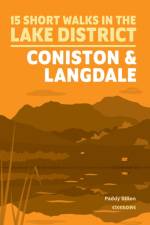
Paddy Dillon has chosen 15 of the best short walks around Coniston and Langdale. Each walk comes with easy-to-read Ordnance Survey maps, clear route description and lots of images, plus information on beauty spots and refreshment stops. No challenging terrain or complicated navigation means walks can be enjoyed by everyone.
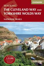
Guidebook to the Cleveland Way and Yorkshire Wolds Way National Trails, plus the Tabular Hills Walk link route. The guidebook also contains a 1:25,000 scale OS route map booklet of the Cleveland Way. The Cleveland Way National Trail, described in seven day stages, is a fine 177km (110 miles) walk around the North York Moors National Park from Helmsley to Filey. The Yorkshire Wolds Way is one of the quietest of Britain's National Trails and wanders for 130km (80 miles) through gentle, cultivated and sparsely populated countryside. Described here in nine day stages, from Hessle near Redcar to Filey, it links end-to-end with the Cleveland Way on the coast. Also described is the three-day, 80km (50 mile) Tabular Hills Walk, a Regional Trail that allows walkers to close the loop of the Cleveland Way and transform it into an enormous circular walk. The guidebook comes with a separate map booklet of 1:25,000 scale OS maps showing the full route of the Cleveland Way. The clear step-by-step route description links together with the map booklet at each stage along the Way, and the compact format is conveniently sized for slipping into a jacket pocket or the top of a rucksack.
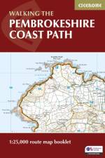
A booklet of all the mapping needed to walk the Pembrokeshire Coast Path National Trail between Amroth near Tenby and St Dogmaels by Cardigan. Covering 290km (180 miles) and over 10,500m of ascent, this trail takes around 2 weeks to complete. The full route is shown on 1:25,000 OS maps The map booklet can be used to walk the trail in either direction Sized to easily fit in a jacket pocket or rucksack The relevant extract from the OS Explorer map legend is included High tide and military range closure alternate routes are provided An accompanying Cicerone guidebook - Walking the Pembrokeshire Coast Path is also available, which includes a copy of this map booklet
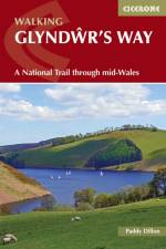
Guidebook to walking Glyndwr's Way, a long-distance National Trail through mid-Wales. The 135 mile route from Knighton to Welshpool via Machynlleth takes 9 days to walk, and 2 more days (29 miles) to complete the loop down the Offa's Dyke Path to create a circular trail. A lovely trail through quiet hills, forests and rolling countryside.
The first in a two-volume set, this guide describes cycling the first half of the 1269km Danube river from its source in the Black Forest to Budapest. The main route in this volume has been broken into 29 stages, averaging 44km per stage. A fit cyclist, cycling an average of 90km per day should be able to complete the route in a fortnight. Suitable for all levels of cyclist, on all types of bike, the route is on a gentle downhill gradient, is mostly off-road and uses well-surfaced and dedicated cycle tracks or quiet country roads. With guidance on the plentiful accommodation and places to stop for food and drink en route. The Danube Cycle Way has become the most popular holiday cycle touring route in mainland Europe. Leading through Germany, Austria, Slovakia and Hungary, the route visits spectacular gorges, hilltop castles, vineyard-clad hillsides and medieval towns.
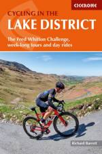
Guidebook to a 5-day cycle tour of the Lake District plus 15 challenging day rides from Keswick, Ambleside, Penrith and bases southwest and southeast of the National Park. Details 2 options each day for the cycle tour, plus a 7-day alternative itinerary. Also outlines other tours including the 112-mile Fred Whitton Challenge, which takes in 7 iconic passes. Step-by-step route descriptions are accompanied by either 1:100,000 or 1:200,000 mapping, together with details on gradient, major climbs and cafes/pubs en route. Also included is a comprehensive 'what to take' checklist plus other practical information such as preparing your bike, packing for a cycle tour, fuelling your ride and more. This comprehensive guidebook also details accommodation options and useful contacts plus information on the district's geology, landscape, plants and wildlife. With its picturesque lakes, lush green dales and high passes, the Lake District offers some of the most scenic and challenging cycling in Britain. Whether touring or day tripping, England's largest National Park will leave you (literally and metaphorically) breathless.
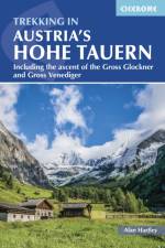
A guide to hut-to-hut trekking in the Hohe Tauern in Austria's Eastern Alps through the provinces of Tirol, Salzburg and Karnten in the Gross Glockner, Reichen and Venediger mountain groups. The Hohe Tauern National Park is the largest in Europe and a World Conservation Area. It is centred on the Gross Glockner, at 3798m Austria's highest mountain, closely followed by its near neighbour and third highest mountain the Gross Venediger 3660m. Each mountain group covered here has distinctive qualities and is serviced by some of the best huts in the Alps. The four hut-to-hut tours described here, including the recently opened 8-10 day Glockner Round Tour that links seven huts together without having to cross glaciers, explore them fully, and a two-week traverse of the whole park is also outlined. En route there is ample opportunity to climb some of the peaks and ascents and excursions are described. This book will appeal to groups of mixed ability and those looking to visit the Alps for the first time without the demands of the higher mountains of the western Alps. With lots of practical advice, including on glacier travel, and a comprehensive hut directory.
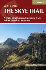
This guidebook describes the challenging 80-mile (128km) Skye Trail, a week-long trek across the magical Isle of Skye, the largest island in Scotland's Inner Hebrides. As yet unwaymarked, the route demands navigational skill, fitness and self-reliance and is therefore suitable for experienced backpackers and mountain walkers. The trail is presented in 7 stages of between 7 (11.5km) and 18 miles (28.5km), plus an alternative stage to include an ascent of Bla Bheinn. Alongside detailed route description, 1:50,000 OS mapping and stunning photography, the guide provides a wealth of information about Skye's rich history, culture, literature, geology, wildlife and plants, as well as practical advice such as when to go, what to take and where to stay. Blending information with inspiration, the result is an ideal companion to trekking this magnificent route. From the headland of Rubha Hunish, through Portree to Broadford, the Skye Trail provides the walker with a tour of Skye's most iconic landforms - including the Quiraing, the Old Man of Storr and the Cuillin - as well as of its turbulent history, from Iron Age forts to the ruins of Clearance villages. Whether making use of island hospitality or opting for the freedom of a tent, completing the continuous route represents a real challenge and a fitting match for the epic landscapes found on Skye.
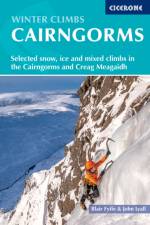
This guide, now in a fully updated sixth edition, offers a selection of some of the best winter routes to be found in the Cairngorms and on Creag Meagaidh. The granite peaks of the Cairngorms have extensive areas of high plateau and four peaks of over 4000ft, while Creag Meagaidh is noted for its classic ice climbs. Well-known routes on Lochnagar are also covered here, as well as the more remote and serious climbs on Braeriach. With something to suit all winter climbers here in the heart of Scotland, the Cairngorms has it all. Routes are illustrated in 51 colour photo topos and include a wide range of grades, lengths and styles, from straightforward to exceptionally difficult. All routes require a solid mountaineering or climbing background.
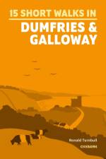
Ronald Turnbull has chosen 15 of the best short walks around Dumfries and Galloway. Each walk comes with easy-to-read Ordnance Survey maps, clear route description and lots of images, plus information on local beauty spots and tasty refreshment stops. No challenging terrain or complicated navigation means walks can be enjoyed by everyone.
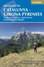
35 varied day walks among the rocky mountains, forested slopes and idyllic wine country in and around Girona. Routes range from 5 to 19km and cover Garrotxa, RipollAs and the CadA -MoixerA(3) Natural Park.
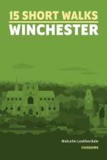
Malcolm Leatherdale has chosen 15 of the best short walks around Winchester and central Hampshire. Each walk comes with easy-to-read Ordnance Survey maps, clear route description and lots of images, plus information on beauty spots and refreshment stops. No challenging terrain or complicated navigation means walks can be enjoyed by everyone.
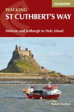
This guidebook describes the long-distance trail of St Cuthbert's Way through Northumberland and the Borders. The route starts in Melrose and travels 100km (62 miles) through the Northumberland National Park to Holy Island. It includes a description of the route from Holy Island up the coast to Berwick-upon-Tweed.
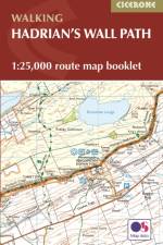
Map of the 84 mile (135km) Hadrian's Wall Path National Trail, from Bowness-on-Solway to Wallsend, Newcastle. This booklet is included with the Cicerone guidebook to the trail, and shows the full route on OS 1:25,000 maps. The trail typically takes a week to walk, and is suitable for walkers at all levels of experience.
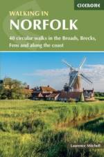
Guidebook to 40 easy to moderate walks in the English county of Norfolk. Circular routes of 4 to 12 miles show off the area's surprisingly varied landscape: the Broads, Brecks and Fens and coastal dunes, salt marsh and tidal creeks. Also includes information on Norfolk's rich history and unique plants and wildlife.
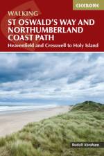
St Oswald's Way runs 97 miles from Heavenfield near Hadrian's Wall. St Cuthbert's Way is 62 miles from Melrose. The Northumberland Coast Path, which St Oswald's Way partially follow, is also described here.
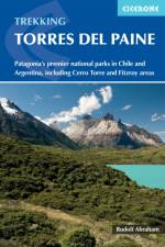
Guidebook to trekking Chile's 10 to 11-day Torres del Paine Circuit, one of the world's great treks. Also included are a shorter Half Circuit (4 to 5 days), further treks and day walks in the Torres del Paine and Los Glaciares National Parks, centred around Puerto Natales. Includes information on linking routes, travel and accommodation.
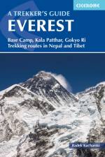
Guidebook to trekking in the Everest region of the Himalaya in Nepal, including Thame Valley, Lukla to Namche, Everest Base Camp from Namche and Gokyo (the Cho la and Phortse route), plus two routes in Tibet (the Rongbuk route and the Kharta Valley). Also describes the new Three Passes trek (Dingboche to Namche via Kongma La, Cho La, Renjo La).
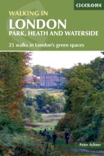
Presents 25 varied walks exploring London's green and open spaces. Covering both the city centre and the Greater London area, this book takes you in royal parks, heaths, forests, canals and rivers, including Epping Forest, Hampstead Heath, the World Heritage site of Kew Gardens and Wimbledon Common.
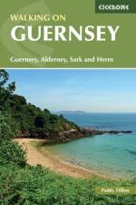
A walking guidebook to the islands of Guernsey, Alderney, Sark and Herm. 24 walks are described. A selection of walks which can be linked to form longer routes, including the Guernsey Coastal Walk and part of the Channel Islands Way. Famous for sunshine, history and a wonderful coastline, Guernsey is an intriguing destination for travellers. Outwardly British but with French overtones, the island has a long tourist season and is often busy with visitors. The walks in this guide use good paths and tracks as well as quiet country roads. Occasionally, more rugged paths are used to explore the excellent cliff coastline. Guernsey has plenty of interesting historical sites and attractions to visit including castles, churches and museums.
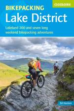
Guide to eight 2-5 day bikepacking routes, including the Lakeland 200, exploring the tracks, bridleways and iconic passes and road climbs of the Lake District. Graded from moderate to severe, most routes are suitable for mountain or gravel bikes. All can be easily accessed by public transport and are well served for accommodation and facilities.
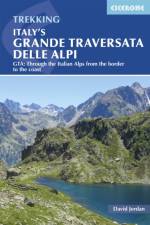
A guidebook to the 798km Grande Traversata Delle Alpi trek through the western Italian Alps traversing the Lepontine, Pennine, Graian, Cottian and Maritime Alps to finish near Monte Rosa. The guide splits the route into 3 sections with 55 day stages. A good level of fitness is required to tackle the route as it contains nearly 60,000m of ascent.
Guidebook to walking the Ribble Way, a 72 mile route following the Ribble valley, from the estuary mouth near Preston to the river's source on Cam Fell in the Yorkshire Dales. The book contains OS map extracts and full route description split into 7 convenient stages, with suggestions for day walkers.
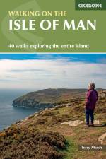
40 walks on the coast, fells and inland valleys of the Isle of Man are explored in this guidebook. Most of the walks are short and accessible for walkers of all abilities, however for a greater challenge, many of the routes (between 2 and 22km) can be combined. The Isle of Man offers the walker a wonderfully diverse range of landscapes within a relatively compact island setting, and the routes reflect this diversity - scale the highest point Snaefell (620m), cross wide open moorlands, drift over beaches and climb coastal clifftops. The assortment provides walkers with fantastic trails, along with detail on the wildlife, wild flowers, unique history and points of interest encountered. Alongside detailed route descriptions and OS maps, there is plenty of practical information on getting to and around the Manx Isle and advice on making the most out of any exploration of the Isle of Man.
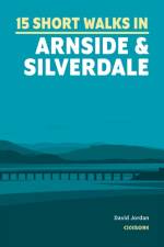
Discover 15 of the best short walks Arnside and Silverdale. Each walk comes with easy-to-read Ordnance Survey maps, clear route description and lots of images, plus information on local beauty spots and tasty refreshment stops. No challenging terrain or complicated navigation means walks can be enjoyed by everyone.
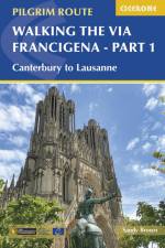
A guidebook to walking the 2000km Via Francigena pilgrimage route from Canterbury to Rome. Part of a three-volume set, this volume covers the first 1090km, from Canterbury, England, through France to Lausanne, Switzerland. Suitable for most abilities, this section can be walked in around two months, or there is the option to cycle the majority of the way, shaving around three weeks off the total time. The route is presented in 52 stages, of between 11 and 40km (7-25 miles). Variants for cyclists are shown on the maps but not described. GPX files available to download 1:100,000 mapping plus larger-scale town maps for key locations Handy route summary tables and pilgrim lodging details help you plan your itinerary Comprehensive information about refreshments and facilities along the route Advice on planning and preparation
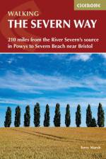
A guidebook to walking the Severn Way between the River Severn's source at Powys and Bristol. Covering 344km (215 miles), this long-distance walk through the counties of Powys, Shropshire, Worcestershire and Gloucestershire takes around 3 weeks to hike and is suitable for all reasonably fit walkers. The route is described from north to south in 22 stages, each between 6 and 23km (4-15 miles) in length. A variant route to the source of the river via Plynlimon and a link route from Severn Beach to Bristol city centre are also included. 1:50,000 OS maps included for each stage Detailed information on facilities and accommodation on route Advice on planning and preparation Highlights include Hafren Forest
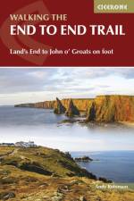
A practical guidebook for walking from Land's End to John o' Groats. The 1956km (1215 mile) long-distance route, known as the End to End Trail, follows paths and tracks rather than road, and takes to the hills whenever it can. The route is presented in 61 daily stages averaging just less than 32km (20 miles).
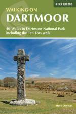
A guidebook to 39 day walks exploring Dartmoor, plus a 2-day Ten Tors challenge. Exploring the dramatic scenery of Devon's national park there are walks suitable for all abilities, from low-level shorter walks to higher level more strenuous and demanding routes. The day walks, all easily accessible from Ivybridge, Tavistock and Okehampton, range from 7-13km (4-21 miles) and can be enjoyed in 2-6 hours. The Ten Tors route is a longer more challenging walk that takes 2 days and covers 58km (36 miles). 1:50,000 OS maps included for each walk Sized to easily fit in a jacket pocket GPX files available to download Refreshment and public transport options are given for each walk Information given on local geology and wildlife
Abonner på vårt nyhetsbrev og få rabatter og inspirasjon til din neste leseopplevelse.
Ved å abonnere godtar du vår personvernerklæring.