
Gjør som tusenvis av andre bokelskere
Abonner på vårt nyhetsbrev og få rabatter og inspirasjon til din neste leseopplevelse.
Ved å abonnere godtar du vår personvernerklæring.Du kan når som helst melde deg av våre nyhetsbrev.
This is the third in a series of personal property tax records for 1782 to 1850. The previous personal property tax books cover the periods 1782-1799 and 1800-20. This volume includes the years 1822, 1825, 1828, 1830, 1832, 1835, 1838, 1840, 1842, 1843, 1845, 1848 and 1850. It correlates with the land tax record years during the period with the exception of 1826. Edmund P. Roberts, Commissioner of Revenue, collected personal property and land tax records until his death late in 1842. Starting in 1843 his son, Edward Roberts served as commissioner of revenue. This also includes totals for each year and a list of retail and ordinary licenses in the back of this work. Unfortunately both are missing in 1833. 1832 is the last year ordinary licenses are noted on the original, however details about ordinaries are found in order books and this information is included in this work. Retail licenses for 1833 in Order Book #39 are also listed as such. Names are in somewhat alphabetical order.
Deed books typically contain records of land transactions, leases, mortgages, bills of sale, powers of attorney, marriage contracts, and other documents of genealogical interest.Richmond County, Virginia Deed Book Abstracts, 1721-1725 contains entries from Richmond County, Virginia Deed Book No. 8, 1720-1733, beginning on page 102 and ending on page 120 for courts held 7 March 1721/2 through 2 February 1725. A full-name index, which includes counties and places, adds to the value of this work.
Records generally include the full names of all persons involved in the transaction (grantor, grantee, witnesses, and court officials), sum paid, description and location of property, date of transaction and date recorded.
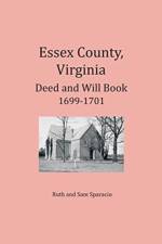
Deed and will books typically contain records of land transactions plus leases, mortgages, bills of sale, slave manumissions, powers of attorney, estate settlements, and more. Deed and will books are a main staple in genealogy research to determine family relationships.This volume contains entries from Essex County Deed & Will Book 1699-1701, June 8, 1699, through March 10, 1700/1. Originally published in 1991, reprinted 2016
These abstracts contain information from deeds, leases, releases, mortgages and other agreements that reveal family relationships.The abstracts are presented in the original order that they were entered in the deed books. The deed book page number is indicated. In addition to family relationships, these abstracts contain hundreds of names of witnesses and neighbors. A full name index is included.
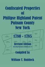
During the Revolution, various states enacted laws that allowed for the confiscation and sale of land which was held by known loyalists. In New York, following the 1779 Act of Attainder, the estates of fifty-nine individuals were confiscated. Four of those on the list were Roger Morris, Esq. (late member of the Council for the Colony of New York) and his wife, Mary Morris; and, Beverly Robinson and his wife, Susannah Robinson. As heirs of Frederick Philipse, his daughters, Mary Morris and Susannah Robinson, held approximately two-thirds of the Philipse Highland Patent. Their brother, Philip Philipse, held the other third. At the time of the 1779 act, there were several hundred farmers leasing land in the Highland Patent from the Robinson and Morris families. Most of the confiscated property was sold to the tenant farmers. This book gives an excellent view of the people living in two-thirds of the Philipse Highland Patent, which was located in the southern part of Dutchess County (present-day Putnam County), New York.This revised edition has been produced to correct a flaw in the first publication. The Concklin maps for lot # 7 of Robinson were placed too far south relative to the USGS bases map. The northern portion of lot #7 actually belongs in what is now Dutchess County and was part of once disputed land in what was called the Beekman Gore. This edition properly places the Concklin maps for lot # 7 where they belong. The name index has been corrected as well to reflect this change to the property placement.A brief historical background precedes a table of property transactions and maps of property which was confiscated by the New York legislature during the Revolutionary War. The table contains information about each property transaction, including parties involved, the date, the amount of the transaction, farms and/or bodies of water on the property, adjacent neighbors, and occupier (if other than the purchaser). The beautifully detailed maps allow researchers to easily find properties relative to today's features. Indices to full-names and places add to the value of this work.
Abonner på vårt nyhetsbrev og få rabatter og inspirasjon til din neste leseopplevelse.
Ved å abonnere godtar du vår personvernerklæring.