
Gjør som tusenvis av andre bokelskere
Abonner på vårt nyhetsbrev og få rabatter og inspirasjon til din neste leseopplevelse.
Ved å abonnere godtar du vår personvernerklæring.Du kan når som helst melde deg av våre nyhetsbrev.
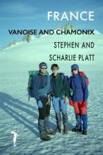
This trip in the early summer of 1994, like other trips we made to the Alps, is a tale of two parts. First we circumnavigated the Vanoise National Park. Created in 1963, it was the first national park in France and is the most bio-diverse with over 5,000 plant species. It borders the Gran Paradiso in Italy and together they form one of the largest protected areas in Europe.We did the six-day hike with Val, a friend from Sheffield and had the alpine flower meadows virtually to ourselves, seeing few other people. The path follows part of the famous Via Alpina, the GR5, that runs from Geneva to Nice, and sections of the GR55. It crosses a number of high passes and most of the path is over 2,500 metres. There was still plenty of snow and we had to watch our step in places. We stayed in refuges or camped near them because wild camping was forbidden in the park.Tony, a friend from Cambridge, joined us for the second week in Chamonix, where we had intended to climb Mont Blanc. In the event, our party of four lacked the experience to tackle the crowning summit and we contented ourselves with three easy routes - the Aiguilles du Tour, Petit Verte and Belvédère. These mixed routes of rock and snow were all delightful, accessible and safe, and the weather was perfect all week. Apart from nights in the Refuges Trient and Lac Blanc, we camped in Frasserands.
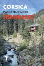
The Mare a Mare Nord traverses Corsica from sea to sea. It's nearly 100 miles long (152 km), involves nearly 7000 metres of ascent and descent and took me 11 days.I sailed to Ajaccio, the capital of Corsica, on the west coast, and the walk climbed thickly wooded valleys before crossing the GR20 and the mountainous backbone of Corsica at the Col de Vergio. From Corte, the town in the middle of the island, the path follows mule tracks that link isolated hilltop villages all the way to the east coast at Moriani.Geology and altitude give character to different parts of the walk. You pass through forests of huge sweet chestnuts, tall Laricio pine and beech and follow clear mountain streams past tumbling cascades. The path traverses rugged mountain ridges, ancient stone mule tracks and sunken lanes.The walk is a time travel to a different age. Quiet sleepy villages where the faded signs suggest a busier more prosperous era. Corsica is like an unspoilt wild garden, a walker's paradise, the way carpeted in wildflowers with the scent of herbs and flowers and the constant song of birds.The walk starts and finishes with sandy beaches at the two largest towns in Corsica - Ajaccio and Bastia. The accommodation in Gites and hotels is warm and comfortable and the food excellent.The Mare a Mare Nord is not as hard, dramatic, or as 'good' as the GR20. But what it has that the GR20 doesn't is peace and tranquility; there are just too many doing the immensely popular GR20.
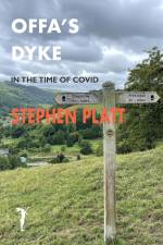
Offa's Dyke runs along the border between England and Wales. I walked from south to north, from Chepstow to Prestatyn, It took me 12 days. The Path was opened in 1971 by Sir John Hunt, leader of the 1952 Everest Expedition. For over a third of its 177 miles it closely follows the earthworks of Offa's Dyke.It falls into 5 stages, all different and equally interesting and challenging. It begins by following the course of the River Wye from its mouth in the Severn Estuary past lush water meadows and limestone cliffs as far as Monmouth. It then crosses farming country to reach the Black Mountains and the long ridgeway to Hay, where the bend in the Wye is joined again, before embarking on one of the tougher sections, the Shropshire Hills, where the Dyke is at its most evident.The Severn floodplain provides a flat respite of canal towpaths and river banks until the land rises again at Llanymynech and the finale of the Eglwyseg Mountain north of Llangollen and the Clwydian Range from Llandegla to PrestatynIn June, Offa's Dyke is a joyous river of bird song, a green abundance of meadows and magnificant, ancient, oak, ash and lime trees in new leaf. Walking, you sense the generations that have settled, farmed and fought over this land and how places harbour the memories of the people that lived and died here.There is little tarmaced road and most of the way is along tracks and grassy paths. None of it is demanding, but for me it was a challenge, not least because I contracted Covid at the start of the trip. Some days were long and tiring but I enjoyed every bit and highly recommend it.
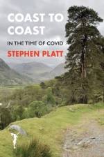
The Coast to Coast was devised by Alfred Wainright and first described in his guide published in 1973. He describes the route in 12 stages; it took me 13 days. I measured it as about 187 miles long (300 km). It traverses three national parks - the Lake District, the Yorkshire Dales and the North York Moors.The walk is extremely varied passing from the dramatic granite pikes and becks of the Lake District to the fascinating Westmorland limestone pavement. Perhaps the most delightful section is that of the Yorkshire Dales from Kirkby Stephen, over Nine Standards and then along the Swale from Keld to Reeth.The C2C starts with a coastal walk along the sandstone cliffs of St Bees Head and finishes satisfyingly with a similar stretch of the Cleveland Way along the shale and mudstone cliffs from Hawkster to Robin Hoods Bay. The idea of a route from the Irish to the North Sea is beguiling and Wainwright cleverly used parts of bridleways and ancient tracks to link the three national parks but there is too much road and the route feels contrived.I'm glad I did it, however, and enjoyed much of it, apart from the tedious stretch from Richmond to Ingleby Arncliffe across the Vale of Mowbray. Looking back, I most enjoyed the Lakes, despite the rain and storms because I know them so well. And I enjoyed the easy day from Keld to Reeth with Scharlie and Bridget, not least because of their obvious pleasure in the landscape and flora
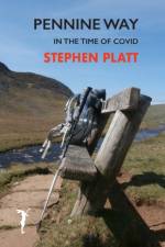
The Pennine Way is a tough old walk. It's about 270 miles long (435 km), was the first National trail in England and is one of the most famous long-distance walks. I did it a couple of weeks before I should have, during the Covid pandemic of 2020 when the guidelines encouraged outdoor exercise but advised against overnight stays away from home. There was no accommodation or catering en-route and few shops open. I arranged two poste-restante food drops at post offices in Alston and Hawes at approximately one-third and two-thirds of the way. That meant I had to wild camp and carry food for a week.Lockdown during the Covid pandemic was a great time to do the Pennine Way. No one else was on the walk. In fact hardly anyone had done it for months and nature had reclaimed the way and at times the path was almost indistinct. The guidelines that everyone should stay at home meant that the villages and settlements I passed through were deserted. It was like a sci-fi movie when everyone has disappeared.When I got back people asked me, what was the best bit. The problem is that so much happens in the 17 days of a walk like this, so much that is singular and arresting. But with the repetition of walking each day over similar ground it becomes difficult for the mind to encompass and remember.Alfred Wainright, who devised the walk in 1938, said he wrote his 'pictorial companion' for himself, so he could relive the walk back in the comfort of home. In part that's what motivated me. But I also needed to make sense of what I'd done, to map it out, and to fit the parts together as a whole.
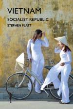
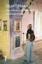
went to Vietnam at Vietnam at very short notice to do a job for the World Bank about housing reconstruction after Typhoon Damrey in Novemeber 2017. Others on the team were reporting on transport, irrigation, agriculture, fisheries and economic development. Unfortunately I pulled a calf muscle at dawn on day one running along Nha Trang beach, as shown in the photo, so I didn't see as much of Vietnam as I would have liked. Nevertheless I did go north up the coast and inland to the highlands to see ieffect of storm and progress in recovery.I loved Vietnam. I liked the food, the way the country is developing and the confidence and directness of the people. I wish I could have stayed a month and seen more.
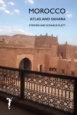
We had a trip to Morocco in mind for some years, since Frances, our daughter, went there on buying trips twenty years ago. But this time we visited parts that were new to her. From Fez we crossed the Atlas Mountains and went south into the desert, then west along the mountains to Finnt, across to Marrakesh and back along the northern flank to Fez. I'm glad we went now because Morocco is changing. Everywhere we went there were signs of development - half finished apartments blocks, new suburbs and building plots. But Morocco feels authentic - women in bright Berber costume riding donkeys loaded with fodder, families out for an evening stroll, women washing clothes in the river. Even the stallholders and merchants seemed more polite and agreeable than in other places. Everyone was friendly and helpful and it was a pleasure to speak bad French.
In the summer of 2004 we went climbing with Dimitri in the Valle Garrafano in the Apuane Alps, a limestone area famous for its Carrara marble. Dimitri had been a tenant of ours in Cambridge when he had a sabbatical working in the University Library. We returned the following summer and were whisked off again to the rocky valleys of Italy's far northwest. We climbed in the Valle Maira and Valle Gesso in the Maritime Alps, Then we drove further north to the Valle dell'Orco in the Graian Alps near the Parco Gran Paradiso. The rock was superb and we did some great routes following our 'Pied Piper' Dimitri.
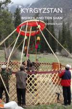
I went to Kyrgyzstan as part of the EU SENSUM team investigating using remote sensing to map hazards and monitor disaster recovery. We ran a scenario planning game in Bishkek with Emergency personnel from Kyrgyzstan and Tajikistan.Our host takes us to a night club. It's in a vast concert bunker. We toast each other unmercifully with vodka shots until encouraged onto the dance floor where we dance with a group of attractive young girls they call the 'jet-set'.We went for a walk in the snow covered Tien Shan and walked up the Ala Acha gorge. We wanted to see snow leopard, but all we saw were the inquisitive marmots and circling eagles. Having forgotten my trainers I had only sandals to keep my feet warm.Bishkek, capital of Kyrgyzstan is a fascinating city, with its tree-lined boulevards, Soviet 'brave new world' architecture and a huge statue of Lenin pointing towards a future long gone. Bishkek is a city on the ancient 'silk-road' and there is a relaxed human feel to the place.
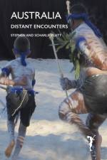
Australia is far-flung and until the airplane overcame the tyranny of distance Australia was terra incognita. Aboriginals of Australia are one of the oldest living peoples of the world having occupied the same territory longer than any other human population, about 50,000 years. They believe their ancestors brought the world into being by naming the landscape and the creatures that inhabit it. They sing to keep the land alive and their songs are stories of ancestor figures and a GPS to help guide them over vast distances. In Sydney and were treated to a spectacular exhibition of Aboriginal art and dance depicting places along the Canning Stock Route in Western Australia but we missed a visit to the Opera House and ferry rides across the harbour because of a mix-up with the flights. In Perth we attended the 60th Perth International Arts Festival with a dawn-dusk opening that aimed to reconcile the Nyungar guardians of Mudurup Rocks at Cottesloe with modern Australia.
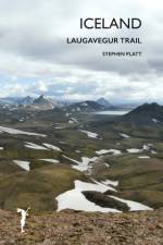
The Laugavegur is one of the big walks. It is the most famous trek in Iceland and crosses other worldly landscapes formed by recent volcanos. I did it from north to south and it runs over 80km from Landmannalauger via Thorsmork to Skogar on the coast. The trail is normally open from late June to mid-August. I started on the 15 June, the first day the bus ran to Landmannalaugar. I hadn't booked the huts as I didn't know whether I'd make it. So I took camping gear. The scenery is sensational and unlike anywhere I'd been before. At this time of the year there is still a lot of snow. I was alone much of the time, having started early in the year. There were three river crossings in flood and I needed to strip and take care.You pass through vivid rhyolite mountains, climb snow slopes, cross ash deserts, rift canyons and glacial streams. There are wild flowers, sweet birch and the cries of redshank and ptarmigan. I did the trek from Landmannalaugar to Skogar in 4 days including the bus trips at either end.
Abonner på vårt nyhetsbrev og få rabatter og inspirasjon til din neste leseopplevelse.
Ved å abonnere godtar du vår personvernerklæring.