

Gjør som tusenvis av andre bokelskere
Abonner på vårt nyhetsbrev og få rabatter og inspirasjon til din neste leseopplevelse.
Ved å abonnere godtar du vår personvernerklæring.Du kan når som helst melde deg av våre nyhetsbrev.
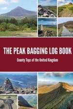
Take on the ultimate challenge of conquering the highest point in every county.To help you undertake a challenge like no other, this book provides a fantastic way of keeping a track record of how and when you have reached the highest point in every one of the United Kingdom’s 108 counties. Each county top is listed in order from highest to smallest, providing stats, a short bio, and log to fill in, allowing you to tick off every county top once you have reached each summit.Encompassing England, Scotland, Wales and Northern Ireland, the hills and mountain tops of the United Kingdom are an assorted bunch. These geographical, highest points range in both height and uniqueness - from the mighty Ben Nevis at 1,345 m, the highest point in Scotland, to the-low lying Holborn Hill in the metropolitan City of London at 22 m above sea level. Conquering each peak provides an incredible adventure and allows you to explore the diverse and beautiful landscapes of the entire United Kingdom. Get ready to embark on your own adventure and let us be there to help you along the way. Have fun!
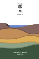
<p><i><b>8 days of torrential rain, battling the prevailing winds, wild camping, solo, self-supported, cycling 80 miles with one leg - all made for one of the hardest challenges I''ve attempted; a true test of mental and physical strength.</b></i></p><p>Land''s End to John O''Groats is a, renowned and iconic, long-distance cycle ride which traverses the length of mainland Britain. The route traditionally starts in the South West and finishes in the North East, passing through some of the most scenic landscapes in England and Scotland. Every year, hundreds embark on the cycling experience that, no doubt, leaves a lasting impression of an unforgettable experience.</p><p>Cycling End to End had been on my mind for some years, after all it is one of the most iconic long-distance rides in the world. The appeal was not only the challenge of travelling such an epic distance under my own steam, but to also see the beautifully diverse landscape throughout the United Kingdom. For logistical reasons, mainly living in Exeter, I decided to complete my journey from top to bottom, going the wrong way; not giving much thought to why everyone goes Land''s End to John O''Groats.</p><p>I wanted to take a more scenic route and immerse myself in the whole experience, rather than race to the end. I planned my trip over 18 days, using the national Cycle Network of quiet roads and tracks. With my noble steed (old mountain bike), I set off for John O''Groats to start on a solo, self-supported adventure that would cover the breadth of Britain. My End to End cycle adventure would turn out be one of the hardest tests of mental and physical challenges I''ve endured.</p><p>I''ve set out to create this book to provide information on every part of cycling JOGLE /LEJOG should you wish to undertake the challenge. It includes my account of each day giving you a feel for of the experience. Unlike traditional route books, I haven''t included maps, you will find links to resources where you''ll be able to download GPX files or purchase route books.</p>
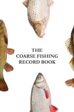
There are around 25 different species of coarse fish commonly fished for in the UK, making it the most popular form of fishing. The Coarse Fishing Record Book is a handy pocket sized book to log information of your fishing trip. Log data on all of your different catches including venue, time, date, bait used and any other additional notes.Record important data such as: -Species of fish, Inc. weight, lengthTime CaughtVenue DetailsStart Time / Finish TimeDay / DateBaitAdditional Notes
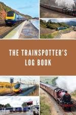
The Trainspotter’s Log BookThe Trainspotter’s Log Book is a practical, pocket sized, book to keep a record of the rail industry’s, powered and unpowered, rolling stock that is currently in operation along the railway lines of Great Britain.The rail system in Great Britain is the oldest in the world. The first public railway operated in north-east England from 1825, using steam locomotives. What followed was the rapid expansion of rail travel. Today there is a network spanning 9,824 miles with 2,560 stations, making the UK’s rail network the 17th largest in the world and one of the busiest in Europe.LocationStart time – time arrived at locationEnd Time – time left locationElapsed time – total time at locationRailway Line – line on which data is recordedLocation – station or location where data is recordedCounty – county where location is situatedRolling StockOperatorNumberNameTypeCategoryClassBuilderYear BuiltCarriagesLivery
Word SearchSit back, relax, and stimulate your mind with the Educational Word Search Collection. A collection of fifty word searches covering a range of different topics.50 challenging puzzles with solutionsLearn and improve your problem-solving skills at the same timeEach puzzle has a different themeDevelop word and pattern recognitionBoost your working memoryExtend your vocabularyImprove your spelling
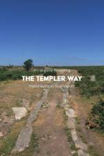
A helpful and practical pocket guide to walking the long-distance Templer Way path.The Templer Way, starting in Haytor, links the picturesque National Park Dartmoor with the coastal town of Teignmouth. This trail begins where tramways once quarried granite in the early nineteenth century. From Haytor, the trail passes down through the historic town of Bovey Tracey where it joins up with the Stover Canal. From here, the route leads onwards through the market town of Newton Abbot. The final leg follows alongside the southern shore of the Teign Estuary to Shaldon. To reach the finishing point, enjoy a crossing on the Teign Ferry, traced back to 1296. You will now arrive in Teignmouth where this journey ends and another may begin.This guide contains:Detailed 1:25 000 OS maps covering the entire routeDirections for the route broken down into easily manageable legsA suggested kit list, also available for free to downloadPlaces of interest and village amenities such as historic locations, accommodation, eateries, and public facilitiesA full six-figure and eight-figure grid reference for GPS referenceColour photography throughoutTravel information
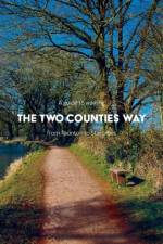
A helpful and practical pocket guide to walking the long-distance Two Counties Way.Starting in Somerset's county town, Taunton, follow this beautiful 56-mile route along the remains of the Grand Western Canal to Tiverton. From here it is then down over the Exe Valley through the villages of Bickleigh, Silverton, Killerton, and Broadclyst before heading down to Exeter's historic quayside.The last section takes you along Exeter's ship canal towpath all the way along the Exe Estuary by-passing the lavish, fortified, 14th-century manor estate of Powderham Castle, to finish up at Starcross.This guide contains Detailed 1:25 000 OS maps covering the entire route Route broken down into easily manageable legs A suggested kit list, also available for free to download Travel information Places of interest and village amenities such as historic locations, accommodation, eateries, public facilities Full six-figure and eight-figure grid reference for GPS reference Colour photography throughout
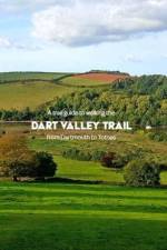
A helpful and practical pocket guide to walking the long-distance Dart Valley Trail.The Dart Valley Trail is a walk along one of the most scenic rivers in Devon, the River Dart. The trail begins in Dartmouth Harbour, a town long associated with naval activity and home to the prestigious Britannia Royal Naval College. From here, the path leads along and over the rising hills and wooded banks of the Dart Valley. The variety of landscape provides striking views up and down the valley as well as beyond to Dartmoor National Park. En route, you will pass through the picturesque villages of Dittisham, Tuckenhay, Cornworthy, and Ashprington before finally arriving in Totnes. All these villages provide a different selection of cosy pubs, waterside restaurants, and places to stay.This guide contains:Detailed 1:25 000 OS maps covering the entire routeDirections for the route broken down into easily manageable legsA suggested kit list, also available for free to downloadPlaces of interest and village amenities such as historic locations, accommodation, eateries, and public facilitiesFull six-figure grid reference for GPS referenceColour photography throughoutTravel information
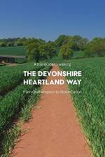
A helpful and practical pocket guide to walking the long-distance Devonshire Heartland Way path.Graced with a view of Dartmoor’s rising hills in the foreground, the Devonshire Heartland Way starts in the ancient town of Okehampton. As you proceed, you will follow this wonderful route west to east through the very heart of Devon’s beautiful and stunningly rural countryside. This route takes you along ancient footpaths, bridleways, and country lanes as it winds through many sleepy picturesque villages. This includes Sampford Courtenay, North Tawton, Yeoford, and the historic market town of Crediton. From here the route follows onwards to Newton St Cyres and Brampford Speke before finally arriving to the north of Exeter in the village of Stoke Canon.This guide contains: Detailed 1:25 000 OS maps covering the entire routeDirections for the route broken down into easily manageable legsA suggested kit list, also available for free to downloadTravel informationPlaces of interest and village amenities such as historic locations, accommodation, eateries, and public facilitiesA full six-figure and eight-figure grid reference for GPS referenceColour photography throughout
Anyone can start a blog. It really is very easy. Learn how to become a blogger is a beginner's insight into what is required if you're thinking about getting into the world of blogging, using the very popular WordPress.org platform. The book contains 5 important sections, that are broken down into the steps needed to get you up and running, that include: - Introduction Planning Setting up your blog Prepare to launch Maintaining Inside you'll also find various tips and exercises to help prepare you for writing great content and creating a personal blog to be proud of. Plus, there is an additional section on the numerous ways in which you can make money from your blog, showing you the potential of turning your website into a professional business. As an added bonus you will even find check lists, at the back of the book, covering the steps within each section that you can tick off when you have completed each stage.
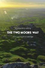
A helpful and practical pocket guide to walking the long-distance Two Moors Way path.Starting in Lynmouth on the North Devon Coast, follow this amazing 103-mile route through areas of outstanding beauty. Traverse on, into, and over, the high hills and ancient monuments of Exmoor. Next, continue through historic farmsteads and settlements into Mid Devon. Finally, pass over the expansive and gorgeous Dartmoor National Park to enjoy its tors and experience the desolate wild moorland.This Guide containsDetailed 1:25 000 OS maps covering the entire routeRoute broken down into easily manageable legsA suggested kit list, also available for free to downloadTravel informationPlaces of interest and village amenities such as historic locations, accommodation, eateries, public facilitiesFull six-figure grid reference for GPS referenceColour photography throughout
Abonner på vårt nyhetsbrev og få rabatter og inspirasjon til din neste leseopplevelse.
Ved å abonnere godtar du vår personvernerklæring.